Al-Yamun
| al-Yamun | |
|---|---|
| Other transcription(s) | |
| • Arabic | اليامون |
 Al Yamoun | |
 al-Yamun Location of al-Yamun within Palestine | |
| Coordinates: 32°29′11.35″N 35°14′06.98″E / 32.4864861°N 35.2352722°ECoordinates: 32°29′11.35″N 35°14′06.98″E / 32.4864861°N 35.2352722°E | |
| Palestine grid | 171/210 |
| Governorate | Jenin |
| Government | |
| • Type | Municipality |
| Area | |
| • Jurisdiction | 20,361 dunams (20.4 km2 or 7.9 sq mi) |
| Population (2007)[1] | |
| • Jurisdiction | 16,383 |
| Name meaning | from personal name,[2] |
Al-Yamun (Arabic: اليامون) is a Palestinian town located nine kilometers west of Jenin in the Jenin Governorate, in the northern West Bank. Al-Yamun's land area consists of approximately 20,000 dunams, of which 1,300 dunams is built-up area.[3]
According to the Palestinian Central Bureau of Statistics, the town had a population of 16,383 inhabitants in the 2007 census.[1] The population is formed mainly of a number of families such as Frehat, Khamaysa, Samudi, Hushiya, Abu al-Hija, Samara 'Abahra, Zaid, Jaradat, Sharqieh and Nawahda that sourced many inspirational figures such as Ayham Frehat and Ibrahim Frehat .[3]
History
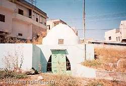
The town is an ancient one, where two columns and two capitals have been reused at the door of the mosque.[4]
Potsherds from the early and late Roman, Byzantine, early Muslim and the Middle Ages have been found here.[5]
Ottoman era
Yamun, like the rest of Palestine, was incorporated into the Ottoman Empire in 1517, and in the census of 1596, the village appeared as “Yamoun”, located in the nahiya of Sara in the liwa of Lajjun. It had a population of 28 households, all Muslim. They paid a fixed tax rate of 25% on agricultural products, including wheat, barley, summer crops, olive trees, goats and beehives, in addition to occasional revenues; a total of 15,000 akçe.[6] Potsherds from the Ottoman era have also been found here.[5]
In 1799, Al-Yamun was named the village Ellamoun on the map Pierre Jacotin made during the French campaign in Egypt and Syria.[7]
In 1838 Edward Robinson noted it on his travels,[8] and in 1870 Victor Guérin found that Yamun had 500 inhabitants, and was divided into two quarters, each commanded by its own sheikh.[9]
In 1882 the Palestine Exploration Fund's Survey of Western Palestine described it as “A large village, with olives round it, standing on high ground, with a well on the east. This appears to be the 'Janna of the Onomasticon,’ 3 miles south of Legio; does not exactly agree, being 7 English miles."[10]
British Mandate era
In the 1922 census of Palestine, conducted by the British Mandate authorities, Yamun had a population of 1,485; all Muslims except one Christian[11] who was Orthodox.[12] The population increased in the 1931 census to 1,836; all Muslim, in a total of 371 houses.[13]
In the 1945 statistics the population was 2,520; all Muslims,[14] with 20,361 dunams of land, according to an official land and population survey.[15] 6,036 dunams were used for plantations and irrigable land, 11,121 dunams for cereals,[16] while a total of 58 dunams were built-up, urban land.[17]
Jordanian era
In the wake of the 1948 Arab–Israeli War, and after the 1949 Armistice Agreements, Al-Yamun came under Jordanian rule. Some of Al-Yamun inhabitants descended from Abu-Hija, a commander who came to Palestine with Saladin. After 1948, Al-Yamun received fellow Abu-Hija descendants from the depopulated village of Ein Hod, presently in Israel.[18]
In 1961, the population of Al-Yamun was 4,173.[19]
post-1967
After the Six-Day War in 1967, Al-Yamun has been under Israeli occupation.
On October 29, 2008, Muhammad 'Abahra, a farmer in the town was killed by the IDF. 'Abahra had a shotgun in his possession leading the IDF to believe he would fire at them. 'Abahra's son, however, alleged, that his father was guarding his sheep from suspected thieves.[20]
References
- 1 2 2007 Locality Population Statistics. Palestinian Central Bureau of Statistics (PCBS).
- ↑ Palmer, 1881, p. 156
- 1 2 Israeli army's terror and Sabotage actions in Al Yamun town, Jenin District Applied Research Institute of Jerusalem (ARIJ). 2004-07-05.
- ↑ Dauphin, 1998, pp. 748-9
- 1 2 Zertal, 2016, pp. 188-190
- ↑ Hütteroth and Abdulfattah, 1977, p. 160
- ↑ Karmon, 1960, p. 169
- ↑ Robinson and Smith, 1841, vol 2, pp. 161, 167
- ↑ Guérin, 1875, p. 225
- ↑ Conder and Kitchener, 1882, SWP II, p. 46
- ↑ Barron, 1923, Table IX, Sub-district of Jenin, p. 30
- ↑ Barron, 1923, Table XV, p. 47
- ↑ Mills, 1932, p. 71
- ↑ Government of Palestine, Department of Statistics, 1945, p. 17
- ↑ Government of Palestine, Department of Statistics. Village Statistics, April, 1945. Quoted in Hadawi, 1970, p. 55
- ↑ Government of Palestine, Department of Statistics. Village Statistics, April, 1945. Quoted in Hadawi, 1970, p. 100
- ↑ Government of Palestine, Department of Statistics. Village Statistics, April, 1945. Quoted in Hadawi, 1970, p. 150
- ↑ Ben Ze'ev, 2011, p. 92
- ↑ Government of Jordan, Department of Statistics, 1964, p. 13
- ↑ West Bank farmer killed by troops BBC News. BBC MMVIII. 2008-10-29.
Bibliography
- Barron, J. B., ed. (1923). Palestine: Report and General Abstracts of the Census of 1922. Government of Palestine.
- Ben Ze'ev, Efrat (2011). Remembering Palestine in 1948: Beyond National Narratives. Cambridge University Press. ISBN 978-0-521-19447-1.
- Conder, C.R.; Kitchener, H.H. (1882). The Survey of Western Palestine: Memoirs of the Topography, Orography, Hydrography, and Archaeology. 2. London: Committee of the Palestine Exploration Fund.
- Dauphin, Claudine (1998). La Palestine byzantine, Peuplement et Populations. BAR International Series 726 (in French). III : Catalogue. Oxford: Archeopress. ISBN 0-860549-05-4.
- Government of Jordan, Department of Statistics (1964). First Census of Population and Housing. Volume I: Final Tables; General Characteristics of the Population (PDF).
- Government of Palestine, Department of Statistics (1945). Village Statistics, April, 1945.
- Guérin, V. (1875). Description Géographique Historique et Archéologique de la Palestine (in French). 2: Samarie, pt. 2. Paris: L'Imprimerie Nationale. (p. 225)
- Hadawi, S. (1970). Village Statistics of 1945: A Classification of Land and Area ownership in Palestine. Palestine Liberation Organization Research Center.
- Hütteroth, Wolf-Dieter; Abdulfattah, Kamal (1977). Historical Geography of Palestine, Transjordan and Southern Syria in the Late 16th Century. Erlanger Geographische Arbeiten, Sonderband 5. Erlangen, Germany: Vorstand der Fränkischen Geographischen Gesellschaft. ISBN 3-920405-41-2.
- Karmon, Y. (1960). "An Analysis of Jacotin's Map of Palestine" (PDF). Israel Exploration Journal. 10 (3, 4): 155–173, 244–253.
- Mills, E., ed. (1932). Census of Palestine 1931. Population of Villages, Towns and Administrative Areas. Jerusalem: Government of Palestine.
- Palmer, E.H. (1881). The Survey of Western Palestine: Arabic and English Name Lists Collected During the Survey by Lieutenants Conder and Kitchener, R. E. Transliterated and Explained by E.H. Palmer. Committee of the Palestine Exploration Fund.
- Robinson, E.; Smith, E. (1841). Biblical Researches in Palestine, Mount Sinai and Arabia Petraea: A Journal of Travels in the year 1838. 3. Boston: Crocker & Brewster.
- Zertal, A. (2016). The Manasseh Hill Country Survey. 3. Boston: BRILL. ISBN 9004312307.
External links
- Welcome to al Yamun
- Yamun, Welcome to Palestine
- Survey of Western Palestine, Map 8: IAA, Wikimedia commons
- Jacotin map #46
- many photos from al yamoun
| Cities |  | |
|---|---|---|
| Municipalities |
| |
| Villages |
| |