Worstead
| Worstead | |
|---|---|
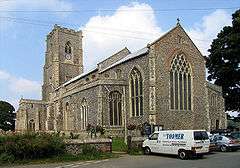 St Mary, Worstead | |
 Worstead Worstead shown within Norfolk | |
| Area | 10.65 km2 (4.11 sq mi) |
| Population | 922 (2011) |
| • Density | 87/km2 (230/sq mi) |
| OS grid reference | TG3026 |
| District | |
| Shire county | |
| Region | |
| Country | England |
| Sovereign state | United Kingdom |
| Post town | NORTH WALSHAM |
| Postcode district | NR28 |
| Dialling code | 01692 |
| Police | Norfolk |
| Fire | Norfolk |
| Ambulance | East of England |
| EU Parliament | East of England |
| UK Parliament | |
Worstead /ˈwʊstɪd/ is a village and civil parish in the English county of Norfolk. It lies 3 miles (5 km) south of North Walsham, 5 miles (8 km) north of Wroxham, and 13 miles (21 km) north of Norwich. The village is served by Worstead railway station on the Bittern Line.[1][2]
The civil parish has an area of 10.65 km² and in the 2001 census had a population of 862 in 365 households, For the purposes of local government, the parish falls within the district of North Norfolk.[3] the population included Bengate and increased to 922 at the 2011 census.[4]
In the Domesday Book, Worstead is called Wrdesteda and Ordested. King Canute gave the village to the abbots of St. Benet's Abbey on the River Bure in the Norfolk Broads. The village became very prosperous from the twelfth century when weavers from Flanders arrived in the area. They had been encouraged to settle in Norfolk by King Edward III of England who had married a Flemish princess.
Worsted cloth derives its name from this weaving heritage, although it is no longer manufactured in the village and the last weaver, John Cubitt, died in 1882 at the age of 91. The oldest Act of Parliament kept in the House of Lords Record Office is the Taking of Apprentices for Worsteads in the County of Norfolk Act of 1497. Weaving and spinning demonstrations are part of the annual Worstead Festival on the last weekend in July.[5]
Governance
An electoral ward in the same name exists. This ward stretches north to Suffield with a total population taken at the 2011 Census of 2,384.[6]
References
- ↑ Ordnance Survey (2002). OS Explorer Map 252 - Norfolk Coast East. ISBN 0-319-21888-0.
- ↑ Ordnance Survey (2005). OS Explorer Map OL40 - The Broads. ISBN 0-319-23769-9.
- ↑ Office for National Statistics & Norfolk County Council (2001). Census population and household counts for unparished urban areas and all parishes Archived 2017-02-11 at the Wayback Machine.. Retrieved 2 December 2005.
- ↑ "Civil Parish population 2011". Retrieved 4 September 2015.
- ↑ Worstead village history. Retrieved 15 December 2005.
- ↑ "Ward population 2011". Retrieved 4 September 2015.
External links
| Wikimedia Commons has media related to Worstead. |
- Information from Genuki Norfolk on Worstead.
- Parish Council