Neatishead
| Neatishead | |
|---|---|
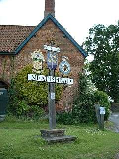 Signpost in Neatishead | |
 Neatishead Neatishead shown within Norfolk | |
| Area | 7.71 km2 (2.98 sq mi) |
| Population | 565 (2011) |
| • Density | 73/km2 (190/sq mi) |
| OS grid reference | TG342210 |
| Civil parish |
|
| District | |
| Shire county | |
| Region | |
| Country | England |
| Sovereign state | United Kingdom |
| Post town | NORWICH |
| Postcode district | NR12 |
| Police | Norfolk |
| Fire | Norfolk |
| Ambulance | East of England |
| EU Parliament | East of England |
Neatishead (/ˈniːtstəd/ NEET-stəd)[1] is a village and civil parish in the English county of Norfolk. The village is situated some 20 km (12 mi) north-east of the city of Norwich, within The Norfolk Broads and to the west of Barton Broad. Access to Neatishead from the broad is by way of Limekiln Dyke, a narrow channel leading off the broad.[2]
The civil parish has an area of 7.71 km2 (2.98 sq mi) and in the 2001 census had a population of 537 in 235 households, the population increasing to 565 at the 2011 census.[3] For the purposes of local government, the parish falls within the district of North Norfolk.[4]
It is famous due to the nearby RAF Neatishead radar station.
References
- ↑ G.M. Miller, BBC Pronouncing Dictionary of British Names (London: Oxford University Press, 1971), p. 108: "[This] is the traditional village pronunciation. [NEET-is-hed] is used by Service personnel for the local R.A.F. Station."
- ↑ Ordnance Survey (2005). OS Explorer Map OL40 - The Broads. ISBN 0-319-23769-9.
- ↑ "Civil Parish population 2011". Retrieved 2 September 2015.
- ↑ Office for National Statistics & Norfolk County Council (2001). Census population and household counts for unparished urban areas and all parishes Archived 2017-02-11 at the Wayback Machine.. Retrieved December 2, 2005.
External links
| Wikimedia Commons has media related to Neatishead. |
- Map sources for Neatishead.
- Information from Genuki Norfolk on Neatishead.
This article is issued from
Wikipedia.
The text is licensed under Creative Commons - Attribution - Sharealike.
Additional terms may apply for the media files.