Wood Norton, Norfolk
| Wood Norton | |
|---|---|
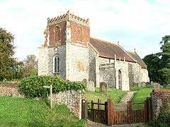 All Saints, Wood Norton | |
 Wood Norton Wood Norton shown within Norfolk | |
| Area | 6.99 km2 (2.70 sq mi) |
| Population | 217 (2011) |
| • Density | 31/km2 (80/sq mi) |
| OS grid reference | TG012279 |
| Civil parish |
|
| District | |
| Shire county | |
| Region | |
| Country | England |
| Sovereign state | United Kingdom |
| Post town | DEREHAM |
| Postcode district | NR20 |
| Police | Norfolk |
| Fire | Norfolk |
| Ambulance | East of England |
| EU Parliament | East of England |
| UK Parliament | |
Wood Norton is a village and civil parish in the English county of Norfolk. It is located 10 km (6.2 mi) east of Fakenham and 30 km (19 mi) north-west of Norwich.[1][2]
The civil parish has an area of 6.99 km2 (2.70 sq mi) and in the 2001 census had a population of 221 in 94 households, reducing slightly to 217 at the 2011 Census.[3] For the purposes of local government, the parish falls within the district of North Norfolk.[4] For Westminster elections, Wood Norton lies within the Broadland constituency, currently represented by a Conservative, Keith Simpson.
People
The original Blue Stocking, Benjamin Stillingfleet was born here where his father Edward Stillingfleet was rector.[5]
Notes
- ↑ Ordnance Survey (1999). OS Explorer Map 238 - East Dereham & Aylsham. ISBN 0-319-21869-4.
- ↑ Ordnance Survey (2002). OS Explorer Map 251 - Norfolk Coast Central. ISBN 0-319-21887-2.
- ↑ "Parish population 2011". Retrieved 25 August 2015.
- ↑ Office for National Statistics & Norfolk County Council (2001). Census population and household counts for unparished urban areas and all parishes Archived 2017-02-11 at the Wayback Machine.. Retrieved December 2, 2005.
- ↑ I. D. Hughes, ‘Stillingfleet, Benjamin (1702–1771)’, Oxford Dictionary of National Biography, Oxford University Press, Sept 2004; online edn, May 2008 accessed 26 Feb 2010
External links
| Wikimedia Commons has media related to Wood Norton, Norfolk. |
- Map sources for Wood Norton, Norfolk.
- Information from Genuki Norfolk on Wood Norton.
- NorfolkCoast.co.uk on Wood Norton.
This article is issued from
Wikipedia.
The text is licensed under Creative Commons - Attribution - Sharealike.
Additional terms may apply for the media files.