West Rockhill Township, Bucks County, Pennsylvania
| West Rockhill Township | |
|---|---|
| Township | |
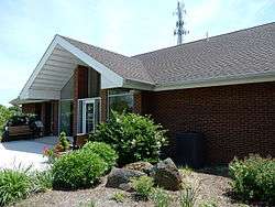 Township Municipal Offices | |
 Location of West Rockhill Township in Bucks County | |
 West Rockhill Township Location in Pennsylvania and the United States  West Rockhill Township West Rockhill Township (the US) | |
| Coordinates: 40°22′20″N 75°22′59″W / 40.37222°N 75.38306°WCoordinates: 40°22′20″N 75°22′59″W / 40.37222°N 75.38306°W | |
| Country | United States |
| State | Pennsylvania |
| County | Bucks |
| Area[1] | |
| • Total | 16.43 sq mi (42.55 km2) |
| • Land | 16.28 sq mi (42.16 km2) |
| • Water | 0.15 sq mi (0.39 km2) |
| Elevation | 489 ft (149 m) |
| Population (2010) | |
| • Total | 5,256 |
| • Estimate (2016)[2] | 5,248 |
| • Density | 322.42/sq mi (124.48/km2) |
| Time zone | UTC-5 (EST) |
| • Summer (DST) | UTC-4 (EDT) |
| Area code(s) | 215 |
| FIPS code | 42-017-83960 |
| Website |
www |
West Rockhill Township is a township in Bucks County, Pennsylvania, United States. The original Rockhill Township was established in 1740 and was divided into East Rockhill and West Rockhill Townships in 1890. The population was 5,256 at the 2010 census. West Rockhill Township is part of Pennridge School District.
Geography
According to the United States Census Bureau, the township has a total area of 16.4 square miles (42.4 km²), of which, 16.3 square miles (42.2 km²) of it is land and 0.1 square miles (0.2 km²) of it (0.49%) is water. It is in the Delaware watershed and, while most of West Rockhill is drained by the East Branch Perkiomen Creek and Unami Creek into the Perkiomen Creek and Schuylkill River, an area in the northeast portion drains via Threemile Run, Lake Nockamixon, and the Tohickon Creek eastward to the Delaware River. Other natural features include Butter Creek, Ingram Hill, Mill Creek, Ridge Valley Creek, and Rock Hill. The township's villages include Almont, Argus, Derstein, Knockthopher, Naceville (also in Montgomery County,) Rich Hill, Ridge Valley, Rocky Ridge, Smoketown (also in East Rockhill,) and White Horse.
Adjacent municipalities
- Milford Township (northwest)
- Richland Township (north)
- East Rockhill Township (northeast)
- Perkasie (east)
- Sellersville (east)
- Hilltown Township (southeast)
- Telford (south)
- Franconia Township, Montgomery County (south)
- Salford Township, Montgomery County (southwest)
- Marlborough Township, Montgomery County (west)
Demographics
| Historical population | |||
|---|---|---|---|
| Census | Pop. | %± | |
| 1930 | 1,390 | — | |
| 1940 | 1,645 | 18.3% | |
| 1950 | 2,020 | 22.8% | |
| 1960 | 2,484 | 23.0% | |
| 1970 | 3,270 | 31.6% | |
| 1980 | 3,776 | 15.5% | |
| 1990 | 4,518 | 19.7% | |
| 2000 | 4,233 | −6.3% | |
| 2010 | 5,256 | 24.2% | |
| Est. 2016 | 5,248 | [2] | −0.2% |
| [3] | |||
As of the 2010 census, the township was 95.0% White, 1.1% Black or African American, 0.2% Native American, 1.4% Asian, and 0.9% were two or more races. 1.4% of the population were of Hispanic or Latino ancestry.[4]
As of the census[5] of 2000, there were 4,233 people, 1,636 households, and 1,146 families residing in the township. The population density was 259.7 people per square mile (100.3/km²). There were 1,701 housing units at an average density of 104.4/sq mi (40.3/km²). The racial makeup of the township was 98.23% White, 0.54% African American, 0.14% Native American, 0.47% Asian, 0.14% from other races, and 0.47% from two or more races. Hispanic or Latino of any race were 0.59% of the population.
There were 1,636 households, out of which 26.2% had children under the age of 18 living with them, 60.3% were married couples living together, 6.1% had a female householder with no husband present, and 29.9% were non-families. 25.7% of all households were made up of individuals, and 15.8% had someone living alone who was 65 years of age or older. The average household size was 2.47 and the average family size was 2.97.
In the township the population was spread out, with 20.9% under the age of 18, 6.5% from 18 to 24, 25.9% from 25 to 44, 25.3% from 45 to 64, and 21.3% who were 65 years of age or older. The median age was 43 years. For every 100 females, there were 94.0 males. For every 100 females age 18 and over, there were 92.3 males.
The median income for a household in the township was $50,948, and the median income for a family was $63,871. Males had a median income of $44,063 versus $30,306 for females. The per capita income for the township was $25,026. About 1.7% of families and 4.7% of the population were below the poverty line, including none of those under age 18 and 11.0% of those age 65 or over.
Gallery
 Jerusalem Lutheran Church.
 Ridge Rd.
 Barn on Ridge Rd.
See also
References
- ↑ "2016 U.S. Gazetteer Files". United States Census Bureau. Retrieved Aug 13, 2017.
- 1 2 "Population and Housing Unit Estimates". Retrieved June 9, 2017.
- ↑ http://www.dvrpc.org/data/databull/rdb/db82/appedixa.xls
- ↑ "Census 2010: Pennsylvania". Usatoday.Com. Retrieved 2013-07-22.
- ↑ "American FactFinder". United States Census Bureau. Retrieved 2008-01-31.
External links
| Wikimedia Commons has media related to West Rockhill Township, Bucks County, Pennsylvania. |
