Saguenay–St. Lawrence Marine Park
| Saguenay–St. Lawrence Marine Park | |
|---|---|
| (in French) Parc marin du Saguenay–Saint-Laurent | |
|
IUCN category II (national park) | |
 Location of Saguenay–St. Lawrence Park in Canada | |
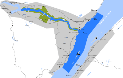
| Location | Baie-Sainte-Catherine, Charlevoix-Est Regional County Municipality / Sacré-Coeur, and Tadoussac, La Haute-Côte-Nord Regional County Municipality, Quebec, Canada |
| Nearest city | La Baie, Tadoussac |
| Coordinates | 48°04′11″N 69°39′41″W / 48.06967°N 69.66151°WCoordinates: 48°04′11″N 69°39′41″W / 48.06967°N 69.66151°W |
| Area | 1,246 km2 (481 sq mi)[1] |
| Established | 1998 |
| Visitors | 1,089,459 (in 2007[2]) |
| Governing body | Parks Canada, Sépaq |
The Saguenay–St. Lawrence Marine Park is a National Marine Conservation Area, one of three in the Canadian national park system, located where the Saguenay River meets the Saint Lawrence River. It is the first national park in Québec to protect a purely marine environment. Whales are drawn to the rich food supply stirred up by the mixing of waters here, including a colony of belugas.
This park is co-managed by Société des établissements de plein air du Québec (Sépaq) and Parks Canada.
See also
References
- ↑ "Registre des aires protégées du Québec" (PDF). Ministère du Développement durable, de l'Environnement et des Parcs du Québec. Retrieved 2008-04-27.
- ↑ "Parks Canada Attendance 2003-04 to 2007-08" (PDF). Parks Canada. 2008. Archived from the original (PDF) on 2011-06-05. Retrieved 2009-04-04.
External links
- Official site of Saguenay–St. Lawrence Marine Park
- Saguenay–St. Lawrence Marine Park at Parks Canada
This article is issued from
Wikipedia.
The text is licensed under Creative Commons - Attribution - Sharealike.
Additional terms may apply for the media files.