Municipal District of Acadia No. 34
| Municipal District of Acadia No. 34 | ||
|---|---|---|
| Municipal district | ||
| ||
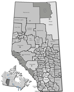 Location of Acadia No. 34 in Alberta | ||
| Coordinates: 51°09′27″N 110°12′50″W / 51.15750°N 110.21389°WCoordinates: 51°09′27″N 110°12′50″W / 51.15750°N 110.21389°W | ||
| Country |
| |
| Province |
| |
| Region | Southern Alberta | |
| Census division | No. 4 | |
| Established | 1913 | |
| Incorporated | 1945 | |
| Government[1] | ||
| • Reeve | Peter Rafa | |
| • Governing body | M.D. of Acadia Council | |
| • Office location | Acadia Valley | |
| Area (2016)[2] | ||
| • Land | 1,082.6 km2 (418.0 sq mi) | |
| Population (2016)[2] | ||
| • Total | 493 | |
| • Density | 0.5/km2 (1/sq mi) | |
| Time zone | UTC-7 (MST) | |
| Website | Official website | |
The Municipal District (M.D.) of Acadia No. 34 is a municipal district in southern Alberta, Canada, east of Calgary, close to the Saskatchewan border, in Census Division No. 4.
It is located on Highway 41 on the north side of the Red Deer River and bordered on the east by Saskatchewan. Highway 41 is a main route between Medicine Hat and Cold Lake.
Demographics
In the 2016 Census of Population conducted by Statistics Canada, the Municipal District of Acadia No. 34 recorded a population of 493 living in 159 of its 184 total private dwellings, a −0.4% change from its 2011 population of 495. With a land area of 1,082.6 km2 (418.0 sq mi), it had a population density of 0.5/km2 (1.2/sq mi) in 2016.[2]
In the 2011 Census, the Municipal District of Acadia No. 34 had a population of 495 living in 151 of its 161 total dwellings, a -9.2% change from its 2006 population of 545. With a land area of 1,076.26 km2 (415.55 sq mi), it had a population density of 0.5/km2 (1.2/sq mi) in 2011.[3]
Communities and localities
|
The following urban municipalities are surrounded by the Municipal District of Acadia No. 34:[4]
The following hamlets are located within the Municipal District of Acadia No. 34:[4]
|
The following localities are located within the Municipal District of Acadia No. 34:[6]
|
Attractions
- Prairie Elevator Museum in the Hamlet of Acadia Valley[7]
- Acadia Municipal Recreation Dam - trout fishing
See also
References
- ↑ "Municipal Officials Search". Alberta Municipal Affairs. September 22, 2017. Retrieved September 25, 2017.
- 1 2 3 "Population and dwelling counts, for Canada, provinces and territories, and census subdivisions (municipalities), 2016 and 2011 censuses – 100% data (Alberta)". Statistics Canada. February 8, 2017. Retrieved February 8, 2017.
- ↑ "Population and dwelling counts, for Canada, provinces and territories, and census subdivisions (municipalities), 2011 and 2006 censuses (Alberta)". Statistics Canada. February 8, 2012. Retrieved February 8, 2012.
- 1 2 "Specialized and Rural Municipalities and Their Communities" (PDF). Alberta Municipal Affairs. 2012-03-01. Retrieved 2012-08-11.
- ↑ Statistics Canada (2009-02-16). "GeoSearch2006". Retrieved 2010-11-07.
- ↑ "Standard Geographical Classification (SGC) 2006, Economic Regions: 4804001 - Acadia No. 34, geographical codes and localities, 2006". Statistics Canada. 2010-03-05. Retrieved 2012-08-11.
- ↑ M.D. of Acadia No. 34 - Points of Interest
External links
Places adjacent to Municipal District of Acadia No. 34 | |
|---|---|