Kejimkujik National Park
| Kejimkujik National Park | |
|---|---|
|
IUCN category II (national park) | |
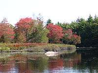
 Little River | |
 Location of Kejimkujik National Park in Canada | |
| Location | Nova Scotia, Canada |
| Nearest city | Halifax |
| Coordinates | 44°23′57″N 65°13′06″W / 44.39917°N 65.21833°WCoordinates: 44°23′57″N 65°13′06″W / 44.39917°N 65.21833°W |
| Area | 404 km2 (156 sq mi) |
| Established | 1967 |
| Visitors | 36,090[1] (in 2015-16) |
| Governing body | |
| Official name | Kejimkujik National Historic Site of Canada |
| Designated | 1994 |
Kejimkujik National Park (often called Keji for short) is part of the Canadian National Parks system, located in the province of Nova Scotia. The park consists of two separate properties: the main park is located in the upland interior of the Nova Scotia peninsula bordering Queens and Annapolis counties; and the smaller Kejimkujik Seaside unit, located on the Atlantic coast of Queens County. The park covers 404 km2 (156 sq mi). The inland unit is designated a National Historic Site of Canada,[2] making Kejimkujik unique in the park system as the only national park whose virtually entire area is a National Historic Site.[3]
Geology and soils
The bedrock of the park consists of Precambrian to Ordovician period quartzite and slate, plus Devonian period granite. All of these rocks, especially quartzite, have a high silica content and provide scanty amounts of nutrients to the soils that develop on them. The slate, however, is fine-grained and produces a loamy soil which yields its nutrients more quickly than the stony sandy loams and loamy sands found over the coarse-grained rocks. Most of the slaty loams occur around Kejimkujik Lake. Deep outwash sands and gravels form a band west of the lake. Elsewhere the soil landscape is dominated by the cobbly, often shallow granite or quartzite material. Podzols underlie most well-drained areas. Gleysols and peat bogs dominate where drainage is poor.[4][5] The park receives acid rain, and its soils have few available acid-buffering minerals, so strong acidity is the rule for soils and waters—even large bodies of water such as Kejimkujik Lake.[6]
Landscape and environment
Kejimkujik National Park conserves two distinct environments:
The large main section of the park is a forested upland plain located approximately 50 kilometres inland from the South Shore and Annapolis Valley and may be accessed from Trunk 8 running between Liverpool and Annapolis Royal.
The smaller Kejimkujik Seaside includes white sandy beaches and coastal wetland areas. The park includes habitat for the endangered piping plover and other coastal birds. It is located off Highway 103 near the villages of Port Mouton and Port Joli.
The park is named after Kejimikujik Lake, the largest lake inside the main section of the park. The many lakes and rivers form interior waterways that were important canoe routes between the Bay of Fundy and the Atlantic for the ancestors of the Mi'kmaq First Nations. The park also contains the petroglyphs left behind by these inhabitants. The lake's Mi'kmaq name has been translated as "attempting to escape" or "swollen waters", possibly related to fishing weirs placed on the lake. The park's official stance is that Kejimkujik is a Mi'kmaq word meaning "tired muscles".
Methyl mercury contamination
in 1995, Environment Canada scientists discovered that the concentration of methyl mercury in the park's loons was highly elevated, spurring investigation as to where it originated. After 20 years of research, the source is still unclear.[7]
Kejimkujik National Historic Site of Canada
Kejimkujik is a cultural landscape associated with the Mi’kmaq people, and incorporates 38 aboriginal sites, four petroglyph sites, three villages and a cemetery. Artifacts have been collected from an estimated 4000 years of occupation.[8]
Bodies of water
Rivers
Rivers in the park include the:
- Mersey River
- West River
- Little River
- Shelburne River
Lakes
In addition to the largest and namesake lake, Kejimikujik Lake, major lakes in the park include:
- Peskowesk Lake
- Peskawalake
- Big Dam Lake
- Frozen Ocean Lake
- Grafton Lake
- Liberty Lake
- Luxton Lake
Park buildings

- Kejimkujik National Park Visitor Centre which features backcountry check-in, theatre, Friends of Keji gift shop, information centre.
- Science Centre
- Outdoor Amphitheatre
- Whynot Adventure Outfitters at Jakes Landing
- Keji Beach Restaurant
Backcountry camping
Although there are numerous drive-in campgrounds in Keji the park is also known for its backcountry camping: campsites which are only accessible by canoe, bicycle or hiking in the summer. Keji provides excellent canoeing, with numerous navigable lakes and rivers forming an interconnected system. The further a camper progresses from access points, the more wild the park becomes, and it is possible to spend several days in the backcountry with little or no sight of other campers. Park staff maintain portages along major routes.
One of Keji's most popular canoe routes is the Frozen Ocean loop. Traditionally, paddlers will begin their canoe trip at Big Dam Lake with a quick 400m portage from the parking lot to the lake. This route follows Big Dam Lake to Stillwater Brook, which connects to Frozen Ocean Lake via a series of portages. Frozen Ocean Lake is home to multiple backcountry campsites, including Site 7, which is a group site for larger parties. Also found on Frozen Ocean Lake is a roofed shelter at backcountry Site 8, and a warden's cabin is located at the northeastern end of Frozen Ocean Lake. Most paddlers choose a campsite on Frozen Ocean Lake for their first night.
The Frozen Ocean loop continues down Little River towards Channel Lake, encompassing a few more park maintained portages, some of which follow along rougher sections of river via a boardwalk. The portage out of Channel Lake starts at Campsite 9, and reconnects with Little River after a 700m carry. From that point it's less than 2km down Little River to Keji Lake. Many paddlers opt to spend an additional night on or near Keji Lake, before finishing their trip at Jake's Landing.
A popular strategy is for paddlers to park their vehicle at Jake's Landing and use the shuttle service provided for the outfitter to transport them and their equipment up to the Big Dam parking lot, so that they finish their canoe trip at their vehicle.
Hiking
There are 15 hiking trails available for both day hikes and overnight backpack camping, the longest being the 56 km Liberty Lake trail.[9] Resource issues have led the park to close some hiking trails in recent years such as the former Luxton Lake Trail.
Wildlife
Interior camping can provide excellent wildlife viewing opportunities. Moose, warblers, white-tailed deer, barred owls, beavers, porcupines, woodpeckers, martens, and loons are not uncommon, especially along waterways. Black bears, though present in the park, are seldom seen. Coyotes are also present in this park. Harbour and grey seals are often seen along the seaside coast basking on its rocks. There are several uncommon species of organisms that call Kejimkujik their home. The Blanding's turtle which is considered an endangered species in Nova Scotia is similar in size to the common painted turtle; however the Blanding's is characterized by its yellow neck. Juveniles measure between 5 and 12 cm in carapace diameter while adult females can measure between 25 and 35 cm. It is a very gentle turtle that frequently nests on beaches that are accessible by the public. For this reason it is important for visitors to be careful not to disturb nesting turtles, and to report any sightings to the visitor centre. The eastern ribbon snake is a threatened species in Nova Scotia and lives in several isolated areas in the park. The eastern ribbon snake, upon first glance, may be easily confused with the common garter snake, but the eastern ribbon snake is defined by three longitudinal yellow stripes on the dorsal side and a black or dark brown colouration. Adult eastern ribbon snakes in the park usually measure between 50 and 70 cm in length. Kejimkujik is one of two places in Canada where Hydrocotyle umbellata or water pennywort exists. The other is in Yarmouth County.
Dark-Sky Preserve
The park was designated as a Dark-Sky Preserve on July 6, 2010 by the Royal Astronomical Society of Canada as part of their Dark-Sky Preserve Program. The designation recognizes the commitment by the park to protect the nighttime environment from the effects of artificial lighting. This policy will maintain the pristine quality of most of the park by limiting the use of artificial lighting and will benefit the nocturnal wildlife scotobiology within the park and preserve the appearance of the night sky for stargazers.
History
Jim Charles Point
Jim Charles was a local First Nations Guide. He lived in a cabin on the point during the mid 1800s. It is rumored that Jim Charles found gold in Kejimkujik. Many tried to find out where he found it, until an incident at his cabin late one night made him flee into the backcountry for a few years. In the book John Paul's Rock, by Frank Parker Day is believed to be based on his friend Joe Charles.[10]
Luxie Cove
During the summer of 1973 planned Archaeological salvage excavation of Luxie Cove, by Trent University. Known as BcDh-3, it was not completed due to protest from local First Nation members, who felt that the team "had desecrated the sacred Indian Burial grounds" in the area. The actions of the group were not supported by the Union of Nova Scotia Indians. Later that summer 3 prehistoric sites were identified in the area.[11] Currently this is a picnic area, but back in the 1940s a cabin once stood with remains of the foundation still present. On a nearby granite boulder is compass carved in the stone.[12]
The Tent Dwellers
The Tent Dwellers is a book by Albert Bigelow Paine[13] which chronicles his travels through inland Nova Scotia on a trout fishing trip with Dr. Edward "Eddie" Breck, and with guides Charles "the strong" and Del "the stout", in the early 1900s. Originally published in 1908, the book takes place in what is now Kejimkujik National Park and the Kejimkujik Seaside Tobeatic Game Reserve:
... the shores are green; the river or brook is clear and cold – and tarry black in the deep places; the water leaps and dashes in whirlpools and torrents, and the lakes are fairy lakes, full of green islands – mere ledges, many of them, with two or three sentinel pines – and everywhere the same clear, black water, and always the trout, the wonderful, wild, abounding Nova Scotia trout.
The trout which brought Paine and Breck to the park area are now largely absent, due to higher acid levels in the water from acid rain.
Kejimkujik Seaside
In 1985 Parks Canada acquired lands along the coast of Nova Scotia about 25 kilometres (16 mi) south of Liverpool. In 1988 these lands became part of Kejimkujik National Park to include coastal ecosystems within Kejimkujik National Park. The land acquisition was important for Canadian culture and heritage due to the expanding development along the East Coast of Canada. These properties are still the largest tract of undeveloped coast in Nova Scotia.
Kejimkujik Seaside includes two sides, one of which contain trails and parking facilities at St Catherines River Beach. The Little Port Joli Basin and Basin Lake side is accessible but not marked as a national park with signage. The two barrier beaches are both nesting sites for the endangered piping plover. The lagoons are important migration stops for many species of birds such as short-billed dowichers, semipalmated plovers, sandpipers and black-bellied plovers.
The Little Port Joli Basin and Basin Lake are being used for European green crab research. The removal of the green crabs are essential in research into the dwindling fish stocks on the East Coast.
Two trails exists at Kejimkujik Seaside. Port Joli Head Trail is a coastal trail that takes you along the rocky coast of Port Joli Head around berms, and ponds. Cormorants, deer, and the occasional black bear can be seen on this trail. Harbour Rocks Trail takes you straight to the beach through the upland barrens and bogs. The trail continues along the rocky shore to St Catherines River Beach where the clean white sand beach well greet you with its turquoise waters. Seals, cormorants, jellyfish, plovers, great blue heron, deer, mink, osprey and many other forms of wildlife are often seen in this area.

Climate
The park has a humid continental climate (Köppen climate classification Dfb) with four distinct seasons. Being located inland, in the western part of Nova Scotia, the park has warmer temperatures and higher precipitation than eastern sections of Nova Scotia.[14] Winters are cold with a January average of −6.1 °C (21.0 °F). During this time of the year, the maximum temperature often stays below freezing although frequent mild spells push maximum temperatures above freezing frequently (about 12–19 days from December to February) and occasionally above 10 °C (50.0 °F) when the wind is from the southwest.[14][15] On average, there are 8 days where the temperature falls below −20 °C (−4.0 °F).[15] Winters are characterized by stretches of unsettled weather, resulting in high precipitation and cloud cover.[14] Snowfall is high, averaging 244 centimetres (96.1 in) a year.
Summers are warm with a July average of 18.4 °C (65.1 °F) and precipitation is lower (though significant) than the winter months. Temperatures in the park rarely exceed 30 °C (86.0 °F), occurring on 2 days per year owing to the moderating influence of the ocean.[14] Spring and fall are transitional seasons that feature mild temperature although they are unpredictable. The park receives 1,399 millimetres (55 in) of precipitation per year, which is fairly evenly distributed throughout the year.
| Climate data for Kejimkujik National Park, 1981–2010 normals, extremes 1966–present | |||||||||||||
|---|---|---|---|---|---|---|---|---|---|---|---|---|---|
| Month | Jan | Feb | Mar | Apr | May | Jun | Jul | Aug | Sep | Oct | Nov | Dec | Year |
| Record high °C (°F) | 18.0 (64.4) |
17.6 (63.7) |
27.9 (82.2) |
31.5 (88.7) |
33.3 (91.9) |
34.0 (93.2) |
34.4 (93.9) |
34.7 (94.5) |
34.0 (93.2) |
27.5 (81.5) |
21.3 (70.3) |
17.6 (63.7) |
34.7 (94.5) |
| Average high °C (°F) | −0.4 (31.3) |
0.7 (33.3) |
4.7 (40.5) |
10.2 (50.4) |
17.1 (62.8) |
22.5 (72.5) |
25.6 (78.1) |
25.0 (77) |
20.8 (69.4) |
14.0 (57.2) |
8.3 (46.9) |
2.8 (37) |
12.6 (54.7) |
| Daily mean °C (°F) | −5.0 (23) |
−4.2 (24.4) |
−0.1 (31.8) |
5.0 (41) |
11.1 (52) |
16.4 (61.5) |
19.7 (67.5) |
19.1 (66.4) |
15.1 (59.2) |
8.9 (48) |
4.2 (39.6) |
−1.2 (29.8) |
7.4 (45.3) |
| Average low °C (°F) | −9.5 (14.9) |
−9.0 (15.8) |
−4.9 (23.2) |
−0.2 (31.6) |
5.1 (41.2) |
10.2 (50.4) |
13.9 (57) |
13.0 (55.4) |
9.5 (49.1) |
3.7 (38.7) |
0.1 (32.2) |
−5.0 (23) |
2.2 (36) |
| Record low °C (°F) | −31.0 (−23.8) |
−34.0 (−29.2) |
−27.0 (−16.6) |
−15.6 (3.9) |
−7.8 (18) |
−2.0 (28.4) |
0.0 (32) |
−1.0 (30.2) |
−5.0 (23) |
−8.9 (16) |
−17.0 (1.4) |
−29.0 (−20.2) |
−34.0 (−29.2) |
| Average precipitation mm (inches) | 147.7 (5.815) |
108.5 (4.272) |
128.9 (5.075) |
116.2 (4.575) |
100.6 (3.961) |
96.2 (3.787) |
103.6 (4.079) |
87.0 (3.425) |
93.0 (3.661) |
112.2 (4.417) |
148.6 (5.85) |
156.8 (6.173) |
1,399.1 (55.083) |
| Average rainfall mm (inches) | 76.0 (2.992) |
55.0 (2.165) |
89.7 (3.531) |
103.3 (4.067) |
99.8 (3.929) |
96.2 (3.787) |
103.6 (4.079) |
87.0 (3.425) |
93.0 (3.661) |
109.9 (4.327) |
136.3 (5.366) |
105.5 (4.154) |
1,155.4 (45.488) |
| Average snowfall cm (inches) | 71.7 (28.23) |
53.4 (21.02) |
39.1 (15.39) |
12.9 (5.08) |
0.7 (0.28) |
0.0 (0) |
0.0 (0) |
0.0 (0) |
0.0 (0) |
2.3 (0.91) |
12.3 (4.84) |
51.2 (20.16) |
243.7 (95.94) |
| Average precipitation days (≥ 0.2 mm) | 15.6 | 12.3 | 13.3 | 12.1 | 12.6 | 11.5 | 10.5 | 9.9 | 9.7 | 12.5 | 13.9 | 15.5 | 149.4 |
| Average rainy days (≥ 0.2 mm) | 6.5 | 5.1 | 8.8 | 10.7 | 12.5 | 11.5 | 10.5 | 9.9 | 9.7 | 12.4 | 12.5 | 8.5 | 118.5 |
| Average snowy days (≥ 0.2 cm) | 10.6 | 8.4 | 5.8 | 2.1 | 0.13 | 0.0 | 0.0 | 0.0 | 0.0 | 0.13 | 2.0 | 8.3 | 37.4 |
| Source: Environment Canada[15][16][17][18] | |||||||||||||
See also
References
- ↑ Parks Canada Visitation Records Accessed November 17, 2016
- ↑ Kejimkujik. Canadian Register of Historic Places. Retrieved 10 March 2013.
- ↑ Park Management Executive Summary
- ↑ "Archived copy". Archived from the original on 2011-05-24. Retrieved 2009-04-13. D.B. Cann and J. D. Hilchey (1959). Soil Survey of Queens County, Nova Scotia.
- ↑ "Archived copy". Archived from the original on 2011-05-24. Retrieved 2009-04-13. J. I. MacDougall, J. L. Nowland and J. D. Hilchey (1969). Soil Survey of Annapolis County, Nova Scotia.
- ↑ "Archived copy". Archived from the original on 2005-12-17. Retrieved 2005-12-20. International Lake and Environment Committee -- Kejimkujik Lake
- ↑ "Kejimkujik National Park mercury source still a mystery". CBC News. 20 August 2014. Retrieved 21 August 2014.
- ↑ "Kejimkujik National Historic Site of Canada". Canada's Historic Places. Parks Canada. Retrieved 28 January 2018.
- ↑ Details of hiking trails
- ↑ Crowell, Bill (April 2008). The artist & the colonel: The story of Mabel Killam Day and Frank Parker Day. one. Glen Margaret Publishing. p. 142. ISBN 978-1-897462-03-4.
- ↑ Myers, H. Brad (1973). Kejimkujik Archaeological Project (5 ed.). Canadian Archaeological Association. pp. 151–153.
- ↑ https://avoidingchores.com/kayaking-luxie-cove-kejimkujik-national-park/
- ↑ Paine, Albert Bigelow (1908). The Tent Dwellers. The Outing Publishing Co., London, England.
- 1 2 3 4 "Nova Scotia's Climate" (PDF). Natural History of Nova Scotia, Volume 1. Nova Scotia Museum of Natural History. Archived from the original (PDF) on November 13, 2013. Retrieved May 10, 2013.
- 1 2 3 "Kejimkujik Park, Nova Scotia". Canadian Climate Normals 1971–2000 (in English and French). Environment Canada. Retrieved May 10, 2013.
- ↑ "Kejimkujik 1". Canadian Climate Data. Environment Canada. Retrieved 21 May 2016.
- ↑ "Kejimkujik" (CSV). Canadian Climate Normals 1981–2010. Environment Canada. Climate ID: 8202592. Retrieved 21 May 2016.
- ↑ "Daily Data Report for February 2017". Canadian Climate Data. Environment Canada. Climate ID: 8202592. Retrieved 26 February 2017.
External links
| Wikimedia Commons has media related to Kejimkujik National Park. |
- Official Parks Canada site for Kejimkujik National Park
- Friends of Keji website
- Keji @ Google Maps
- HalifaxTrails.ca - Keji Guide
| Provinces | |
|---|---|
| Territories | |
| Other countries | |
| |