Upshi
| Upshi | |
|---|---|
| village | |
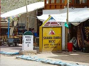
.jpg) The village of Upshi and road junction at the northern end of the Leh Manali Highway | |
 Upshi Location in Jammu and Kashmir, India  Upshi Upshi (India) | |
| Coordinates: 33°48′N 77°48′E / 33.8°N 77.8°ECoordinates: 33°48′N 77°48′E / 33.8°N 77.8°E | |
| Country | India |
| State | Jammu and Kashmir |
| District | Leh |
| Tehsil | Leh |
| Population (2011) | |
| • Total | 128 |
| Time zone | UTC+5:30 (IST) |
| Census code | 890 |
Upshi is a village and road junction on the Leh-Manali Highway in Ladakh region of the Indian state of Jammu and Kashmir. It is located 47 km (29 mi) to the southeast of Leh along the Indus river valley and Tanglang La on the Leh-Manali highway. Gya is also to the south.[1]
An ancient trading road (right turn while coming from Manali) heads to the east from Upshi towards Tibet. There is a helipad on this road. There is a Customs and Excise department's check post on Leh-Manali highway towards Manali after crossing the river. Goat farming is important to the local economy.[2]
Demographics
According to the 2011 census of India, Upshi has 26 households. The effective literacy rate (i.e. the literacy rate of population excluding children aged 6 and below) is 72.65%.[3]
| Total | Male | Female | |
|---|---|---|---|
| Population | 128 | 64 | 64 |
| Children aged below 6 years | 11 | 8 | 3 |
| Scheduled caste | 0 | 0 | 0 |
| Scheduled tribe | 128 | 64 | 64 |
| Literates | 85 | 46 | 39 |
| Workers (all) | 70 | 35 | 35 |
| Main workers (total) | 70 | 35 | 35 |
| Main workers: Cultivators | 53 | 20 | 33 |
| Main workers: Agricultural labourers | 0 | 0 | 0 |
| Main workers: Household industry workers | 0 | 0 | 0 |
| Main workers: Other | 17 | 15 | 2 |
| Marginal workers (total) | 0 | 0 | 0 |
| Marginal workers: Cultivators | 0 | 0 | 0 |
| Marginal workers: Agricultural labourers | 0 | 0 | 0 |
| Marginal workers: Household industry workers | 0 | 0 | 0 |
| Marginal workers: Others | 0 | 0 | 0 |
| Non-workers | 58 | 29 | 29 |
References
- ↑ Outlook Publishing (July 2008). Outlook Traveller. Outlook Publishing. p. 35. Retrieved 25 August 2012.
- ↑ Jina, Prem Singh (1995). High Pasturelands of Ladakh Himalaya. Indus Publishing. p. 53. ISBN 978-81-7387-026-2. Retrieved 25 August 2012.
- 1 2 "Leh district census". 2011 Census of India. Directorate of Census Operations. Retrieved 2015-07-23.