U.S. Route 45 in Illinois
| ||||
|---|---|---|---|---|
_map.svg.png) | ||||
| Route information | ||||
| Maintained by IDOT | ||||
| Length | 428.99 mi[1] (690.39 km) | |||
| Major junctions | ||||
| South end |
| |||
|
| ||||
| North end |
| |||
| Location | ||||
| Counties | Massac, Johnson, Williamson, Saline, Gallatin, White, Wayne, Clay, Effingham, Shelby, Cumberland, Coles, Douglas, Champaign, Ford, Iroquois, Kankakee, Will, Cook, Lake | |||
| Highway system | ||||
| ||||

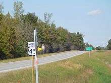
In the U.S. state of Illinois, U.S. Route 45 is a major north–south highway that runs from the Brookport Bridge over the Ohio River at Brookport north through rural sections of eastern Illinois and then through the suburbs of Chicago to the Wisconsin border east of Antioch. This is a distance of 428.99 miles (690.39 km).[1] U.S. 45 is the longest numbered route in Illinois.
Route description
Champaign/Urbana
US 45 serves as the western boundary of the University of Illinois at Urbana-Champaign campus. Entering downtown Champaign as Neil Street, US 45 then goes east on Springfield Avenue, running concurrently with US 150. Farther east of downtown Champaign, it again serves as a boundary for the campus. Following Wright Street, US 45 then moves east on University Avenue, forming the northern border of the University. This path continues to Cunningham Avenue in Urbana. US 45 then turns onto Cunningham Avenue northward towards Chicago.
Kankakee to Hickory Hills
US 45 overlaps US 52 at an intersection with Illinois 49 east of Ashkum. US 45/52 intersects with Illinois Route 17 in Kankakee and Illinois Route 102 in Bourbonnais. Just west of Peotone, US 52 takes a westward course, and US 45 heads north. From this point on until its intersection with Cermak Road/22nd Street in Westchester, US 45 is also known as La Grange Road.
In Frankfort, US 45 intersects with US 30. From that point on until its interchange with Archer Avenue/Illinois Route 171, US 45/La Grange Road is also known as 96th Avenue (9600 W in Chicago's street grid, 96 blocks and 12 miles (19 km) west of State Street). During this stretch it intersects with Interstate 80 and US 6/159th Street in Orland Park. It also intersects Illinois Route 83 (Calumet Sag Road) for the first time in Palos Hills, just south of the Cal-Sag Channel.
Starting at 95th Street near Hickory Hills, US 45 becomes concurrent US 12 and US 20. Two miles further north, at Archer, the road loses its 96th Avenue designation; this is due to the road entering suburbs that do not use Chicago's address system, and that most of its alignment north of Archer would be at 10000 W anyway, if the address system extended to these suburbs.
Hickory Hills to O'Hare International Airport
The concurrent US 12/20/45, past 87th Street, briefly becomes a 4-lane freeway as it intersects with Illinois Route 171 (Archer Avenue) in Justice and Interstate 55 (The Stevenson Expressway) in Hodgkins (along with Interstate 294, which only has a southbound interchange ramp). North of Interstate 55, US 12/20/45 becomes a regular 4-lane highway before it intersects with the former US 66 at Joliet Road in Countryside.
In Downtown La Grange, US 12/20/45 intersects the Burlington Northern/Santa Fe railroad tracks and intersects with US 34 (Ogden Avenue), possibly the only intersection of 4 separate US routes in Illinois.
Following the intersection with US 34, US 12/20/45 passes through La Grange Park (as La Grange Road), moving in a slight northwesterly direction. After passing over Salt Creek, US 12/20/45 intersects with Cermak Road/22nd Street in Westchester and is known as Mannheim Road north of this intersection. Mannheim Road, as US 12/20/45 serves as the Eastern starting point for Illinois Route 38 (Roosevelt Road) in Hillside, has a full interchange with Interstate 290, also in Hillside, and serves as the Eastern starting point for Illinois Route 56 (briefly Washington Boulevard in Bellwood, before becoming Butterfield Road).
After passing over a Union Pacific rail yard, US 45 becomes concurrent with only US 12 in Melrose Park as US 20 breaks off at Lake Street there. US 12 and US 45 remain concurrent on Mannheim Road, passing Interstate 294 again without an interchange, but, after passing Illinois Route 19 (Irving Park Road), has a full interchange with Interstate 190, which leads directly to O'Hare International Airport or Interstate 90 East (into Chicago). This area between IL19 and IL72 once ran straight though but was realigned to the east in 1960 for the construction of O'hare's 4R22L runway.
O'Hare International Airport to Antioch
Past O'Hare airport, US 12/45 intersects with Illinois Route 72 in Illinois, and continues along Mannheim Road in Des Plaines. Mannheim Road ends and feeds into Lee Street at the end of an S-curve. The northbound and southbound routes are split in downtown Des Plaines between Lee Street (West 12/North 45) and Graceland Avenue (East 12/South 45). During this time, US 12/45 intersects with US 14 (Miner Street) at two separate points, due to the separation of their directions.
Just north of US 14, US 12/45 are reunited in both directions on Lee Street, only to be separated as US 12 diverges onto Rand Road and US 45 becomes Des Plaines River Road in a complicated intersection on the north side of Des Plaines, just south of Illinois Route 58.
US 45 continues along Des Plaines River Road, intersecting with Illinois 58 in Des Plaines, and eventually becomes concurrent with Illinois Route 21, Milwaukee Avenue, in Prospect Heights, until Lincolnshire (just north of Illinois Route 22) where US 45 takes a northwest route.
US 45 also intersects with Illinois Route 83 just south of Mundelein (where they exchange routes, as IL 83 goes northwest, and US 45 continues north), Illinois Route 60 in Mundelein, Illinois Route 137 in Libertyville, Illinois Route 120 in Grayslake, and Illinois Route 173 just south of the Wisconsin border.
Major intersections
| County | Location | mi[2] | km | Destinations | Notes |
|---|---|---|---|---|---|
| McCracken | Paducah | Continuation into Kentucky | |||
| Ohio River | 0.0 | 0.0 | Brookport Bridge | ||
| Massac | Metropolis | 5.1 | 8.2 | ||
| 5.5 | 8.9 | I-24 exit 37 | |||
| | 21.4 | 34.4 | |||
| Johnson | Vienna | 30.5 | 49.1 | ||
| | 32.8 | 52.8 | I-24 exit 14 | ||
| | 45.2 | 72.7 | |||
| Saline | Harrisburg | 62.0 | 99.8 | Southern end of IL 34 concurrency | |
| 63.2 | 101.7 | Northern end of IL 34 concurrency | |||
| Eldorado | 70.2 | 113.0 | |||
| Gallatin–White county line | | 79.1 | 127.3 | ||
| White | Norris City | 83.3 | 134.1 | ||
| | 91.6 | 147.4 | |||
| Wayne | Mill Shoals | 104.7 | 168.5 | I-64 exit 110 | |
| Fairfield | 112.7 | 181.4 | Southern end of IL 15 concurrency | ||
| 115.2 | 185.4 | Northern end of IL 15 concurrency | |||
| Clay | | 137.5 | 221.3 | Southern end of US 50 concurrency | |
| | 141.3 | 227.4 | Northern end of US 50 concurrency | ||
| Effingham | | 165.9 | 267.0 | ||
| Effingham | 172.5 | 277.6 | Southern end of US 40 concurrency | ||
| 172.8 | 278.1 | Northern end of US 40 concurrency | |||
| 174.6 | 281.0 | ||||
| Cumberland | | 188.9 | 304.0 | ||
| | 192.5 | 309.8 | Southern end of IL 121 concurrency | ||
| Coles | Mattoon | 197.1 | 317.2 | ||
| 201.0 | 323.5 | Southern end of IL 16 concurrency | |||
| 201.0 | 323.5 | Northern end of IL 16 concurrency | |||
| 201.6 | 324.4 | Northern end of IL 121 concurrency | |||
| Douglas | Arcola | 215.5 | 346.8 | ||
| | 223.2 | 359.2 | |||
| Champaign | Pesotum | 231.4 | 372.4 | ||
| Champaign | 245.9 | 395.7 | Southern end of US 150 concurrency | ||
| Urbana | 248.2 | 399.4 | Northern end of US 150 concurrency | ||
| 249.6 | 401.7 | I-74 exit 184 | |||
| Rantoul | 262.2 | 422.0 | |||
| Ford | Paxton | 273.1 | 439.5 | Southern end of IL 9 concurrency | |
| 273.4 | 440.0 | Northern end of IL 9 concurrency | |||
| Iroquois | Onarga | 291.6 | 469.3 | ||
| Gilman | 294.6 | 474.1 | Southern end of US 24 concurrency | ||
| 296.4 | 477.0 | Northern end of US 24 concurrency | |||
| Ashkum | 304.8 | 490.5 | |||
| | 309.4 | 497.9 | Southern end of US 52 concurrency | ||
| Kankakee | Kankakee | 322.5 | 519.0 | ||
| 324.4 | 522.1 | ||||
| 325.1 | 523.2 | ||||
| 325.7 | 524.2 | Southern end of IL 17 concurrency | |||
| 326.1 | 524.8 | Northern end of IL 17 concurrency | |||
| Bourbonnais | 328.5 | 528.7 | |||
| Will | | 342.3 | 550.9 | ||
| Frankfort | 353.4 | 568.7 | |||
| Mokena–Orland Park– Tinley Park tripoint | 356.7 | 574.1 | I-80 exit 145 | ||
| Cook | Orland Park | 360.1 | 579.5 | ||
| 362.5 | 583.4 | ||||
| | 365.8 | 588.7 | Interchange | ||
| Oak Lawn | 368.2 | 592.6 | Southern end of US 12 & US 20 concurrency | ||
| Willow Springs | 370.1 | 595.6 | Interchange | ||
| Hodgkins | 371.6 | 598.0 | I-55 exit 279 | ||
| Countryside | 372.7 | 599.8 | |||
| La Grange | 375.4 | 604.1 | |||
| Westchester | 378.7 | 609.5 | |||
| 379.2 | 610.3 | I-290 exit 17 | |||
| Bellwood | 379.9 | 611.4 | |||
| Stone Park | 381.0 | 613.2 | Northern end of US 20 concurrency | ||
| 381.7 | 614.3 | ||||
| Schiller Park | 385.2 | 619.9 | |||
| Chicago | 387.0 | 622.8 | I-190 exit 2 | ||
| Rosemont | 388.3 | 624.9 | |||
| Des Plaines | 391.6 | 630.2 | |||
| 392.1 | 631.0 | Northern end of US 12 concurrency | |||
| 392.6 | 631.8 | ||||
| Prospect Heights | 396.1 | 637.5 | Southern end of IL 21 concurrency | ||
| Wheeling | 398.8 | 641.8 | |||
| Cook–Lake county line | Buffalo Grove–Wheeling line | 399.8 | 643.4 | Lake Cook Road | Interchange |
| Lake | Vernon Hills | 403.1 | 648.7 | ||
| 403.4 | 649.2 | Northern end of IL 21 concurrency | |||
| Mundelein | 407.3 | 655.5 | |||
| 407.6 | 656.0 | ||||
| 410.1 | 660.0 | ||||
| Libertyville | 412.9 | 664.5 | Interchange | ||
| Grayslake | 414.6 | 667.2 | |||
| Grandwood Park | 418.1 | 672.9 | |||
| Antioch | 423.7 | 681.9 | |||
| Kenosha | | 428.99 | 690.39 | Continuation into Wisconsin | |
1.000 mi = 1.609 km; 1.000 km = 0.621 mi
| |||||
References
- 1 2 Illinois Technology Transfer Center (2007). "T2 GIS Data". Retrieved 2007-11-08.
- ↑ Google (March 16, 2017). "Overview Map of US 45" (Map). Google Maps. Google. Retrieved March 16, 2017.
| Previous state: Kentucky |
Illinois | Next state: Wisconsin |