Illinois Route 43
| ||||
|---|---|---|---|---|
|
Harlem Avenue Waukegan Road | ||||
| Route information | ||||
| Maintained by IDOT and CDOT | ||||
| Length | 60.30 mi[1] (97.04 km) | |||
| Existed | 1967[2] – present | |||
| Major junctions | ||||
| South end |
| |||
|
| ||||
| North end |
| |||
| Location | ||||
| Counties | Will, Cook, Lake | |||
| Highway system | ||||
| ||||

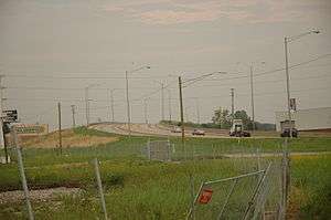
Illinois Route 43 is a major north–south state road in the U.S. state of Illinois. It runs from U.S. Route 30 in Frankfort north to the large intersection of Illinois Route 120 (Belvidere Road) and U.S. Route 41 (Skokie Highway) in Waukegan.
Route description
Illinois 43 is called Waukegan Road for the first 20 miles (32 km) until its intersection with Oakton Street in Niles; it then follows that road west one block until it turns back south and remains Harlem Avenue for the duration. When Illinois Route 50 begins in Skokie and Illinois Route 171 begins in Chicago, It parallels those routes for much of the rest of its length. It enters, exits, and runs parallel to Chicago limits several times, passing through or parallel to Edison Park, Norwood Park, Dunning, Montclare, and Austin on the Northwest Side then Garfield Ridge and Clearing on the Southwest Side. It's listed as 7200 West in the Chicago address system. It is one of seven state roads that travel through the city of Chicago.
History
Illinois Route 42A originally ran on Waukegan Road and Harlem Avenue along modern-day Illinois 43. It was extended north to Highland Park in 1937 before being dropped for Illinois 43 in 1967.[2]
The original Illinois 43 is a current section of Illinois Route 4 from Marine to Murphysboro.
In Deerfield, Route 43 is designated a Blue Star Memorial Highway.[3]
Major intersections
| County | Location | mi[4] | km | Destinations | Notes |
|---|---|---|---|---|---|
| Will–Cook county line | Frankfort | 0.00 | 0.00 | Harlem Avenue continues south | |
| Tinley Park | 3.1 | 5.0 | I-80 exit 148 | ||
| Cook | Orland Park–Tinley Park line | 6.6 | 10.6 | ||
| Palos Heights | 11.7 | 18.8 | |||
| Worth | 13.3 | 21.4 | Northern terminus of IL 7 | ||
| Bridgeview | 14.7 | 23.7 | interchange | ||
| Forest View | 20.4 | 32.8 | I-55 exit 283 | ||
| Lyons | 21.6 | 34.8 | Southern end of Historic US 66 concurrency | ||
| Riverside | 22.1 | 35.6 | Northern end of Historic US 66 concurrency; Eastern terminus of US 34 | ||
| Forest Park | 25.5 | 41.0 | I-290 exit 21B | ||
| River Forest | 27.9 | 44.9 | |||
| Chicago | 31.0 | 49.9 | |||
| 33.0 | 53.1 | Eastern terminus of IL 72 | |||
| 33.1 | 53.3 | I-90 exit 81A | |||
| Niles | 35.5 | 57.1 | Southern terminus of IL 21 | ||
| Morton Grove | 37.0 | 59.5 | Southern end of US 14 concurrency | ||
| 37.3 | 60.0 | Northern end of US 14 concurrency / Southern end of IL 58 concurrency | |||
| 38.3 | 61.6 | Northern end of IL 58 concurrency | |||
| Northbrook | 44.5 | 71.6 | |||
| 45.0 | 72.4 | ||||
| Cook–Lake county line | Deerfield | 45.6 | 73.4 | Lake Cook Road | |
| Lake | Bannockburn | 49.2 | 79.2 | ||
| Lake Forest | 52.1 | 83.8 | |||
| Lake Bluff | 54.9 | 88.4 | |||
| North Chicago | 57.1 | 91.9 | |||
| Park City | 60.30 | 97.04 | IL 120: Southbound exit and northbound entrance; US 41: Northbound exit and southbound entrance | ||
1.000 mi = 1.609 km; 1.000 km = 0.621 mi
| |||||
External links
Route map:
| Wikimedia Commons has media related to Illinois Route 43. |
References
- ↑ Illinois Technology Transfer Center (2006). "T2 GIS Data". Retrieved 2007-11-08.
- 1 2 Carlson, Rick. Illinois Highways Page: Routes 41 thru 60. Last updated March 15, 2006. Retrieved March 28, 2006.
- ↑ Blue Star Memorial Highway plaque located at intersection of Waukegan Road and Hazel Avenue
- ↑ Google Maps,