U.S. Route 52 in Illinois
| ||||
|---|---|---|---|---|
_map.svg.png) | ||||
| Route information | ||||
| Maintained by IDOT | ||||
| Length | 215.78 mi[1] (347.26 km) | |||
| Major junctions | ||||
| West end |
| |||
| East end |
| |||
| Location | ||||
| Counties | Carroll, Ogle, Lee, LaSalle, Kendall, Will, Kankakee, Iroquois | |||
| Highway system | ||||
| ||||

U.S. Route 52 (US 52) in the state of Illinois, is a surface road that traverses the north central and eastern portions of the state. It runs from the Savanna-Sabula Bridge over the Mississippi River between Sabula, Iowa, and Savanna with Illinois Route 64 (IL 64) southeast to the Indiana state line near Sheldon with US 24. This is a distance of 215.78 miles (347.26 km).
Route description
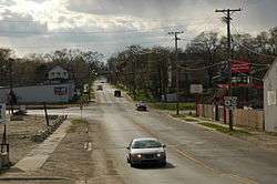
US 52 travels southeast from the Savanna–Sabula Bridge at the terminus of Iowa Highway 64 (Iowa 64) and IL 64 in Savanna, going through the cities of Dixon, Amboy and Mendota.
US 52 then turns due south and then east, crossing Interstate 39 (I-29) and US 51 near Troy Grove. It continues east, traveling through Shorewood and then through the southern portion of Joliet, where it is a major thoroughfare in the city of Joliet (Jefferson Street), avoiding the city of Chicago proper. It joins with US 45 through Kankakee, and then travels concurrently with US 24, east of Watseka to the Indiana state line.
Major intersections
| County | Location | mi[2] | km | Destinations | Notes |
|---|---|---|---|---|---|
| Jackson | Union Township | Continuation into Iowa | |||
| Mississippi River | 0.00 | 0.00 | Savanna–Sabula Bridge | ||
| Carroll | Savanna | 0.13 | 0.21 | Western ends of IL 84 and Great River Road overlaps | |
| 2.19 | 3.52 | Eastern ends of IL 84 and Great River Road overlaps | |||
| Mount Carroll | 11.09 | 17.85 | |||
| Lanark | 18.69 | 30.08 | |||
| Rock Creek–Lima Township | 28.62 | 46.06 | Eastern end of IL 64 overlap | ||
| Ogle | Buffalo Township | 35.0 | 56.3 | Western end of IL 26 overlap | |
| Lee | Dixon | 49.3 | 79.3 | Western end of IL 2 overlap | |
| 49.8 | 80.1 | Eastern end of IL 2 overlap | |||
| 50.1 | 80.6 | Eastern end of IL 26 overlap | |||
| 50.5 | 81.3 | ||||
| Franklin Grove–Amboy township line | 60.1 | 96.7 | |||
| LaSalle | Mendota | 78.0 | 125.5 | Northern end of IL 251 overlap | |
| 79.0 | 127.1 | ||||
| Troy Grove Township | 84.4 | 135.8 | Southern end of IL 251 overlap | ||
| Troy Grove–Ophir township line | 88.5 | 142.4 | |||
| Freedom Township | 99.4 | 160.0 | Western end of IL 23 overlap | ||
| Freedom–Serena township line | 101.6 | 163.5 | Eastern end of IL 23 overlap | ||
| Mission Township | 110.3 | 177.5 | |||
| Kendall | Lisbon Township | 122.2 | 196.7 | ||
| Will | Shorewood | 134.7 | 216.8 | Alternate route of Historic US 66 | |
| 135.2 | 217.6 | ||||
| Joliet | 138.5 | 222.9 | |||
| 140.7 | 226.4 | Western end of US 6 overlap | |||
| 141.2 | 227.2 | Eastern end of US 6 overlap; northern end of IL 53 overlap | |||
| 141.6 | 227.9 | ||||
| 142.0 | 228.5 | Southern end of IL 53 overlap | |||
| Peotone Township | 159.4 | 256.5 | Northern end of US 45 overlap | ||
| Kankakee | Bourbonnais | 173.1 | 278.6 | ||
| Kankakee | 175.5 | 282.4 | Western end of IL 17 overlap | ||
| 175.9 | 283.1 | Eastern end of IL 17 overlap | |||
| 176.5 | 284.0 | ||||
| 177.2 | 285.2 | ||||
| 179.1 | 288.2 | ||||
| Iroquois | Ashkum Township | 192.2 | 309.3 | Southern end of US 45 overlap | |
| Martinton Township | 199.3 | 320.7 | |||
| Sheldon | 213.8 | 344.1 | Western end of US 24 overlap | ||
| Sheldon Township | 215.78 | 347.26 | Continuation into Indiana | ||
1.000 mi = 1.609 km; 1.000 km = 0.621 mi
| |||||
References
- ↑ Illinois Technology Transfer Center (2007). "T2 GIS Data". Retrieved November 8, 2007.
- ↑ Google (March 20, 2017). "Overview Map of US 52" (Map). Google Maps. Google. Retrieved March 20, 2017.
| Previous state: Iowa |
Illinois | Next state: Indiana |