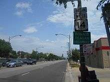
U.S. Route 14 in Illinois
| ||||
|---|---|---|---|---|
|
Northwest Highway Ronald Reagan Highway[1] | ||||
_map.svg.png) | ||||
| Route information | ||||
| Maintained by IDOT and CDOT | ||||
| Length | 69.55 mi[2] (111.93 km) | |||
| Existed | 1933[3]–present | |||
| Major junctions | ||||
| West end |
| |||
|
| ||||
| East end |
| |||
| Location | ||||
| Counties | McHenry, Lake, Cook | |||
| Highway system | ||||
| ||||

In the U.S. state of Illinois, U.S. Route 14 is a major arterial that runs southeast from the Wisconsin state line north of Harvard, Illinois to the north side of Chicago at U.S. Route 41.
Route description
U.S. 14 begins in Chicago as Broadway on the city's north side. It runs north as Broadway and turns northwest onto Ridge Boulevard. One half block after crossing Clark Street, U.S. Route 14 turns west onto Peterson Avenue. At Cicero Avenue, Peterson Avenue becomes Caldwell Avenue and travels in a northwest/northern direction entering Niles. U.S. Route 14 joins Illinois Route 43 (Waukegan Road) for a short time before turning west onto Dempster Street. U.S. 14 travels west briefly touching Park Ridge and enters Des Plaines.
Where U.S. Highway 14 crosses Interstate 294 is an unusual intersection where all four street names change. From the south is Northwest Highway coming out of Park Ridge and Chicago; from the north is Rand Road. U.S. Highway 14 continues straight west but no longer as Dempster Street, but now as Miner Street. Miner Street begins a northwesterly direction into downtown Des Plaines crossing two intersections of U.S. Routes 45 and 12. The name Miner Street changes to Northwest Highway after going under a wooden railroad underpass on a large S-curve. U.S. Route 14 continues for most of the rest of its length northwest to Wisconsin designated as Northwest Highway.
Though the name is not used among locals, the entire portion of U.S. 14 in Illinois is given the honorary name Ronald Reagan Highway, which is not to be confused with the Ronald Reagan Memorial Tollway.[1] U.S. 14 in Illinois is 69.55 miles (111.93 km) in length.[2]
History
At one point, U.S. Route 14 continued down Foster Avenue to Lake Shore Drive, where it then turned south. It left Lake Shore Drive for Michigan Avenue and intersected U.S. Route 66. It then terminated at what was U.S. Route 20 before it was diverted.
Major intersections
| County | Location | mi | km | Destinations | Notes |
|---|---|---|---|---|---|
| McHenry | Chemung Township | 0.00 | 0.00 | Wisconsin state line | |
| Harvard | 2.6 | 4.2 | Western terminus of CR A15 | ||
| 5.2 | 8.4 | Northern end of IL 173 concurrency | |||
| 5.7 | 9.2 | Southern end of IL 173 concurrency | |||
| 6.2 | 10.0 | ||||
| 6.9 | 11.1 | Northern terminus of IL 23 | |||
| Woodstock | 11.5 | 18.5 | Western terminus of CR A28 | ||
| 12.4 | 20.0 | Eastern terminus of CR A29 | |||
| 14.9 | 24.0 | Western terminus of IL 120 | |||
| 19.6 | 31.5 | ||||
| Crystal Lake | 25.4 | 40.9 | |||
| 29.3 | 47.2 | Interchange | |||
| Fox River Grove | 34.1 | 54.9 | Western terminus of IL 22 | ||
| Lake | Barrington | 38.5 | 62.0 | ||
| Cook | Palatine Township | 41.7 | 67.1 | Interchange | |
| Palatine | 46.6 | 75.0 | Interchange | ||
| Mt. Prospect | 51.6 | 83.0 | |||
| Des Plaines | 52.9 | 85.1 | |||
| 54.5 | 87.7 | ||||
| 55.6 | 89.5 | ||||
| Niles | 57.7 | 92.9 | Interchange | ||
| Morton Grove | 59.1 | 95.1 | Northern end of IL 43 concurrency | ||
| 59.5 | 95.8 | Southern end of IL 43 concurrency | |||
| Chicago | 63.8 | 102.7 | No access from US 14 east to I-94 west | ||
| 63.9 | 102.8 | ||||
| 66.0 | 106.2 | ||||
| 68.5 | 110.2 | Hollywood Avenue to Lake Shore Drive | |||
| 69.2 | 111.4 | Eastern terminus of US 14 | |||
1.000 mi = 1.609 km; 1.000 km = 0.621 mi
| |||||
References
Route map:
- 1 2 Ronald Reagan Presidential Foundation & Library. "Things Named in Honor of Ronald Reagan". Retrieved 2007-10-23.
- 1 2 Illinois Technology Transfer Center (2007). "T2 GIS Data". Retrieved 2007-11-08.
- ↑ Carlson, Rick (2005-03-15). "Illinois Highways Page: Routes 1-20". Retrieved 2006-05-27.
| Previous state: Wisconsin |
Illinois | Next state: Terminus |