Sunbury, North Carolina
| Sunbury, North Carolina | |
|---|---|
| Census-designated place | |
 Sunbury  Sunbury | |
| Coordinates: 36°26′28″N 76°36′42″W / 36.44111°N 76.61167°WCoordinates: 36°26′28″N 76°36′42″W / 36.44111°N 76.61167°W | |
| Country | United States |
| State | North Carolina |
| County | Gates |
| Area | |
| • Total | 2.45 sq mi (6.35 km2) |
| • Land | 2.45 sq mi (6.35 km2) |
| • Water | 0.0 sq mi (0.0 km2) |
| Elevation | 33 ft (10 m) |
| Population (2010) | |
| • Total | 289 |
| • Density | 118/sq mi (45.5/km2) |
| Time zone | UTC-5 (Eastern (EST)) |
| • Summer (DST) | UTC-4 (EDT) |
| ZIP code | 27979 |
| Area code(s) | 252 |
| GNIS feature ID | 1025733[1] |
| FIPS code | 37-65700 |
Sunbury is a census-designated place (CDP) and unincorporated community in Gates County, North Carolina, United States. As of the 2010 census it had a population of 289.[2]
Sunbury is located at the junction of U.S. Route 158 and North Carolina Highway 32 10 miles (16 km) east-northeast of Gatesville, the Gates County seat. Sunbury has a post office with ZIP code 27979.[3]
Sunbury High School was listed on the National Register of Historic Places in 2009.[4]
References
- ↑ U.S. Geological Survey Geographic Names Information System: Sunbury, North Carolina
- ↑ "Geographic Identifiers: 2010 Demographic Profile Data (G001): Sunbury CDP, North Carolina". American Factfinder. U.S. Census Bureau. Retrieved January 3, 2017.
- ↑ ZIP Code Lookup
- ↑ National Park Service (2010-07-09). "National Register Information System". National Register of Historic Places. National Park Service.
Municipalities and communities of Gates County, North Carolina, United States | ||
|---|---|---|
| Town | 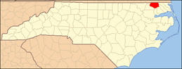 | |
| CDP | ||
| Unincorporated communities | ||
This article is issued from
Wikipedia.
The text is licensed under Creative Commons - Attribution - Sharealike.
Additional terms may apply for the media files.