Torrens Road, Adelaide
| Torrens Road South Australia | |
|---|---|
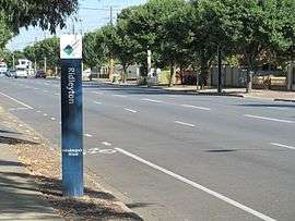 | |
| Torrens Road, Ridleyton | |
| General information | |
| Type | Road |
| Length | 8 km (5.0 mi) |
| Route number(s) |
|
| Major junctions | |
| SE end | Ovingham, Adelaide |
| NW end | Rosewater, Adelaide |
| Location(s) | |
| Major suburbs | Ovingham, Bowden, Renown Park, Brompton, Ridleyton, Croydon, West Croydon, Croydon Park, Kilkenny, Woodville Park, Woodville North, Woodville, Cheltenham, Pennington, Rosewater |
Torrens Road is an arterial road in the northwestern suburbs of Adelaide, Australia.[1] The road travels in a southeast-northwest direction and is parallel with Port Road for most of its length.
It commences at Park Terrace (A21). Travelling northwest, major roads that intersect Torrens Road include Churchill Road (A22), South Road (A13), and Regency Road. It meets the Outer Harbor railway line in Alberton, and ceases a short distance later, a couple of hundred metres south of Grand Junction Road (A16).
The short section between Park Terrace and Churchill Road at the southeastern end of Torrens Road is designated route A22, which then follows Churchill Road.
The former Cheltenham Park Racecourse ( now a residential area ) and Armada Arndale Shopping Centre are both located on Torrens Road.
Torrens Road is located in the Cities of Prospect, Charles Sturt and Port Adelaide Enfield.
Major intersections
| LGA | Location[2] | km[3] | mi | Destinations[3] | Notes |
|---|---|---|---|---|---|
| Adelaide, Charles Sturt, Prospect | North Adelaide, Ovingham, Fitzroy | 0.0 | 0.0 | ||
| Charles Sturt, Prospect | Ovingham | 0.35 | 0.22 | ||
| Ovingham, Brompton, Renown Park | 0.45 | 0.28 | Gawler and Port Augusta railways | Level crossing | |
| Charles Sturt | Renown Park, Ridleyton, Croydon | 2.0 | 1.2 | South Road is being renumbered to A2 as part of Torrens to Torrens upgrade. By the end of 2018, there will be traffic lights for South Road and grade separation for North South Motorway in a trench in the median. | |
| Kilkenny, Woodville Park | 4.2 | 2.6 | Regency Road, David Terrace | ||
| Kilkenny, Woodville Park, Woodville, Woodville North | 4.5 | 2.8 | Hanson Road | ||
| Pennington, St Clair, Cheltenham | 6.7 | 4.2 | Addison Road, Cheltenham Parade | ||
| Port Adelaide Enfield | Rosewater, Alberton | 7.6 | 4.7 | Newcastle Street | |
| Rosewater | 8.4 | 5.2 | No through road | Ends inside fork of junction of Dry Creek and Adelaide railway lines to Port Adelaide | |
| 1.000 mi = 1.609 km; 1.000 km = 0.621 mi | |||||
See also
![]()
References
- ↑ 2003 Adelaide Street Directory, 41st Edition. UBD (A Division of Universal Press Pty Ltd). 2003. ISBN 0-7319-1441-4.
- ↑ "map with LGA and suburb layers". Property Location Browser. Government of South Australia. Retrieved 8 July 2017.
- 1 2 Google (8 July 2017). "Torrens Road" (Map). Google Maps. Google. Retrieved 8 July 2017.
34°53′56″S 138°35′16″E / 34.898952°S 138.587682°E