Kilkenny, South Australia
| Kilkenny Adelaide, South Australia | |||||||||||||||
|---|---|---|---|---|---|---|---|---|---|---|---|---|---|---|---|
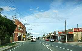 Looking south on David Terrace. Kilkenny is on the left. | |||||||||||||||
| Population |
1,551 (2006 census)[1] 1,392 (2001 Census)[2] | ||||||||||||||
| Established | 1849[3] | ||||||||||||||
| Postcode(s) | 5009[4] | ||||||||||||||
| Location | 7.5 km (5 mi) NW of Adelaide city centre[4] | ||||||||||||||
| LGA(s) | City of Charles Sturt[5] | ||||||||||||||
| State electorate(s) | Croydon (2012) & Enfield (2012)[6] | ||||||||||||||
| Federal Division(s) | Port Adelaide (2012)[7] | ||||||||||||||
| |||||||||||||||
Kilkenny is an inner north-western suburb of Adelaide, South Australia. It is located in the City of Charles Sturt. It is named after Kilkenny (Cill Chainnigh), Ireland.
History
The suburb of Kilkenny was created by subdivision of section 388 of the Hundred of Yatala in 1849 and was known as the Township of Kilkenny.[3] Section 388 was bounded on its north east by Torrens Road, indicating the historic township occupied only the southern half of the present suburb. The present-day boundaries of Kilkenny include the former suburb of Challa Gardens, created by subdivision of section 411E of the same hundred in 1950, which was also known as Woodville East and Kilkenny North prior to the 1950 subdivision.[8]
Geography
Kilkenny straddles Torrens Road where it joins with Regency Road. Kilkenny Road and David Terrace forms its western boundary.[9]
Demographics
The 2006 Census by the Australian Bureau of Statistics counted 1,551 persons in Kilkenny on census night. Of these, 48.0% were male and 52.0% were female.[1]
The majority of residents (56.9%) are of Australian birth, with other common census responses being Italy (5.0%), Vietnam (4.6%), England (3.4%) and Greece (2.4%).[1]
The age distribution of Kilkenny residents is similar to that of the greater Australian population. 71.4% of residents were over 25 years in 2006, compared to the Australian average of 66.5%; and 28.6% were younger than 25 years, compared to the Australian average of 33.5%.[1]
Politics
Local government
Kilkenny is part of Hindmarsh Ward in the City of Charles Sturt local government area, with representative councillors Paul Alexandrides and Alice Campbell.[5]
State and federal
Kilkenny lies in the state electoral districts of Croydon and Enfield[6] and the federal electoral division of Port Adelaide.[7] The suburb is represented in the South Australian House of Assembly by Michael Atkinson (Croydon) and John Rau (Enfield) [6] and federally by Mark Butler.[7]
Community
The local newspaper is the Weekly Times Messenger in the past this paper used to be delivered by hand, but now it's more easily accessed on-line. Other regional and national newspapers such as The Advertiser and The Australian are also available.[10]
Community and Arts
There is a very active community arts scene in Kilkenny, pursued strongly through local arts community group Kilkenny Gorilla Art", who share much information on Facebook and are a group very worthy of joining.
Schools
Challa Gardens Primary School is located on Humphries Terrace[11] and Kilkenny Primary School is located in the adjacent suburb of West Croydon on Jane Street, just south west of Kilkenny.
Facilities and attractions
Shopping and dining
Armada Arndale Shopping Centre is located on Torrens Road in the north of the suburb.[9]
Parks
The main park in the suburb is Alton Reserve on Reynell Street. McInerny Reserve, in West Croydon, is accessible from Pinda and Mundulla streets.[9]
Transportation
Roads
Kilkenny is serviced by Regency Road and Torrens Road, the latter of which connects the suburb to Adelaide city centre.[9]
Public transport
Kilkenny is serviced by public transport run by the Adelaide Metro.[12]
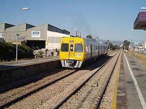
Trains
The Grange and Outer Harbour railway lines pass through the suburb. The closest station is Kilkenny.
Buses
The suburb is serviced by bus routes run by the Adelaide Metro.[12]
See also
| Wikimedia Commons has media related to Kilkenny, South Australia. |
References
- 1 2 3 4 Australian Bureau of Statistics (25 October 2007). "Kilkenny (State Suburb)". 2006 Census QuickStats. Retrieved 2 February 2012.
- ↑ Australian Bureau of Statistics (9 March 2006). "Kilkenny (State Suburb)". 2001 Census QuickStats. Retrieved 2 February 2012.
- 1 2 "Place Names of South Australia". The Manning Index of South Australian History. State Library of South Australia. Retrieved 2 February 2012.
- 1 2 "Kilkenny, South Australia (Adelaide)". Postcodes-Australia. Postcodes-Australia.com. Retrieved 2 February 2012.
- 1 2 "City of Charles Sturt Wards and Council Members" (PDF). City of Charles Sturt. Archived from the original (PDF) on 5 August 2011. Retrieved 2 February 2012.
- 1 2 3 "Electoral Districts - Electoral District for the 2010 Election". Electoral Commission SA. Archived from the original on 22 August 2011. Retrieved 2 February 2012.
- 1 2 3 "Find my electorate: Port Adelaide". Australian Electoral Commission. Archived from the original on 27 July 2011. Retrieved 2 February 2012.
- ↑ Manning, Geoffrey. "Challa Gardens". Manning Index of South Australian Place Names. State Library of South Australia. Retrieved 16 August 2017.
- 1 2 3 4 Adelaide and surrounds street directory (49th ed.). UBD. 2011. ISBN 978-0-7319-2652-7.
- ↑ "South Australian Newspapers". Newspapers.com.au. Australia G'day. Retrieved 2 February 2012.
- ↑ "Australian Schools Directory". Australian Schools Directory. Retrieved 2 February 2012.
- 1 2 "Public Transport in Adelaide". Adelaide Metro official website. Dept. for Transport, Energy and Infrastructure, Public Transport Division. Archived from the original on 26 April 2011. Retrieved 2 February 2012.
External links
- "City of Charles Sturt". Official website. City of Charles Sturt. Retrieved 2 February 2012.