Teviot Brook
| Teviot Brook (Ickkaybin) | |
| River | |
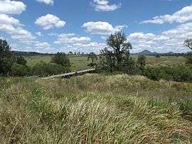 Closed road bridge at Kagaru | |
| Name origin: Allan Cunningham | |
| Country | Australia |
|---|---|
| State | Queensland |
| Region | South East Queensland |
| Local government areas | Scenic Rim Region |
| Source | Scenic Rim |
| - location | below Mount Roberts |
| - coordinates | 28°10′06″S 152°33′22″E / 28.16833°S 152.55611°E |
| Mouth | Logan River |
| - location | east of Cedar Grove |
| - elevation | 31 m (102 ft) |
| - coordinates | 27°50′36″S 152°56′46″E / 27.84333°S 152.94611°ECoordinates: 27°50′36″S 152°56′46″E / 27.84333°S 152.94611°E |
| National park | Main Range National Park |
| Impoundment | Wyaralong Dam |
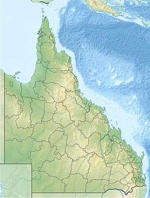 Location of the Teviot Brook mouth in Queensland | |
Teviot Brook is a waterway in South East Queensland, Australia. It rises in the Main Range at Carneys Creek and joins the Logan River at Cedar Grove. It is part of the Clarence Moreton Basin, a sedimentary basin on the easternmost part of the Australian continent.
The catchment experiences strong seasonality with heavy rainfall in summer and a dry winter.[1] Teviot Brook passes through the town of Boonah[2] and Mount Alford. Close to its mouth, Teviot Brook is cross by the Sydney–Brisbane rail corridor.
History
It was named on 6 August 1828 by Allan Cunningham, a botanist and explorer, after the Teviot River, Roxburghshire, Scotland.[3] A plaque commemorating the naming is found at Coulson School in Coulson.[4] In 2011, the Wyaralong Dam was opened. It dams the Teviot Brook between Allenview and Wyaralong at the southern end of the Teviot Range. At the headwaters of the waterway close to the News South Wales border is Teviot Falls.
Management
The state government is working with landholders in the catchment to reduce sediment and nutrient runoff.[5] Other restoration programs along the river aim to control weeds, restore native vegetation and stabilise eroding banks.[6]
References
- ↑ Duvert, Clément; Dioni I. Cendon; Matthias Raiber; Jean-Luc Seidel; Malcolm E. Cox. "Seasonal and spatial variations in rare earth elements to identify inter-aquifer linkages and recharge processes in an Australian catchment". Chemical Geology. 396 (9 March 2015): 83–97. Retrieved 17 July 2017.
- ↑ "Boonah". Queensland Places. Centre for the Government of Queensland. Retrieved 6 July 2017.
- ↑ "Queensland place names search". The State of Queensland. Retrieved 17 July 2017.
- ↑ "Teviot Brook". Monument Australia. Retrieved 17 July 2017.
- ↑ "Making a difference to Teviot Brook: Merrilyn Stenzel's creek project". SEQ Catchments. The State of Queensland. Retrieved 17 July 2017.
- ↑ "Upper Teviot Brook Restoration: Gillett". The State of Queensland. 26 November 2014. Retrieved 17 July 2017.
Rivers of Queensland | |||||||||||||||
|---|---|---|---|---|---|---|---|---|---|---|---|---|---|---|---|
| |||||||||||||||
| |||||||||||||||
| |||||||||||||||
| |||||||||||||||
| |||||||||||||||
| |||||||||||||||