Normanby River
| Normanby | |
| East Normanby, West Normanby, East Normanby North Branch, East Normanby South Branch, Granite Normanby | |
| River | |
 | |
| Name origin: In honour of George Phipps, 2nd Marquess of Normanby[1] | |
| Country | Australia |
|---|---|
| State | Queensland |
| Region | Far North Queensland, Cape York Peninsula, Wet Tropics of Queensland |
| Tributaries | |
| - left | Banana Creek (Queensland), Beardmore Creek, Cabbage Tree (Welcome) Creek, Laura River, Kennedy River |
| - right | Nigger Creek (Queensland), Surrender Creek, Trapp Creek, Bridge Creek (Queensland), Jack River (Queensland), House Creek (Queensland) |
| Source | Great Dividing Range |
| - location | west of Wajul Wajul |
| - coordinates | 15°55′S 145°12′E / 15.917°S 145.200°E |
| Source confluence | East and West Normanby Rivers |
| - elevation | 125 m (410 ft) |
| - coordinates | 15°39′39″S 144°56′17″E / 15.66083°S 144.93806°E |
| Mouth | Princess Charlotte Bay |
| - location | Lakefield National Park |
| - elevation | 0 m (0 ft) |
| - coordinates | 14°23′47″S 144°08′37″E / 14.39639°S 144.14361°ECoordinates: 14°23′47″S 144°08′37″E / 14.39639°S 144.14361°E |
| Length | 350 km (217 mi) |
| Basin | 24,408 km2 (9,424 sq mi) |
| Discharge | for Princess Charlotte Bay |
| - average | 390 m3/s (13,773 cu ft/s) |
| National park | Lakefield National Park |
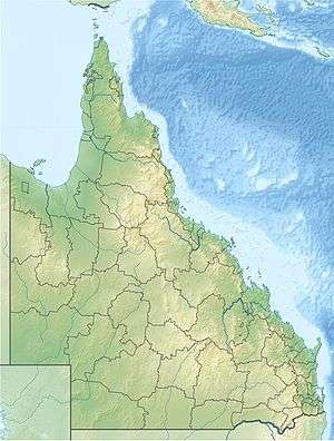 Location of Normanby River river mouth in Queensland | |
| Wikimedia Commons: Normanby River | |
| [2][3][4][5][6][7] | |
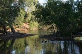
The Normanby River, comprising the East Normanby River, the West Normanby River, the East Normanby River North Branch, the East Normanby River South Branch and the Granite Normanby River, is a river system located in Far North Queensland, Australia.
Location and features
With its headwaters in the Great Dividing Range west of Wajul Wajul in the Wet Tropics of Queensland, the Normanby River is formed by the confluence of the East and West Branches of the river at an elevation of 125 metres (410 ft) AHD . The river flows generally north-northwestw through seasonally flooded savanna grassland to reach its mouth in Princess Charlotte Bay about 150 kilometres (93 mi) northwest of Cooktown. The river is joined by 18 tributaries including the Laura River. The river flows through the Lakefield National Park, which covers as much as a fifth of the river's basin and is completely impassable during the wet season between November and May. The Lakefield National Park consists of large wetlands which possess a high diversity of fish species. Near its mouth, the Normanby River flows very slowly and forms a large delta, which is almost inaccessible even during the dry season as there are no roads – even unsealed ones. This land, though, is still dry enough during the dry season that tropical rainforests cannot grow.
The combined river system descends from a peak elevation of 622 metres (2,041 ft) AHD to sea level, with a combined course from source to mouth of over 490 kilometres (300 mi).[2][3][4][5][6][7]
While one source considers the Normanby River system as the third largest river in Australia,[8] the Australian Government agency, Geoscience Australia, does not assess the Normanby River system within the ten longest rivers in Australia nor within the three longest continuous river systems in the country.[9] The river may be the largest river flowing into the Coral Sea. The Normanby River system has less than half the flow of the Murray and Mitchell Rivers - though data regarding its flow are sparse with less than a third of the 24,408-square-kilometre (9,424 sq mi) catchment area gauged. Together with the Laura River, the Normanby River system is the fourth largest river system in the Great Barrier Reef catchment, with the third largest mean annual discharge into the Reef.[10] Consequently almost all scientific research into the flow and hydrology of the Normanby basin has been done with the health of the reef rather than the river per se in mind. The fact that the Normanby is completely free of dams means that Australian Government studies have used it as a model for the behaviour of rivers further south when they were in something closer to a virgin state.
The Normanby basin is almost entirely used for the grazing of beef cattle on large stations - mostly worked by Aborigines. The density of cattle is very low, as are rents. The soils, being mostly ancient lateritic Orthents, are totally unsuitable for the growing sugar cane, which is the principal crop in tropical Australia.
Etymology
The river was named by William Hann in September 1872 in honour of George Phipps, 2nd Marquess of Normanby, who served as the third Governor of Queensland between 1871 and 1874.[1][11]
See also
References
- 1 2 "Normanby River". Queensland place names search. Queensland Government. Retrieved 31 October 2015.
- 1 2 "Map of Normanby River, QLD". Bonzle Digital Atlas of Australia. Retrieved 31 October 2015.
- 1 2 "Map of East Normanby River, QLD". Bonzle Digital Atlas of Australia. Retrieved 31 October 2015.
- 1 2 "Map of East Normanby River North Branch, QLD". Bonzle Digital Atlas of Australia. Retrieved 31 October 2015.
- 1 2 "Map of East Normanby River South Branch, QLD". Bonzle Digital Atlas of Australia. Retrieved 31 October 2015.
- 1 2 "Map of West Normanby River, QLD". Bonzle Digital Atlas of Australia. Retrieved 31 October 2015.
- 1 2 "Map of Granite Normanby River, QLD". Bonzle Digital Atlas of Australia. Retrieved 31 October 2015.
- ↑ Brown, John Alexander Henstridge (1983). Australia’s Surface Water Resources. Canberra: Australian Government Publication Service.
- ↑ "Longest rivers". Geoscience Australia. Australian Government. 21 December 2012. Retrieved 15 June 2013.
- ↑ Howley, Christina (2013). "Normanby River Water Quality: 2006-2013 Monitoring Results" (PDF). Cape York Water Quality. p. 2. Retrieved 31 October 2015.
- ↑ Jack, R. L. (1922). Northmost Australia. 2. Melbourne: George Robertson and Co. p. 410.
Rivers of Queensland | |||||||||||||||
|---|---|---|---|---|---|---|---|---|---|---|---|---|---|---|---|
| |||||||||||||||
| |||||||||||||||
| |||||||||||||||
| |||||||||||||||
| |||||||||||||||
| |||||||||||||||