Styx River (East Central Queensland)
| Styx | |
| River | |
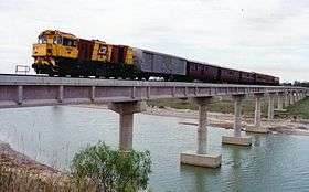 Railway bridge over the Styx River | |
| Country | Australia |
|---|---|
| State | Queensland |
| Region | Central Queensland |
| Source | Connors and Broadsound Range |
| - elevation | 7 m (23 ft) |
| Mouth | Broad Sound |
| - location | Charon Point |
| - elevation | 0 m (0 ft) |
| - coordinates | 22°21′39″S 149°47′55″E / 22.36083°S 149.79861°ECoordinates: 22°21′39″S 149°47′55″E / 22.36083°S 149.79861°E |
| Length | 33 km (21 mi) |
| Basin | 3,055 km2 (1,180 sq mi) |
| Conservation area | Charon Point Conservation Park |
| Islands | Rosewood; Turtle |
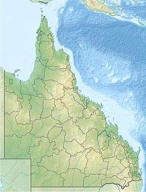 Location of Styx River mouth in Queensland | |
| [1][2] | |
The Styx River is a river in the eastern portion of Central Queensland, Australia.
The river rises in the Connors and Broadsound Range and enters Broad Sound south of the Port of St Lawrence and to the north of the town of Ogmore. The river is crossed by both the Bruce Highway and North Coast railway line. From source to mouth, the river descends 7 metres (23 ft) over its 33-kilometre (21 mi) course.[1]
The Styx River is wide at its mouth, resulting in a tidal bore at certain times. Much of the river valley remains natural leaving the water quality in a healthy state.[3]
See also
References
- 1 2 "Map of Styx River, QLD". Bonzle Digital Atlas of Australia. Retrieved 26 November 2015.
- ↑ "Styx River (entry 32717)". Queensland Place Names. Queensland Government. Retrieved 26 November 2015.
- ↑ "Rivers: Assessment of River Condition - Queensland". Retrieved 2008-05-24.
Rivers of Queensland | |||||||||||||||
|---|---|---|---|---|---|---|---|---|---|---|---|---|---|---|---|
| |||||||||||||||
| |||||||||||||||
| |||||||||||||||
| |||||||||||||||
| |||||||||||||||
| |||||||||||||||
This article is issued from
Wikipedia.
The text is licensed under Creative Commons - Attribution - Sharealike.
Additional terms may apply for the media files.