Wilson River (Queensland)
| Wilson | |
| River | |
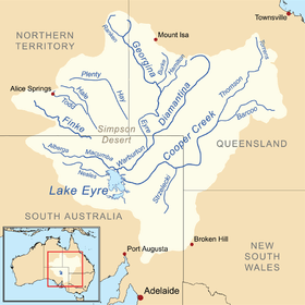 Map of the Lake Eyre basin | |
| Country | Australia |
|---|---|
| State | Queensland |
| Regions | Channel Country, Western Qld |
| Part of | Lake Eyre basin |
| Tributaries | |
| - left | Tookabarnoo Creek, Nockanoora Creek |
| Source | Grey Range |
| - location | Oonagie Sandhill |
| - elevation | 69 m (226 ft) |
| Mouth | confluence with the Cooper Creek |
| - location | Depot Camp (Camp 63) |
| - elevation | 27 m (89 ft) |
| - coordinates | 27°48′S 142°11′E / 27.800°S 142.183°ECoordinates: 27°48′S 142°11′E / 27.800°S 142.183°E |
| Length | 28 km (17 mi) |
| Waterhole | Nockanoora |
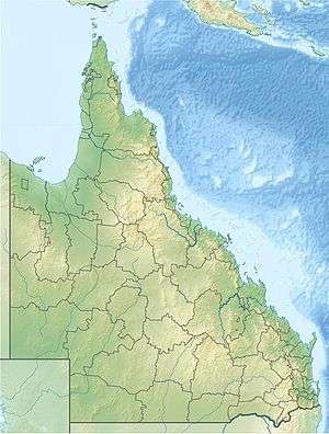 Location of the river mouth in Queensland | |
| [1] | |
The Wilson River, part of the Lake Eyre Basin, is an ephemeral river located in the Channel Country in western Queensland, Australia.
The Wilson River rises on the slopes of the Grey Range and flows generally northwest through the Nockanoora (or Noccundra) waterhole and is joined by two minor tributaries before reaching its confluence with the Cooper Creek at what was known as Depot Camp (Camp 63). The river descends 8 metres (26 ft) over its 28-kilometre (17 mi) course.[1][2]
It is believed that Burke and Wills first found water on the Macleay Plains and crossed Cooper Creek near its junction with the Wilson River, on 11 November 1860.[3]
See also
References
- 1 2 "Map of Wilson River, QLD". Bonzle Digital of Australia. Retrieved 25 March 2017.
- ↑ "Wilson River History". Thargo Tourism. The Bulloo Shire. Retrieved 25 March 2017.
- ↑ "Where did Burke cross Cooper's Creek". Dig: the Burke & Wills research gateway. State Library of Victoria. Retrieved 25 March 2017.
Rivers of Queensland | |||||||||||||||
|---|---|---|---|---|---|---|---|---|---|---|---|---|---|---|---|
| |||||||||||||||
| |||||||||||||||
| |||||||||||||||
| |||||||||||||||
| |||||||||||||||
| |||||||||||||||
This article is issued from
Wikipedia.
The text is licensed under Creative Commons - Attribution - Sharealike.
Additional terms may apply for the media files.