South Mumbai
| South Mumbai | |
|---|---|
| Precinct of Mumbai | |
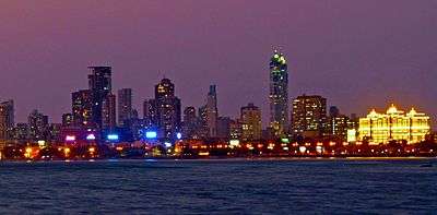 Night view of South Mumbai from the sea | |
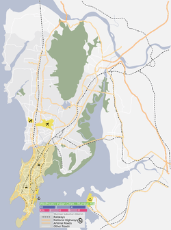 The South Mumbai precinct is shown in orange | |
 South Mumbai The South Mumbai precinct is shown in orange  South Mumbai South Mumbai (Maharashtra)  South Mumbai South Mumbai (Mumbai) | |
| Coordinates (India Post Office GPO): 18°56′20″N 72°50′14″E / 18.9389245°N 72.8372392°E | |
| Country | India |
| State | Maharashtra |
| District | Mumbai City |
| City | Mumbai |
| Wards |
A, B, C, D, E, FS, FN, GS, GN |
| Area | |
| • Total | 67.7 km2 (26.1 sq mi) |
| Population (2011) | |
| • Total | 3,145,966 |
| • Density | 46,000/km2 (120,000/sq mi) |
| Time zone | UTC+5:30 (IST) |
| South Mumbai: Population Growth | |||
|---|---|---|---|
| Census | Pop. | %± | |
| 1971 | 3,070,380 | — | |
| 1981 | 3,285,040 | 7.0% | |
| 1991 | 3,174,910 | -3.4% | |
| 2001 | 3,326,840 | 4.8% | |
| Est. 2011 | 3,145,966 | -5.4% | |
| Source: MMRDA[1] Data is based on Government of India Census. | |||
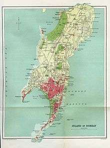
.jpg)
South Mumbai (sometimes referred to informally as "SoBo"- i.e. South Bombay[2]) is the southernmost precinct of the city of Mumbai, Maharashtra, India, and comprises the city's main business localities. It is the richest urban precinct in India. Property prices in South Mumbai are the highest in India and are among the highest in the world.
Notably Cumballa Hill, Cuffe Parade, Malabar Hill, Breach Candy, Altamount Road-Kemps Corner as well as some parts of Worli are constantly ranked in the Global Property Index.
Billionaire Mukesh Ambani's $1.5 billion home Antilia is located here and is now a part of the iconic skyline. Most residents of South Mumbai belong to old money business, law, trade and fashion families. Geographically, South Mumbai lies at the southern corner of Salsette Island. Most city residents use the term to refer to the stretch extending from Colaba to Mahim as South Mumbai. The area is delimited on the east by Mumbai harbour and on the west by the Arabian Sea.
South Bombay is also home to the most prestigious schools; namely The Cathedral & John Connon School, JB Petit, Campion, Bombay International etc. ; the most exclusive clubs: CCI, The Willingdon Sports Club as well as Bombay Gymkhana and the most expensive hospitals: Breach Candy Hospital, Jaslok and Hurkisondas Hospital; in the nation.
Some areas which are close to South Bombay but aren't really a part of it such as Lalbaug. This is a mistake and is considered to be minorly offensive to say so.
Significance
South Mumbai hosts the Reserve Bank of India, Bombay Stock Exchange and oldest YMCA Procter. Its primary business districts are the Fort, Nariman Point, Ballard Estate and more recently Lower Parel, Mumbai Central. Many leading Indian and multi-national companies are headquartered here. Chhatrapati Shivaji Terminus (CST) and Churchgate serve as headquarters and starting point for country's Central and Western Railway lines respectively.
The area houses a significant proportion of prime upmarket residential neighbourhoods of Mumbai including: Peddar Road, Nepean Sea Road, [Kemps Corner], Altamont Road, Carmichael Road, Breach Candy and Walkeshwar Road, forming a sort of golden quadrilateral and includes some of the most expensive residential areas in the world, such as the Hanging Gardens, Kemps Corner, Cuffe Parade and Malabar Hill.
Many distinctive sporting clubs have been an integral part of South Mumbai landscape like the Willingdon Sports Club, the Turf Club at Mahalaxmi Racecourse, the Bombay Gymkhana, the Breach Candy Club, the N.S.C.I, and the Malabar Hill Club (Formerly W.I.A.A Club). The CCI and MCA are located at Mumbai's two cricket stadiums, Brabourne and Wankhede respectively.
Although land reclamation has allowed the southernmost tip of the district to double in size since the 1970s, the business districts face an acute shortage of real estate. As a result, the real-estate prices are among the top ten worldwide. As a ratio to average per capita income, real-estate prices in the business districts remain the most expensive in the world.
South Mumbai is also the home to several of the city's sporting grounds, including Brabourne Stadium, Wankhede Stadium, Cooperage Ground, Azad Maidan Oval Maidan and Shivaji Park.
Ethnically, south Mumbai continues to be dominated by the diverse communities of the ethnic population.
South Mumbai has become even more congested with the creation of the Bandra Worli Sealink. This facilitates quicker transport between people residing in the suburbs and the corporate offices in south Mumbai. Traffic is a major concern and is not looking like improving any time soon. South Mumbai is one of Indias most diverse areas since it contains a variety of eating options from 5 star hotels to street food. Being connected to the coast has also made it a very important port for business.
Division
The city of Mumbai lies on Salsette Island. Administratively it has two official divisions: Mumbai City district and Mumbai Suburban district. Mumbai City district consists of the southernmost part of Salsette Island - the area called South Mumbai. Mumbai Suburban district consist the Western, Eastern, Central and Northern part of the city
The northernmost portion of the island - outside Mumbai city limits - lies in Thane District.
Old Bombay
Old Bombay was used to refer to the area which was formed by the merging of the seven original islands of Mumbai, India. The term was used from the 19th century until the 1980s, and is now considered archaic. The more widely used term today is South Mumbai '.
See also
Notes
References
- "Population and Employment profile of Mumbai Metropolitan Region". Mumbai Metropolitan Region Development Authority (MMRDA). Archived from the original (PDF) on 28 December 2009. Retrieved 4 June 2010.
External links
| Wikivoyage has a travel guide for South Mumbai. |
| Wikimedia Commons has media related to South Mumbai. |
| Pre-colonial | |
|---|---|
| Colonial | |
| Beaches | |
| Places of worship |
|
| Cultural | |
| Boulevards | |
| Districts | |
| Shopping | |
| Buildings | |
| Parks, zoos and stadia | |
| Museums | |
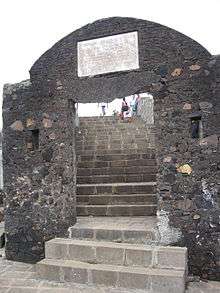
| Forts | |
| Restaurants & Bars | |