Marol
| Marol | |
|---|---|
| Neighbourhood | |
 Marol Location in Mumbai, India | |
| Coordinates: 19°07′09″N 72°52′58″E / 19.119219°N 72.882743°ECoordinates: 19°07′09″N 72°52′58″E / 19.119219°N 72.882743°E | |
| Country | India |
| State | Maharashtra |
| District | Mumbai Suburban |
| Metro | Mumbai |
| Suburb | Andheri |
| Ward | K-East |
| Elevation | 16 m (52 ft) |
| Languages | |
| • Official | Marathi |
| Time zone | UTC+5:30 (IST) |
| PIN | 400 059 |
| Civic agency | BMC |
Marol is a part of the Andheri (East) suburb located on the northern side of Mumbai, India.
History
The area has been inhabited for centuries, [1] successively coming under both Portuguese and British rule.
Geography
Marol consists of the areas Marol village, Marol Naka, Marol Depot, Marol Maroshi Bus Station, Military Road, Marol Pipeline, Vijay Nagar, Bhavani Nagar, parts of JB Nagar, and parts of Marol MIDC. It is near to the international airport. The Marol-Maroshi Road stretches from Marol Naka up to Maroshi Naka (in Aarey colony), beyond which is the Picnic Spot. Marol Mapkhan Nagar and the Marol Church Road are the two diversions, the latter one also leads to Marol Pipeline.
Marol Village is home to a large number of Christians, with the St. John the Evangelist Church which has been established since 1579 [2] and its high school.[3]
Marol Fire Brigade is at Marol Naka.
Police Camp is at the end of Marol and is home to the families of people working for the Maharashtra Police. It is mainly the base camp for the State Armed Constabulary.
The oldest housing colony in the area is a group of 11 buildings on Military Road called Blossom Society.[4] The first occupants arrived here in 1968.
Transport
Roads
Marol is strategically located close to the western express highway and in close proximity to Andheri railway station. Located off the Andheri-Kurla and Andheri-Ghatkopar link roads, it has good east-west connectivity.
Buses

There is excellent bus connectivity to all parts of the city of Mumbai.[5]
Railway
Marol also has close and easy links to Mumbai's three suburban railway lines - Andheri (Western), Ghatkopar (Central) and Kurla (Central/Harbour).
Mumbai Metro
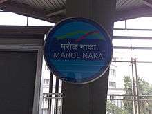
It is a central point along Mumbai's first overhead Metro rail link, Mumbai Metro Line 1, that connects Marol Naka and Airport Road stations to the Ghatkopar in the east and Andheri to Versova in the west of Mumbai. Construction work of the Metro line III project is undergoing which will pass through Marol Naka. According to Dr. E. Sreedharan, known as the 'Metro-man of India',Metro line III project is the most challenging and technically the most complex metro project of the country. [6]
Airport
The Terminal 2 (locally referred to as the International terminal) of Chhatrapati Shivaji International Airport is situated 1.4 km from Marol Naka.
References
- ↑ "Marol, a village where Portuguese interfuses seamlessly with Marathi". Indianexpress.com. 14 January 2016. Retrieved 19 August 2017.
- ↑ "St John Marol - Home". Stjohnmarol.com. Retrieved 19 August 2017.
- ↑ St. John The Evangelist Church - About - Google. Maps.google.co.in. Retrieved on 2013-07-16.
- ↑ Worms in supply water: Marol residents blame road repair work. Indian Express (2009-05-27). Retrieved on 2013-07-16.
- ↑ Marol Maroshi Best Bus Depot. Maps.google.co.in (1970-01-01). Retrieved on 2013-07-16.
- ↑ http://www.freepressjournal.in/mumbai/mumbai-metro-man-dr-e-sreedharan-lauds-metro-iii-project/1222894
| Wikimedia Commons has media related to Marol. |