Mira Road
| Mira Road Mira Bhayandar | |
|---|---|
| Municipal Corporation | |
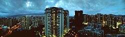 Skyline as seen from Poonam Garden | |
| Nickname(s): Mira Bhayandar | |
 Mira Road Mira Road | |
| Coordinates: 19°17′03″N 72°52′17″E / 19.284113°N 72.871329°ECoordinates: 19°17′03″N 72°52′17″E / 19.284113°N 72.871329°E | |
| Country | India |
| State | Maharashtra |
| Region | Konkan |
| District | Thane |
| City | Mira-Bhayandar[1] |
| Government | |
| • Type | Unicameral |
| • Body | Mira-Bhayandar Municipal Corporation |
| • Mayor | Smt. Dimple Vinod Mehta[2] (BJP) |
| Area[3] | |
| • Total | 79.40 km2 (30.66 sq mi) |
| Elevation | 6.4 m (21.0 ft) |
| Population (2011)[1] | |
| • Total | 8.15 Lakhs |
| Languages | |
| • Official | Marathi |
| Time zone | UTC+05:30 (IST) |
| PIN | 401 107 |
| Telephone code | (+91) 022 |
| Vehicle registration | MH 04 |
| Lok Sabha constituency | Thane |
| Website |
mbmc |
Mira Road is a suburb of the Mumbai Metropolitan Region situated in the north-western portion of the Salsette Island, Maharashtra state, India. Officially, it is part of the Thane district and lies within the jurisdiction of the Mira-Bhayandar city.[1] It is governed by the Mira-Bhayandar Municipal Corporation. It is known to be rapidly developing since it offers easy connectivity to Mumbai, Thane, and Navi Mumbai and is today known as one of the fastest growing areas of the city.[4] A weekly market takes place in Mira Road on every Monday where vendors from the town itself and far flung areas come to sell their vegetables, garments, livestock, daily utility items etc.
History
The rise of Mumbai's real estate prices has been instrumental in the development of Mira-Bhayandar region. From 1975 onwards, the rise in real estate prices made mostly middle-class people to migrate to suburbs like Virar, Vasai and Nalasopara. At that time, the area of Mira-Bhayandar was part of a Gram Panchayat and was mainly consisting of agricultural land, majorly rice. This was the main deterrent which prevented builders to start development projects.[4] By 1980, builders began to buy agricultural land and start developing townships. The Mira Bhayandar Municipal Council was set up on 12 June 1985 by integrating five Gram Panchaats which included the Mira Gram Panchayat, which is where Mira Road got its name.[5]

By 1990, the council was extended and it held the first election resulting in Shri. Gilbert Mendonca becoming the first president of the Mira-Bhayandar Municipal Council. The area, being located very close to the city, easy accessibility by road as well as railways and facilities for the city also extend to this town, resulted in an increase in population and Mira Bhayandar as a whole, began to develop further.
The Municipal Council later on 28 February 2002, was changed to a Municipal Corporation due to its large population and had its first elected mayor Smt. Maira Mendonca on 11 August. Mira Road and neighbouring Bhayandar soon began emerging as a fast developing suburb and experienced economic development mainly due to its manufacturing sector. Most of the development has occurred only on the east side whereas the west side of the railway line is covered with salt pans and mangroves.[4][5]
Most prominent areas include Poonam Garden, Shanti Nagar, Naya Nagar, Queens Park, Lodha Complex, Evershine Enclave, Shrishti, Shanti Garden, Shanti Park, Silver Park,Poonam Sagar Complex,Kanungo Estate, Geeta nagar, Geeta Arcade, Pleasant Park, Kanakia, S K Stone, Hatkesh, Khaugalli, Seven Square High School, Townie, Ramdev Park, Beverly Park, Golden Nest, and Indralok.
Geography
Mira Road is located on the northern portion of Salsette Island and at the northern part of the Konkan region. Mira Road along with Bhayandar comes which is under the jurisdiction of the Mira Bhayandar Municipal Corporation.[6] The entire Mira-Bhayandar region lies just outside the Mumbai Suburban District d officially belong to Thane e district despite it being closer to the island of Mumbai.[7][8] The Mira-Bhayandar region comprises an area of 79 km2. A marshy creek divides Mumbai and Mira Road. The western part of the city is completely made up of barren lands, where salt pans were situated in the past[9]. In the north lies Vasai Creek, to the east Sanjay Gandhi National Park and the Uttan coast, to the west. It mainly is of Deccan lava terrain and consists of waterlogged and marshy areas. The climate here is like that of Mumbai.[6]
Hospitals
- Shalom Medicare Hospital
- MIRA Hospital & IVF Centre
- Indira Gandhi Municipal Hospital
- Bhaktivedanta Hospital[10]
- Wockhardt Hospital (Umrao Hospital)
- Thunga Hospital
- Tanwar Hospital
- Seven Eleven Hospital
- Sanjeevani Multispeciality Hospital & Trauma Centre
- Chirayu Hospital
- Life Care Hospital
- P.V. Doshi Hospital
- Farid Hospital
- Fatima Clinic
- Deepak Hospital
- Balaji Hospital
- Galaxy Hospital
- Sham Bharati Multispeciality Hospital
Schools
There in many number of school's are available in Mira Road, Like as Follows;
- N. L. Dalmia High School[11]
- B.M.S English High School & Junior College Commerce (ST)
- RBK School
- Bright Horizon Preschool
- St Xavier's High School
- Holy Cross Convent School
- Seven Eleven Scholastic School
- Seven Square Academy
- Royal's H.A. Girls High School
- N H English Academy
- Sardar Vallabhbhai Patel Vidyalaya
- Bright International School
- St. Jude's High School
- Rassaz International School
- The Don Bosco High School
- Vedant International High School And Junior College Of Science And Commerce
- GCC International School[12]
- Queen Marys High School
- Santhome Public School
- DeepJyoti School
- A.P. International School
- St. Marys High School
- St. Joseph's High School
- St Paul's High School
- Apple International School
- G. S Jangid Memorial School
- Mount Carmel School
- Banegar School
- Anjuman Mufidul Yatama School
- IP Kidz Place
- Momai Global School
- Madhusudan Global School
- Kids Paradise Play School
- Gracious School
- Shanti Nagar High School
- U.S. Ostwal English Academy[13]
- Cosmopolitan High School
- Jingle Bell Fun School
- Toddlers Pre Primary School
- RAYS International Pre-School
- The Tree House[14]
- Sunflower Playschool
- ST. HARIS HIGH SCHOOL
- Nirmaan International Preschool And Daycare Centre
- Indian High School
- Raval International School
- Annie Basant High School
- Patriot High School
- Rosary High School
- ST. Andrew's Convent English School
- Holy Family Day School & Jr.College of Science & Commerce
- Relevant Public High School
Cinema Theater
- Maxus Movies
- PVR
- Rassaz Cinema
- Cinemax
Utility services and transport
Power from the Tata Power & Reliance Energy, MTNL telecom services and BEST bus services which are normally provided to the city, are provided to this region too which has been instrumental in the increase in its population, unlike Vasai and Virar.[4][15] Mira Road has a railway station, which is a part of the Western Suburban Railway line. All trains from churchgate towards Virar halt at Mira Road. Also Mira Bhayandar Municipal Corporation has its own transportation facility Mira Bhayandar Municipal transportation (MBMT). These bus services had a rapid growth since the late 1990's and initially the population was dependent on MSRTC which are the state transport buses to connect with Thane city and Manori. State transport (ST) buses are also available in Mira Road. They start from Bhayander and are available for Thane, Bhiwandi and Vasai route.
Notable People residing/originated here
- Kunal Khemu, Bollywood actor
- Harshaali Malhotra, Bollywood child artist
- Narendra Mehta, MLA (BJP)
- Geeta Bharat Jain, ex-Mayor (BJP)
- Ayush Mahesh Khedekar, Bollywood actor
- Madhur Mittal, Bollywood actor
- Kavi Kumar Azad, Indian television actor
References
- 1 2 3 "About MMR". Mumbai Metropolitan Region Development Authority. Retrieved 31 October 2017 (Last updated on 22 October 2017)
- ↑ "BJP's Dimple Mehta is new Mira Bhayander Mayor". The Times of India. 2017-08-28. Retrieved 2018-01-01.
- ↑ "Mahanagarpalikechi Mahiti (महानगरपालिकेची माहिती)" (in Marathi). Mira Bhaindar Municipal Corporation. Retrieved 31 October 2017 (Last updated on 22 March 2017)
- 1 2 3 4 "Advantage Mira Road!". The Times of India. 18 February 2005. Retrieved 31 October 2017.
- 1 2 "History". Mira Bhaindar Municipal Corporation. Retrieved 31 October 2017 (Last updated on 14 September 2016)
- 1 2 "Mira-Bhayandar Environmental Status Report 2009–10" (PDF). Department of Environment, Government of Maharashtra. Retrieved 15 May 2013.
- ↑ "District wise List of Assembly and Parliamentary Constituencies". Chief Electoral Officer, Maharashtra. Archived from the original on 18 March 2010. Retrieved 15 May 2013.
- ↑ "Mumbai Suburban District Map". National Informatics Center. Retrieved 15 May 2013.
- ↑ "Why Mira Road (west), Mumbai is vacant? | Roads". www.quora.com. Retrieved 2018-01-06.
- ↑ "Bhaktivedanta Hospital & Research Institute".
- ↑ "N. L. Dalmia Institute of Management Studies and Research". Wikipedia. 2017-10-10.
- ↑ "GCC International School Mira Road - Home Page". GCC International School. Retrieved 2018-01-22.
- ↑ "U.S. Ostwal English Academy". http://usoea.ostwal.com/. External link in
|website=(help) - ↑ Treehouseplaygroup.Net. "Best Play |Pre School for kids:Treehouseplaygroup". www.treehouseplaygroup.net. Retrieved 2018-01-22.
- ↑ "About Mira Road".