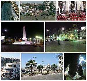
Sohag
| Sohag سوهاج | |
|---|---|
| City | |
 | |
| Nickname(s): Bride of the Nile | |
 Sohag Location in Egypt | |
| Coordinates: 26°33′N 31°42′E / 26.550°N 31.700°ECoordinates: 26°33′N 31°42′E / 26.550°N 31.700°E | |
| Country |
|
| Governorate |
|
| Markaz |
|
| Government | |
| • Governor | Dr/Aymen Abdelmonem |
| Area | |
| • City | 68 km2 (26 sq mi) |
| Elevation | 61 m (200 ft) |
| Population (2012) | |
| • City | 201,339 |
| • Rank | 20th in Egypt |
| • Density | 3,079.69/km2 (7,976.4/sq mi) |
| • Metro | 600,000 |
| Demonym(s) | Sohagi / Sohagy |
| Time zone | UTC+2 (EET) |
| Postal code | 82749[1] |
| Area code | +20 (Egypt) 93 (City)[2] |
| Website | www.sohag.gov.eg/ (in Arabic) |
Sohag (Arabic: سوهاج, Saidi pronunciation: [suːˈhaːdʒ] (![]()
History
Until the 19th century there was only a village located in the area. In 1960, the capital of the Governorate of Girga was transferred from the city of Girga to the growing city of Sohag. The name of the governorate was renamed accordingly.
It is unclear how long this site has been inhabited. There are several mummies that date back to Roman times in the village. In Coptic times, there was a community of monks living at the White Monastery in the area.
The 10th of April is the national day of the governorate to celebrate the victory of the Egyptian national resistance troops on the French troops in Johaina Battle in 1799.
Geography
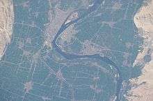
Sohag lies on the western bank of the Nile on a fertile agricultural plain,[5] approximately 6 kilometres (3.7 miles) southwest of Akhmim. In addition, the city includes two islands, Karaman-ez-Zahur Island, which is larger and uninhabited, and ez-Zahur Island (جزيرة الزهور, Ǧazīrat az-Zuhur, "Flower Island") which has some homes.
Economy
The city Sohag of itself encloses only a few archaeological sites, hence tourism represents but a small portion of the city's income. Other sources of income include trade, small industries of carpets, furniture, spinning and weaving and sugar. Administrative and educational services are two big sectors of income.
Demographics
| 1928 | 1976 | 1986 | 1996 | 2006 | 2012 | |||
|---|---|---|---|---|---|---|---|---|
| 20,760[6] | 101,758 | 132,965 | 170,125 | 189,695 | 201,339 | |||
| Starting in 1976: Population of Sohag City[7] | ||||||||
Religion
Islam and Christianity are the main religions in Sohag, whereas Muslims shape the majority, with about 75% of the population.
Historical sites
Mosques
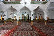
- Sidi Arif Mosque (Arabic: مسجد العارف بالله, Masjid al-ʿArif bi-Allah). The mosque is located in the south of the city. The el-ʿArif Mosque was built in the 14th century (the 8th century of the Islamic calendar). The present building was constructed around 1995. At the corners of the façade are two minarets, and the roof is crowned by a dome. Inside the five-naves mosque the bases of the piers and the walls were lined with red granite. The ceiling is painted ornamentally; in its middle is an elongated light dome. The southeastern half is lit by chandeliers. At the end there are the prayer niche (mihrab) with simple ornaments and to the right of it the wooden pulpit (minbar).
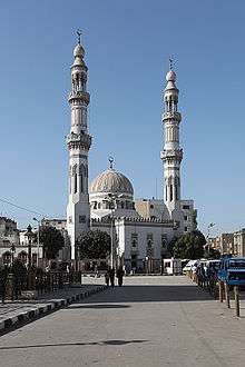 South side of the Sidi Arif Mosque |
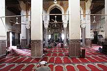 Inside the Sidi Arif Mosque |
 Mihrab and minbar of the Sidi Arif Mosque |
 Ceiling of the Sidi Arif Mosque |
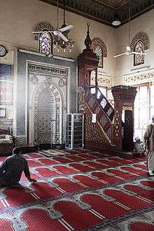
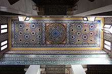
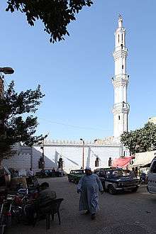
- El-Farshuti Mosque (Arabic: جامع الفرشوطي, Jāmʿi al-Farschūṭī). The el-Fashuti Mosque also named el-'Atiq Mosque (the old mosque) is located approximately 350 metres (1,150 feet) southwest of the Sidi Arif Mosque . The most striking feature of the mosque is its 53-metre-high (174-foot) minaret in the southeast corner. The minaret has galleries with balustrades on four floors. The mosque is a modern, bright building. The mosque is divided into five naves by columns and pillars. It has a light dome in the middle which is inscribed at the bottom with a sura from the Qur'an. The bases of the walls are painted yellow and white with green bands. A very colorful prayer niche next to the wooden pulpit is located at the southeast side.
In the masonry on the east, south and west sides are stones engraved with historic inscriptions moved from previous buildings, including a decree of the penultimate Mamluk sultan al-Ghawri (1441–1516) from the year 1506 (911 AH) on the southeast side.
 South side of the el-Farshuti Mosque |
 Inside the el-Farshuti Mosque |
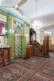 Mihrab and minbar of the el-Farshuti Mosque |
 Ceiling of the el-Farshuti Mosque |
Churches
In the city there are two important churches erected in the 20th century: the Church of the Holy Virgin and the Church of Saint George.
- The Church of the Holy Virgin (Arabic: كنيسة السيدة العذراء, Kanīsat as-Saiyida al-ʿAdraʾ). The church is located in the north of the bazaar (souq Qaiṣarīya). It consists of five naves. There are three sanctuaries for Saint George (left), the Holy Virgin and the Archangel Michael at the ends of the middle three naves. All sanctuaries are completely screened by a wooden iconostasis. On both sides of the entrances to the sanctuaries are wooden icons of the Holy Virgin and Jesus (see Iconostasis). The Lord's Last Supper and the crosses are located above the iconstasis. The presentation in the central nave is framed by a fish and a pigeon, the other ones are framed by angels and a dove. Galleries are located above the aisles and the entrance. On the walls, there are paintings of saints and scenes from the life of Jesus.
 Church of the Holy Virgin |
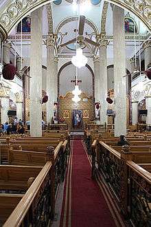 Inside the Church of the Holy Virgin |
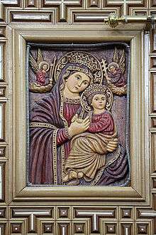 Icon of the Holy Virgin with her child |
- Church of St. George is the cathedral of the diocese of Sohag (Arabic: كنيسة مار جرجس, Kanīsat Mar Girgis). The church is located 300 metres (980 feet) north of the Opera (Midan Obira) or Culture Square (Midan eth-Thaqafa).
- Church of the Archangel Michael (Arabic: كنيسة الملاك ميخائيل). The church is located in the Railway Station Street (El-Mahatta St.), on the east side of the railway tracks.
Monasteries
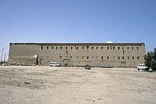
- White Monastery
The Coptic White Monastery is a Coptic Orthodox monastery named after Saint Shenouda the Archimandrite. It is located about 5 kilometres (3.1 miles) west of Sohag. The name of the monastery is derived from the color of the white limestone of its outside walls. The surviving building is the church of what was once a much larger monastery complex.[8]
- Red Monastery
The Red Monastery is a Coptic Orthodox monastery named after an Egyptian saint called Pishay. It is located about 5 kilometres (3.1 miles) north of the White Monastery. The name of the monastery is derived from the color of the construction material of its outside walls, consisting of red (burnt) brick. These walls are considerably thicker at the base than at the top, and just like the walls of Ancient Egyptian temples, they are surmounted by cavetto moldings. The Red Monastery is architecturally similar to the White Monastery.[8]
 Red Monastery |
 White Monastery |
Temples and cemeteries
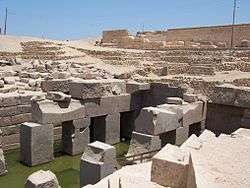
The city is the site of a temple built for the goddess Repyt (Triphis) by Ptolemy XV Caesarion and subsequent Roman emperors. South of this temple was an earlier temple of Ptolemy IX Soter II. One of the tombs nearby, belonging to the brothers Ibpemeny "the younger" and Pemehyt of the late second century BC, has two zodiacs on its ceiling.[9]
Subdivisions
The city of Sohag is informally divided into two division: the East District (Arabic: حى شرق) and the West District (Arabic: حي غرب). Among the most notable regions of the West District are:
- Sidi Aref
- Al Shahid (Arabic for the Martyr)
- Gharb Al-Koubry ("West of the Bridge" neighborhood)
The East District is considered a more upscale district that includes some of the most affluent neighborhoods of the city including 15th Street, Al Kashef Street, Jumhuriya Street, The Courts Compound, and The Technical and Agricultural Schools. Some of the most notable locales of the East District include:
- The Courts Compound of Sohag
- City Hall of Sohag
- Sohag University
- Sohag Teaching Hospital, a member of GOTHI, which is among the biggest hospitals of the region
- Multiple governmental directorates
- Many recreational areas including The Sohag Stadium as well as many parks including Al Zohour (an revitalized island turned park located in the middle of the Nile).
- Nasr City - the first satellite city to be built in the East District. It was established during the time of the late president Gamal Abdel Nasser.
Climate
Köppen-Geiger climate classification system classifies its climate as hot desert (BWh). Luxor, Minya, Sohag, Qena and Asyut have the widest difference of temperatures between days and nights of any city in Egypt, with almost 16 °C (29 °F) difference. Sohag is one of the warmest places in Egypt due to its place in the east side of Sahara in North Africa. Sohag is ranked the 5th driest place in Egypt and the 9th globally. Also ranked 4th warmest place in Egypt and 296th globally.
| Climate data for Sohag | |||||||||||||
|---|---|---|---|---|---|---|---|---|---|---|---|---|---|
| Month | Jan | Feb | Mar | Apr | May | Jun | Jul | Aug | Sep | Oct | Nov | Dec | Year |
| Record high °C (°F) | 30.8 (87.4) |
37.5 (99.5) |
42.2 (108) |
43.9 (111) |
47.4 (117.3) |
47.9 (118.2) |
47.0 (116.6) |
43.4 (110.1) |
44.4 (111.9) |
43.1 (109.6) |
37.0 (98.6) |
33.3 (91.9) |
47.9 (118.2) |
| Average high °C (°F) | 22.0 (71.6) |
23.8 (74.8) |
27.5 (81.5) |
33.6 (92.5) |
37.7 (99.9) |
39.6 (103.3) |
38.8 (101.8) |
37.8 (100) |
36.0 (96.8) |
33.7 (92.7) |
28.2 (82.8) |
23.5 (74.3) |
31.9 (89.4) |
| Daily mean °C (°F) | 13.9 (57) |
15.6 (60.1) |
18.9 (66) |
24.5 (76.1) |
29.1 (84.4) |
30.7 (87.3) |
31.0 (87.8) |
29.9 (85.8) |
27.9 (82.2) |
25.1 (77.2) |
19.8 (67.6) |
15.4 (59.7) |
23.5 (74.3) |
| Average low °C (°F) | 7.3 (45.1) |
8.8 (47.8) |
11.8 (53.2) |
16.6 (61.9) |
21.1 (70) |
23.1 (73.6) |
24.1 (75.4) |
23.1 (73.6) |
20.6 (69.1) |
17.8 (64) |
13.0 (55.4) |
9.2 (48.6) |
16.4 (61.5) |
| Record low °C (°F) | 0.4 (32.7) |
2.6 (36.7) |
3.3 (37.9) |
7.7 (45.9) |
11.5 (52.7) |
15.7 (60.3) |
17.6 (63.7) |
18.0 (64.4) |
15.9 (60.6) |
11.4 (52.5) |
4.8 (40.6) |
2.6 (36.7) |
0.4 (32.7) |
| Average precipitation mm (inches) | 0 (0) |
1 (0.04) |
0 (0) |
0 (0) |
0 (0) |
0 (0) |
0 (0) |
0 (0) |
0 (0) |
0 (0) |
0 (0) |
0 (0) |
1 (0.04) |
| Average precipitation days | 0.1 | 0.1 | 0.2 | 0.1 | 0 | 0 | 0 | 0 | 0 | 0 | 0 | 0.2 | 0.7 |
| Average relative humidity (%) | 57 | 50 | 44 | 36 | 30 | 31 | 37 | 43 | 45 | 44 | 51 | 56 | 43.7 |
| Source #1: NOAA[10] | |||||||||||||
| Source #2: Climate Charts[11] | |||||||||||||
Culture
Language
A version of the dialect continuum of Saidi Arabic is spoken by the people of Sohag. However, the most urbanized people may speak to varying degrees Egyptian Arabic.
Museums
The Sohag Museum contains about 5000 artifacts gathered from around the Sohag governorate, including items stretching from the Middle Kingdom to Greco-Roman times.[5][12]
Bazaars
Souq el-Qisareya: The bazaar in Sohag is named suq Qaiṣarīya, and is partly covered.
Souq el-Itnein: A weekly market held every Monday in the morning for trading in vegetables, fruits, animals and traditional hand made objects (like baskets, farming axes and bags). The weekly market is believed to have been held for the first time during the Ancient Egyptian era. The souq is now in the south of the city and is held in the streets and beside the city cemetery.[5]
Transport
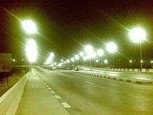
Sohag is linked to Giza and Northern cities through three main roads: road of Asyut Western Desert, Eastern Desert Road, Rural Road also connected to it through the train.
In February 2010, a highway linking the city to the Red Sea city of Hurghada was opened facilitating the ease the movement between Upper Egypt and the Red Sea coastal region.
In May 2010, the Egyptian Ex-President Hosni Mubarak inaugurated an airport to serve the city called Sohag International Airport.
| City | Distance (km) |
|---|---|
| Alexandria | 692 |
| Port Said | 691 |
| Ismaïlia | 616 |
| Suez | 605 |
| Cairo | 471 |
| Aswan | 428 |
| Luxor | 205 |
| Asyut | 98 |
Education
Sohag is characterized by large numbers of graduates in all fields. Illiteracy has continued to drop due to schools (literacy) for all ages free of charge.
There Sohag many schools and colleges most famous:
Primary schools:
- Al-Nasr school
- Huda Sharawi school
- Mulhaqat Al-Mu'allemat school
Middle schools:
- Ahmad Deifalla school
- Nabawi Muhandis school
- Ali Osman Baltak school
- Tarik Ibn Ziad school
High schools:
- Sohag Military school
- Abdelmunim Riad school
- Asmaa Bint Abi Bakr school
- Hag Hadad school
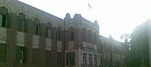
University
Sohag University is a public university with more than 40,000 students[13] located on the eastern side of the city. It was established under the banner of South Valley University, but became independent in 2006. There are currently ten colleges in Sohag University.
Sports
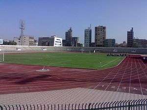
The most popular sport in Sohag is football. Sohag has many football clubs, including the Egyptian Premier League team Sohag FC. In addition, EPL club El Gouna FC used the Sohag stadium as a home ground at times.
Notable people
Sohag has established a very positive reputation around Egypt, since many important people in Egypt, the Arab world, and the Islamic world came from Sohag.
- Narmer, The first pharaoh of unified Egypt and the founder of the Early Dynastic Period (c. 32nd century BC).
- Sheikh Mohamed Siddiq El-Minshawi, one of the most renowned Qur'anic reciters of all the Islamic world.
- Muhammad Sayyid Tantawy, Former Imam of Al-Azhar.
- Rifa'a el-Tahtawi, writer, teacher, translator, Egyptologist, renaissance intellectual and founder of Madrasat al-Alsun (Tongues School).
- Mustafa al-Maraghi, reformer and rector of Al-Azhar Mosque.
- Mohammed Aboul-Fotouh Hassab, gastro-intestinal surgeon well known for the description of his operation Hassab’s decongestion operation for the treatment of oesophageal varices as a result of portal hypertension.
- Gamal El-Ghitani, author of historical novels and cultural and political commentaries.
- Atef El-Tayeb, Film Director .
- George Sidhom, Film Actor.
- Emad Gamal Barakat Hussein, professor at AAssist University.
- Emad Hamdy, Film actor.
- Baligh Hamdi, composer who created hit songs for many prominent Arabic singers.
- Dhul-Nun al-Misri, Sufi saint. He was considered the Patron Saint of the Physicians in the early Islamic era of Egypt .
- Jaber Abu Hussein, The famous narrator of the Taghribat Bani Hilal.
- Omar Taher, Writer and poet.
- Youssef Ziedan, Scholar in Arabic and Islamic Studies.
Nearby attractions
Abydos is one of the most ancient cities of Upper Egypt, and also of the eighth Upper Nome of which it was the capital city. It is also considered one of the most important archaeological sites of Ancient Egypt. The sacred city of Abydos was the site of many ancient temples, including a Umm el-Qa'ab, a royal necropolis where early pharaohs were entombed.
Akhmim has several mosques and two Coptic churches. It maintains a weekly market, and manufactures cotton goods, notably the blue shirts and check shawls with silk fringes worn by the poorer classes of Egypt.
El-Hawawish is the ancient necropolis (cemetery) for the city of Akhmim.
El-Salamuni comprises a rock-cut chapel dedicated to the god Min.
The Meritamen statue in east Akhmim.
Outside Beit Khallaf are two large brick mastabas from very large brick mastabas from the Third Dynasty.
The city Athribis is the site of a temple built for the goddess Repyt (Triphis) by Ptolemy XV Caesarion and subsequent Roman Emperors.
Photo gallery
 Building in Sohag
 Roman theater
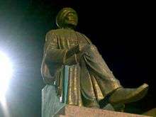 Tahtawy memorial
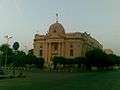 Sohag city hall
 Jumhuriyea St.
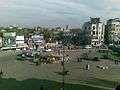 Orouba sq.
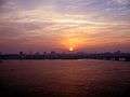 Skyline.
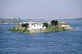 Jazirat Al Zohour .
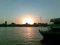 Nile view (east bank)
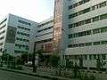 Courts compound
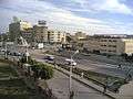 Downtown
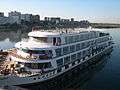 Nile view from Akhmim bridge
See also
References
- ↑ "Egypt Postal Code". Egypt-cairo.com. Retrieved 15 October 2017.
- ↑ Prozzone. "Sohag, EGYPT :: city code, std code, dial code, country code, long distance". www.prozzone.com. Retrieved 15 October 2017.
- ↑ "World Gazetteer: Sohag - profile of geographical entity including nam…". 16 December 2012. Archived from the original on 16 December 2012. Retrieved 15 October 2017.
- ↑ Law, Gwillim (1999). Administrative Subdivisions of Countries: A Comprehensive World Reference, 1900 through 1998 (snippet view). Jefferson, NC: McFarland. p. 114. ISBN 978-0-7864-0729-3. Retrieved 2010-08-07.
- 1 2 3 Richardson, Dan (2003). The Rough Guide to Egypt. pp. 322–323. ISBN 1-84353-050-3.
- ↑ Baedeker, Karl ; Steindorff, Georg : Ägypten und der Sûdan : Handbuch für Reisende, Leipzig: Baedeker, 1928, 8. ed., p. 221.
- ↑ "World Gazetteer: Sohag". Archived from the original on 16 December 2012.
- 1 2 Haag, Michael (2004). Egypt. New Holland Publishers. pp. 222–226. ISBN 1-86011-163-7.
- ↑ Richard Talbert, Barrington Atlas of the Greek and Roman World, ( ISBN 0-691-03169-X), p. 77.
- ↑ "Sohag Climate Normals 1961–1990". National Oceanic and Atmospheric Administration. Retrieved January 17, 2016.
- ↑ "Sohag, Egypt: Climate, Global Warming, and Daylight Charts and Data". Climate Charts. Retrieved 9 July 2013.
- ↑ "The Sohag Museum". Supreme Council of Antiquities - Museums. Retrieved December 14, 2016.
- ↑ "جامعة سوهاج". Sohag-univ.edu.eg. Retrieved 15 October 2017.
External links
| Wikimedia Commons has media related to Sohag. |
- (in German) Sohag on Wikivoyage
- Sohag on Travel grove
- Sohag photo album
Places adjacent to Sohag | |
|---|---|
| 1,000,000 and more | |
|---|---|
| 300,000–999,999 | |
| 100,000–299,999 | |
| <99,999 | |
| Regions | ||
|---|---|---|
| Important sites |
| |
| ||
| Authority control |
|---|