Kafr El Sheikh
| Kafr El Sheikh كفر الشيخ | |
|---|---|
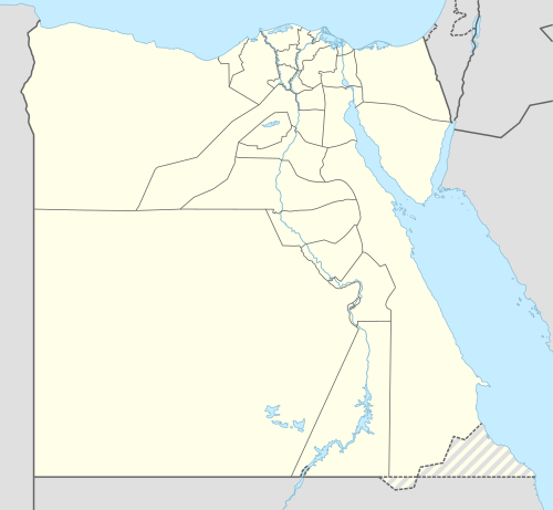 Kafr El Sheikh Location in Egypt | |
| Coordinates: 31°06′42″N 30°56′45″E / 31.11167°N 30.94583°E | |
| Country |
|
| Governorate | Kafr El Sheikh |
| Elevation | 17 m (56 ft) |
| Population (2012) | |
| • Total | 160,266 |
| Time zone | UTC+2 (EET) |
| Area code(s) | (+20) 47 |
Kafr El Sheikh (Egyptian Arabic: كفر الشيخ pronounced [kɑfɾ eʃˈʃeːx]) is the capital of Kafr El Sheikh Governorate, Egypt, about 134 km north of Cairo, in the Nile Delta of lower Egypt. As of November 2006, the town had a population of 147,380 inhabitants.[1]
Kafr El Sheikh was earlier known as Denqiun, and has been settled for thousands of years. In 2006 the University of Kafr El Sheikh was established.
Kafr El Sheikh is responsible for more than 40% of total sea food production in Egypt.
Geography
Kafr El Sheikh is located in the southern side of the Kafr El Sheikh Governorate, it is famous for agriculture, escpecially the production of rice. The city is surrounded to the east by the villages of Qantara and Sawalha which are separated by a small Canal.
Population
The population of the city, according to a census from the Central Agency for Public Mobilization and Statistics, is 147,393. Kafr El Sheikh, is the fourth largest city in the Nile Delta.
Factories
Kafr El Sheikh is the home to various factories, including a rice mill, a poultry forage factory and a sugar beet factory.[2]
Climate
Kafr el-Sheikh is classified by Köppen-Geiger climate classification system as hot desert (BWh).
| Climate data for Kafr el-Sheikh, Egypt | |||||||||||||
|---|---|---|---|---|---|---|---|---|---|---|---|---|---|
| Month | Jan | Feb | Mar | Apr | May | Jun | Jul | Aug | Sep | Oct | Nov | Dec | Year |
| Average high °C (°F) | 18.8 (65.8) |
19.8 (67.6) |
22.2 (72) |
26 (79) |
30.3 (86.5) |
31.6 (88.9) |
33.5 (92.3) |
33 (91) |
31.5 (88.7) |
29.2 (84.6) |
25 (77) |
20.8 (69.4) |
26.8 (80.2) |
| Daily mean °C (°F) | 12.5 (54.5) |
13.2 (55.8) |
15.4 (59.7) |
18.5 (65.3) |
22.5 (72.5) |
24.6 (76.3) |
26.4 (79.5) |
26 (79) |
24.7 (76.5) |
22.6 (72.7) |
19 (66) |
14.7 (58.5) |
20 (68) |
| Average low °C (°F) | 6.3 (43.3) |
6.6 (43.9) |
8.6 (47.5) |
11.1 (52) |
14.7 (58.5) |
17.7 (63.9) |
19.4 (66.9) |
19 (66) |
18 (64) |
16 (61) |
13.1 (55.6) |
8.6 (47.5) |
13.3 (55.8) |
| Average precipitation mm (inches) | 19 (0.75) |
13 (0.51) |
6 (0.24) |
4 (0.16) |
3 (0.12) |
0 (0) |
0 (0) |
0 (0) |
0 (0) |
4 (0.16) |
9 (0.35) |
14 (0.55) |
72 (2.84) |
| Source: Climate-Data.org[3] | |||||||||||||
Notable people
- Ahmed Zewail, Egyptian-American scientist and Nobel Prize holder
- Hamdeen Sabahi, the leader of the Dignity Party and one of the leaders of the Egyptian opposition before the 2011 Egyptian revolution
- Hossam Ghaly, Egyptian soccer player
- Mahmoud Hassan "Trezeguet", Egyptian footballer
- Osama Anwar Okasha, Egyptian screenwriter and journalist
- Saad Zaghloul, Egyptian politician
- Abdel Moneim Wali, Egyptian businessman
References
- ↑ Central Agency for Public Mobilization and Statistics, Egypten. Accessed 11 November 2006.
- ↑ Kafr Elsheikh Governrate Archived 2007-10-23 at the Wayback Machine. sic
- ↑ "Climate: Kafr Al-Sheikh - Climate graph, Temperature graph, Climate table". Climate-Data.org. Retrieved 13 August 2013.
Coordinates: 31°06′42″N 30°56′45″E / 31.11167°N 30.94583°E
| 1,000,000 and more | |
|---|---|
| 300,000–999,999 | |
| 100,000–299,999 | |
| <99,999 | |