Beit Khallaf
| Beit Khallaf | |
|---|---|
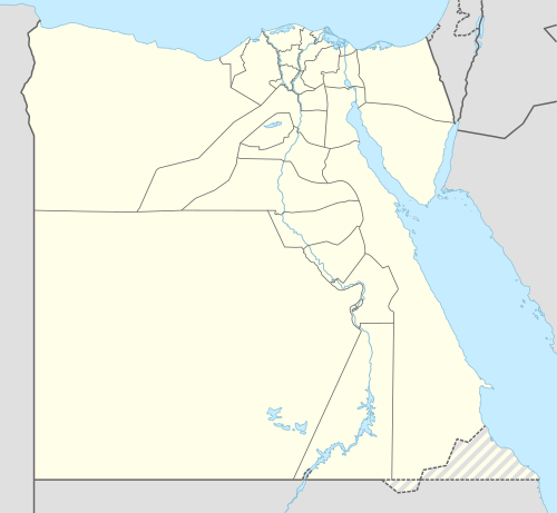 Beit Khallaf Location in Egypt | |
| Coordinates: 26°19′N 31°47′E / 26.317°N 31.783°E | |
| Country |
|
| Governorate | Sohag |
| Time zone | UTC+2 (EST) |
| • Summer (DST) | +3 |
Beit Khallaf (Arabic: بيت خلاف [ˈbeːt χalˈlaːf]) is a village located 10 kilometers west of Girga in Upper Egypt. The village has been ruled by the Sibaq family, a wealthy and traditionally powerful tribe of Houara descent. Beit Khallaf is part of the area known as the Hajer line, which is composed of three other villages: Beit Allam, Beit Khuraybi, and Beit Dawud Sahl. As of 2006, the total population of the village is 10,895 people[1].
Overview
Outside the village are five Third Dynasty mud brick mastaba tombs, which were investigated by archaeologist John Garstang in 1900-1901.[2] Garstang believed he had found the burial place of the 3rd Dynasty Kings Djoser and Sanakht, but it is now generally believed that it is more likely that they were private tombs of the same period.[3]
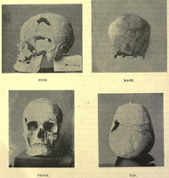
The largest tomb, K1, rises 8 metres above the desert and covers an area of over 3800 square meters.[3] A two metre thick outer wall holds the filling with sand and stone and huge brickwork are made around pits and corners. The burial shaft lies 25 metres below the surface at the bottom of a stairway which was blocked by six massive stones.[2] The ceiling above the stairway was constructed of descending barrel vaults supported by mud brick arches and are thought to be the oldest known vaults in Egypt.[3] Nearly 800 cylindrical alabaster vases were removed from the stairway, including some with mud caps sealed with the name of 'Neter-Khet' (Netjerikhet).[2] The burial chamber comprised 18 chambers leading out from a central passage.[2] Unfortunately the burial has been disturbed by plunderers who had dug a small hole underneath the mastaba, and the bones were scattered and offering vessels were 'strewn about in confusion'.[2] The second largest tomb, K2, was of a similar design to K1, contained human remains and a small fragment inscribed with the name of 'Hen-nekht' or 'sa-nekht' (Sanakht).[2]
References
- ↑ "البيانات السكانية لمدينة أو قرية حسب تقديرات السكان 2006". الجهاز المصري المركزي للإحصاء. اطلع عليه بتاريخ 7 أغسطس 2012.
- 1 2 3 4 5 6 Garstang, John (1903). Maḥâsna and Bêt Khallâf. London: Bernard Quaritch. Retrieved 22 May 2016.
- 1 2 3 Arnold, Dieter (2003). The Encyclopedia of Ancient Egyptian Architecture. London: Tauris. pp. 29–28.
Further reading
- Garstang, John (1903), Maḥâsna and Bêt Khallâf, Egyptian Research Account, 7, London: Bernard Quaritich
- Garstang, John (1904), Tombs of the third Egyptian dynasty at Reqâqnah and Bêt Khallâf, London: Constable
- University College London (2001). "Bet Khallaf mastaba K1". Digital Egypt for Universities. University College London. Retrieved 2016-05-22.
- Garstang Museum of Archaeology, University of Liverpool (2016). "From the Archives: John Garstang at Alawniyeh , Beit Khallaf, and El Mahasna, 1900-1901". Retrieved 2016-05-22.
Primary Sources
The Garstang Museum of Archaeology, University of Liverpool hold photographic materials from John Garstang's excavation at Beit Khallaf. The catalogue is available online on the Archives Hub website.
External links
Ancient Egypt topics | ||
|---|---|---|
| ||
|  | |
| ||