Beni Suef
| Beni Suef بني سويف | |
|---|---|
| City | |
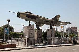 Fighter memorial with Sukhoi Su-7 | |
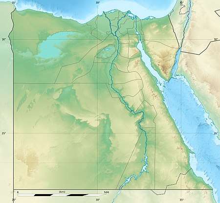 Beni Suef Location within Egypt | |
| Coordinates: 29°04′N 31°05′E / 29.067°N 31.083°E | |
| Country |
|
| Governorate | Beni Suef |
| Elevation | 16 m (52 ft) |
| Population (2012) | |
| • Total | 233,142 |
| Time zone | UTC+2 (EET) |
| Area code(s) | (+20) 82 |
Beni Suef, (Arabic: بنى سويف Baniswēf, IPA: [bænisˈweːf]; Coptic: Ⲡⲁⲛⲓⲥⲱϥ Panisōf) is the capital city of the Beni Suef Governorate in Egypt.
Overview
Beni Suef is the capital of the governorate of the same name in Egypt, located to the south of Greater Cairo in the Nile Valley. It is of archaeological and agricultural importance.
Location
The total area of the governorate is 1,0954 square kilometers, and it is divided into six governorates. It is bordered to the north by Giza governorate and Helwan, to the northeast by Suez, to the east by the Red Sea governorate, to the west by Fayoum governorate, and to the south by Minya governorate. This region connects the north of Egypt to the south, and the east to the west, and this identity of centrality has formed the population, civilization, and economic characters of the region. The geographical proximity to vital governorates such as Cairo and Giza is significant, and the governorates of the Red Sea, Suez, Fayoum and Ismailia tourist areas all act as markets for the industrial products made in Beni Suef.
Important Day
On March 15, during the 1919 revolution by the Egyptians led by Saad Zaghloul, locals of the city cut nearby railway lines, resulting in the deaths of a few British soldiers. The city annually holds March 15 in high regards, as a great honor to its citizens.
Archaeology
Beni Suef is a historical site occupied during all eras of Egyptian history, including many of the treasures of Egypt, where there is the pyramid Medom second oldest pyramid listed in the world, which was built by "King Hony" last kings of the third family and completed the construction of his son King Senefro first king of the fourth family and the father of King Khufu Bani Grand Pyramid The Coptic monuments of the churches and monasteries, including the monastery of Anaboloa, the monastery of St. Anthony in the center of Nasser and the church of the Virgin Mary in the village of Bayad al-Arab, east of the Nile, are scattered throughout the province. And the Monastery of Mary Ger A small village in the bosom of the eastern mountain on the east bank of the Nile towards the city of Beni Suef was found on a small tomb by a mummy of a little girl. A full manuscript was found under her head in the Coptic font on the skin of a deer. Coptic is currently located; the Islamic monuments are distributed in the province where the tomb of Prince Ahmed Shedid is located in the village of Sodas Al-Amara and Marwan Ibn Mohammed cemetery in the village of Abu Sir Al-Malaq and the Mosque of Al-Sayeda Houria in the city of Beni Suef 18 km away and the Sanurho Cave is a huge cave in the heart of the mountain Stabilizers of pure alabaster In the eastern corner of the cave there is a watercourse below the level of the cave, which is believed to be the means of drainage accumulated in the cave The land of the province of Beni Suef throughout the ancient Egyptian history witnessed significant events in the Midum of the center of Wasti Royal cemetery took an important step towards access The whole pyramid form and in the incomplete pyramid of King Honi the last kings of the third and tenth family and had a prominent role in the ancient Egyptian beliefs and the province boasts many important archaeological sites dating back to prehistoric times and throughout the ancient Egyptian history as well as in the era of Hellenistic settlement in Egypt.
Climate
Beni Suef has a hot desert climate (BWh) in Köppen-Geiger classification, as does all of Egypt. It has very hot summers and warm winters with cool nights.
| Climate data for Beni Suef | |||||||||||||
|---|---|---|---|---|---|---|---|---|---|---|---|---|---|
| Month | Jan | Feb | Mar | Apr | May | Jun | Jul | Aug | Sep | Oct | Nov | Dec | Year |
| Record high °C (°F) | 30.4 (86.7) |
34.4 (93.9) |
39.0 (102.2) |
43.3 (109.9) |
47.7 (117.9) |
46.8 (116.2) |
44.9 (112.8) |
44.2 (111.6) |
43.4 (110.1) |
39.9 (103.8) |
36.2 (97.2) |
29.9 (85.8) |
47.7 (117.9) |
| Average high °C (°F) | 19.5 (67.1) |
21.5 (70.7) |
25.0 (77) |
30.3 (86.5) |
34.2 (93.6) |
36.9 (98.4) |
37.1 (98.8) |
36.6 (97.9) |
34.7 (94.5) |
31.0 (87.8) |
25.3 (77.5) |
20.9 (69.6) |
29.4 (84.9) |
| Daily mean °C (°F) | 12.3 (54.1) |
14.2 (57.6) |
17.2 (63) |
22.0 (71.6) |
26.0 (78.8) |
28.7 (83.7) |
29.3 (84.7) |
28.9 (84) |
27.1 (80.8) |
23.5 (74.3) |
18.2 (64.8) |
13.7 (56.7) |
21.8 (71.2) |
| Average low °C (°F) | 5.6 (42.1) |
6.9 (44.4) |
9.6 (49.3) |
13.8 (56.8) |
17.4 (63.3) |
20.2 (68.4) |
21.6 (70.9) |
21.4 (70.5) |
19.5 (67.1) |
16.7 (62.1) |
11.7 (53.1) |
7.4 (45.3) |
14.3 (57.7) |
| Record low °C (°F) | −0.2 (31.6) |
0.8 (33.4) |
2.5 (36.5) |
2.0 (35.6) |
9.5 (49.1) |
15.3 (59.5) |
18.0 (64.4) |
18.6 (65.5) |
9.0 (48.2) |
10.7 (51.3) |
1.8 (35.2) |
0.8 (33.4) |
−0.2 (31.6) |
| Average precipitation mm (inches) | 1 (0.04) |
1 (0.04) |
2 (0.08) |
0 (0) |
0 (0) |
0 (0) |
0 (0) |
0 (0) |
0 (0) |
0 (0) |
1 (0.04) |
0 (0) |
6 (0.24) |
| Average precipitation days (≥ 1.0 mm) | 0.3 | 0.1 | 0.2 | 0.0 | 0.1 | 0.0 | 0.0 | 0.0 | 0.1 | 0.0 | 0.0 | 0.2 | 0.9 |
| Average relative humidity (%) | 61 | 54 | 49 | 40 | 37 | 39 | 45 | 50 | 51 | 54 | 58 | 63 | 50.1 |
| Source #1: NOAA[1] | |||||||||||||
| Source #2: Climate Charts[2] | |||||||||||||
Accidents
- A train accident in 1995 near Beni Suef left 75 people dead.[3]
- The Beni Suef Cultural Palace Fire, on September 5, 2005, killed 46 people.[4][5]
Notable people
- Berlenti Abdul Hamid, actress[6]
Sports
- Telephonat Beni Suef football team has been promoted for the first time in the Egyptian Premier League for the 2011/2012 season.
Gallery
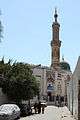 Beni Suef El Sayda Houria Mosque
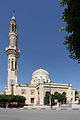 Beni Suef Aziz Mosque
 Beni Suef Archeological Museum
See also
- Sannur Cave national park
- Bishop Athanasius
- The Daughters of St. Mary
References
- ↑ "Beni Suef Climate Normals 1961–1990". National Oceanic and Atmospheric Administration. Retrieved October 25, 2015.
- ↑ "Beni Suef A., Egypt: Climate, Global Warming, and Daylight Charts and Data". Climate Charts. Retrieved 17 July 2013.
- ↑ "One Way Ticket, reported by Fatemah Farag in Al-Ahram". 2002-02-28. Archived from the original on 2012-10-13. Retrieved 2008-03-25.
- ↑ Hala Halim (2005-09-15). "In the aftermath of Beni Suef". Al-Ahram. Archived from the original on 2008-03-18. Retrieved 2008-03-25.
- ↑ Ibn Ad Dunya (2006-05-22). "Eight convicted for negligence in Beni Suef Cultural Palace fire". Retrieved 2008-03-25.
- ↑ "Egyptian movie diva Berlenti Abdul Hamid dies at 75". Al-Masry Al-Youm. December 1, 2010.
External links
| Wikimedia Commons has media related to Beni Suef. |
| Wikivoyage has a travel guide for Beni Suef. |
- Falling Rain Genomics, Inc. - Beni Suef, Egypt
| 1,000,000 and more | |
|---|---|
| 300,000–999,999 | |
| 100,000–299,999 | |
| <99,999 | |