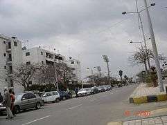
Benha
| Benha بنها | |
|---|---|
| City | |
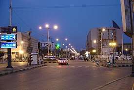 Traffic Square, Benha (1974-2015) | |
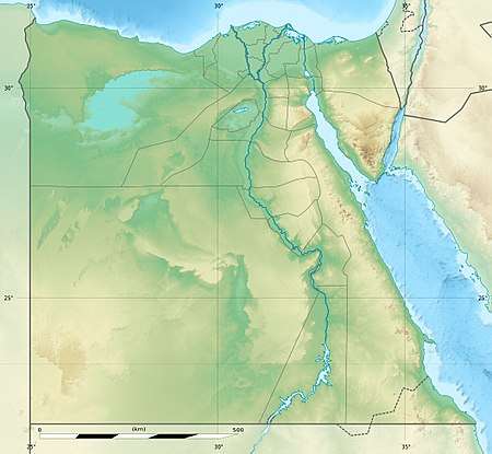 Benha Location within Egypt | |
| Coordinates: 30°27′39″N 31°11′15″E / 30.46083°N 31.18750°E | |
| Country |
|
| Governorate | Qalyubia |
| Elevation | 19 m (62 ft) |
| Population (2012) | |
| • City | 165,906[1] |
| • Metro | 2,500,000 |
| Time zone | UTC+2 (EET) |
| Area code(s) | (+20) 13 |
Benha /'benhæ/ (Arabic: بنها pronounced [ˈbænhæ], Coptic: Ⲡⲁⲛⲁϩⲟ), also spelled Banha , is the capital of the Qalyubia Governorate in north-eastern Egypt. Located between the capital of Cairo and Alexandria, Benha is an important transport hub in the Nile Delta, as rail lines from Cairo to various cities in the Nile Delta pass through Benha.
Etymology
Egyptians call it Benhā el-'asal, which means "Sweet like honey"; the nomenclature originally comes from when Muhammad sent his message to Muqawqis, ruler of Egypt, to convert to Islam; he replied by sending him gifts; two were slave girls Maria and her sister Sirīn, who were from Upper Egypt, and a jar of honey. After Muhammad tasted it, he asked, "Where is it from?" They replied, "From Benha". Muhammad then said, "God bless Benha and its honey".According to Muslim Scholars, this Hadith is supposedly weak or denied due to the lack of citation and complexity of its source. So Muhammad might have not mentioned anything related to Benha.
Geography and economy
It is located 48 km (30 mins) north of Cairo. located on the east bank of the Damietta Branch of the Nile River in the rich farmland of the southern part of the river's delta. Well-irrigated by canals leading off the Delta Barrage, a dam 30 km (20 min) upstream, the surrounding farmland produces wheat and long-staple cotton. Since ancient times, Benha has been known for the production of attar of roses, an ingredient in perfume. Today it is the center of Egypt's electronics industry. Benha is a major junction in the rail network that radiates north from Cairo and it has the 6th biggest train station in Egypt.
The north of Benha is the site of one of several ancient cities called Athribis, the capital of the tenth nome (province) of Lower Egypt in about 1500 BC. The site has never been systematically investigated by archaeologists. Over the years, peasants digging in the area have uncovered a large hoard of silver.
Athribis was the center of worship of the black bull, and enjoyed the most popularity during the Roman period of rule in Egypt. Not much still stands of this ancient capital except some remains from the 18th to the 26th Dynasties. Though not a popular tourist destination, there are such sites here as a Greco-Roman cemetery and silver ingots discovered at the Athribis site currently on display at the Egyptian Museum.
About 20 km (12 mi) southwest of Benha is Tall al Yahudiya, the site of Leontopolis, famed for its glazed tiles in ancient times. Population is around 2,479,347. (2005) and Total Area is 16,105 km².
Climate
Köppen-Geiger climate classification system classifies its climate as hot desert (BWh).
| Climate data for Benha | |||||||||||||
|---|---|---|---|---|---|---|---|---|---|---|---|---|---|
| Month | Jan | Feb | Mar | Apr | May | Jun | Jul | Aug | Sep | Oct | Nov | Dec | Year |
| Average high °C (°F) | 19.2 (66.6) |
20.7 (69.3) |
23.5 (74.3) |
27.8 (82) |
32 (90) |
34.5 (94.1) |
34.8 (94.6) |
34.6 (94.3) |
32.4 (90.3) |
30.2 (86.4) |
25.5 (77.9) |
20.9 (69.6) |
28 (82.4) |
| Daily mean °C (°F) | 12.7 (54.9) |
13.7 (56.7) |
16.2 (61.2) |
19.7 (67.5) |
23.7 (74.7) |
26.5 (79.7) |
27.6 (81.7) |
27.4 (81.3) |
25.3 (77.5) |
23.1 (73.6) |
19.4 (66.9) |
14.6 (58.3) |
20.8 (69.5) |
| Average low °C (°F) | 6.2 (43.2) |
6.8 (44.2) |
9 (48) |
11.7 (53.1) |
15.4 (59.7) |
18.5 (65.3) |
20.4 (68.7) |
20.2 (68.4) |
18.2 (64.8) |
15 (59) |
13.3 (55.9) |
8.4 (47.1) |
13.6 (56.5) |
| Average precipitation mm (inches) | 5 (0.2) |
4 (0.16) |
3 (0.12) |
1 (0.04) |
1 (0.04) |
0 (0) |
0 (0) |
0 (0) |
0 (0) |
2 (0.08) |
3 (0.12) |
6 (0.24) |
25 (1) |
| Source: Climate-Data.org[2] | |||||||||||||
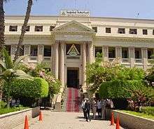
Benha University
Benha University was established in November 1976 as a branch of Zagazig University in the governorate. It became an independent University in 2005 incorporating several facilities and departments with around 60,500 graduates per annum. The Faculty of Medicine is notable for research and management of 2 main hospitals in Benha.

Districts
Benha consists of several districts : Al-Vilal, Benha El-Gedida (New Benha), Attrib, El-Manshia, El-Shedia, Wast Al-Balad (Downtown Area), Al-Haras el-Watani, Manshit Al-Nur and Hayy El-Zehour(Flowers Suburb), Kafr El-Saraia, Ezbet El-Moraba'a,kafr El-gazzar,Batta.
Notable people
- Ahmed Fathy, footballer
- Ahmed Helmy, actor
- Hussien Al Marsafy, one of greatest literature in Khedive Ismael era , Born in Marsafa City and died on 1889
References
- ↑ "World Gazetteer".
- ↑ "Climate: Benha - Climate graph, Temperature graph, Climate table". Climate-Data.org. Retrieved 19 February 2017.
Falling Rain Genomics, Inc. "Geographical information on Benha, Egypt". Archived from the original on 29 March 2008. Retrieved 2008-04-13.
External links
| Wikimedia Commons has media related to Banha. |
- Qalyubia Governorate's official website (in English)
- Qalyubia Group FaceBook (in English)
Coordinates: 30°28′N 31°11′E / 30.467°N 31.183°E
| 1,000,000 and more | |
|---|---|
| 300,000–999,999 | |
| 100,000–299,999 | |
| <99,999 | |
| Authority control |
|---|