Dekernes
| Dekernes دكرنس | |
|---|---|
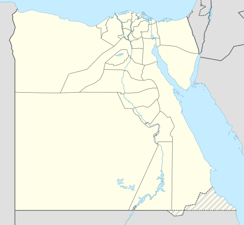 Dekernes Location in Egypt | |
| Coordinates: 31°5′18″N 31°35′49″E / 31.08833°N 31.59694°ECoordinates: 31°5′18″N 31°35′49″E / 31.08833°N 31.59694°E | |
| Country |
|
| Governorate | Dakahlia |
| Elevation | 8 m (26 ft) |
| Population (2012) | |
| • Total | 62,177 |
| Time zone | UTC+2 (EET) |
| Area code(s) | (+20) 50 |
Dekernes (Egyptian Arabic: دكرنس, pronounced [deˈkeɾnes]) is a town in the center of the Dakahlia Governorate of Egypt. It is situated about 20 km east of Mansoura, the capital of Dakahlia.
Overview
Along with Mansoura and other northern cities, Dekernes forms a part of the Dakahlia Governorate. The town is home to one of the oldest High schools in Egypt, Ali Mubarak School, which was built in 1911.
Climate
Dekernes is classified by Köppen-Geiger climate classification system as hot desert (BWh).
| Climate data for Dekernes | |||||||||||||
|---|---|---|---|---|---|---|---|---|---|---|---|---|---|
| Month | Jan | Feb | Mar | Apr | May | Jun | Jul | Aug | Sep | Oct | Nov | Dec | Year |
| Average high °C (°F) | 17.9 (64.2) |
19 (66) |
21.5 (70.7) |
25.4 (77.7) |
30.1 (86.2) |
31.7 (89.1) |
31.9 (89.4) |
32.2 (90) |
30.9 (87.6) |
28.2 (82.8) |
24.4 (75.9) |
19.7 (67.5) |
26.1 (78.9) |
| Daily mean °C (°F) | 12.5 (54.5) |
13.4 (56.1) |
15.6 (60.1) |
18.9 (66) |
22.8 (73) |
25.2 (77.4) |
26.5 (79.7) |
26.6 (79.9) |
25.1 (77.2) |
22.9 (73.2) |
19.3 (66.7) |
14.5 (58.1) |
20.3 (68.5) |
| Average low °C (°F) | 7.2 (45) |
7.8 (46) |
9.8 (49.6) |
12.4 (54.3) |
15.5 (59.9) |
18.7 (65.7) |
21.1 (70) |
21 (70) |
19.3 (66.7) |
17.7 (63.9) |
14.3 (57.7) |
9.4 (48.9) |
14.5 (58.1) |
| Average precipitation mm (inches) | 15 (0.59) |
9 (0.35) |
6 (0.24) |
4 (0.16) |
3 (0.12) |
0 (0) |
0 (0) |
0 (0) |
0 (0) |
5 (0.2) |
8 (0.31) |
11 (0.43) |
61 (2.4) |
| Source: Climate-Data.org[1] | |||||||||||||
Villages
| Location of Dekernes | |
|---|---|
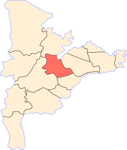 |
Dekernes is the main city in markaz Dekernes. It is surrounded by many small villages which form a part of markaz Dekernes such as:
Local unit of Demouh:
- Demouh
- El Qibab El Kubra
- El Qibab El Sughra
- Kafr El Qibab
- El Gazeera
- Meit Dhafer
- El Mersaah
- Kafr Abdel Mo'men
Local unit of Demeshalt:
- Demeshalt
- Meit El Nahhal
- Kafr El Baz
Local unit of Negeir:
- Negeir
- El Qalyubiya
- El Azazna
- Kafr Abu Nasser
Others:
References
- ↑ "Climate: Dekernes - Climate graph, Temperature graph, Climate table". Climate-Data.org. Retrieved 13 August 2013.
- ↑ Bulletin de l'Institut d'Égypte (in Arabic). l'Institut français d'archeologie orientale. 1971-01-01.
| 1,000,000 and more | |
|---|---|
| 300,000–999,999 | |
| 100,000–299,999 | |
| <99,999 | |
This article is issued from
Wikipedia.
The text is licensed under Creative Commons - Attribution - Sharealike.
Additional terms may apply for the media files.