Kaghaznagar
| Kaghaznagar Sirpur kaghaznagar | |
|---|---|
| Town | |
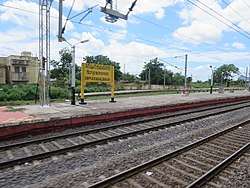 Sirpur Kaghaznagar Railway Station | |
 Kaghaznagar Location in Telangana, India  Kaghaznagar Kaghaznagar (India) | |
| Coordinates: 19°20′00″N 79°29′00″E / 19.3333°N 79.4833°ECoordinates: 19°20′00″N 79°29′00″E / 19.3333°N 79.4833°E | |
| Country |
|
| State | Telangana |
| District | Komaram Bheem Asifabad |
| Government | |
| • Type | Chairman-Council |
| • Body | Kaghaznagar Municipal Council |
| Area[1] | |
| • Total | 8.31 km2 (3.21 sq mi) |
| Elevation | 174 m (571 ft) |
| Population (2011)[2] | |
| • Total | 110,078 |
| • Density | 13,000/km2 (34,000/sq mi) |
| Languages | |
| • Official | Telugu, Urdu |
| Time zone | UTC+5:30 (IST) |
| Area code(s) | +91-8738 |
| Vehicle registration | TS |
| Website |
kagaznagarmunicipality |
Kaghaznagar is a town, and a municipality in Komaram Bheem district in the state of Telangana in India.[3] There were also two factories in Kaghaznagar. They were Sirsilk and Sirpur Paper Mill(SPM).
Geography
Sirpur Kaghaznagar (SKZR) are twin towns is located at 19°20′00″N 79°29′00″E / 19.3333°N 79.4833°E.[4] It has an average elevation of 174 meters (574 feet).
Demographics
As of 2011 India census, the town of Kaghaznagar had a population of 57,583, with 28,649 males, and 28,934 females. The Present population of the twin towns of Sirpur Kaghaznagar is approximately around 100,000. There were a total of 5,576 children between the ages of 0 and 6 and 15,712 inhabitants were classified as illiterate. The town has a unique blend of people settled from different parts of India. Apart from Telugu and Hindi, Marathi is also widely understood due to the town's proximity to Maharashtra. Bengali language is widely spoken in Easgoan village owing to settlement of Bengali refugees. The Literacy rate stood at 73.07 percent.[2]
The city's predominant religion is Hinduism to which 65.85% of the whole population belongs to. Islam is second, with 30.85%, which follows by Christianity at 1.24%, Sikhism at 0.18% and Buddhism at 1.12%.[5]
Government and politics
Civic administration
Kaghaznagar Municipality was constituted in 1995 and is classified as a third grade municipality with 24 election wards. The jurisdiction of the civic body is spread over an area of 8.31 km2 (3.21 sq mi).[1]
Economy
The local economy was heavily dependent on manufacturing at Sirpur Paper Mills is going to re-open soon under JK company ownership and Sirsilk textile factory is closed. Presently the entire economy is run by agriculture allied activities. [6]
References
- 1 2 "Urban Local Body Information" (PDF). Directorate of Town and Country Planning. Government of Telangana. Archived from the original (PDF) on 15 June 2016. Retrieved 28 June 2016.
- 1 2 "Census 2011". The Registrar General & Census Commissioner, India. Retrieved 26 July 2014.
- ↑ "Mandals in Adilabad district". Panchayat Informatics Division. Retrieved 27 March 2018.
- ↑ Falling Rain Genomics. Kaghaznagar
- ↑ Religious demographics Retrieved 27 March 2018.
- ↑ Singh, S. Harpal (5 February 2015). "Memories of Sirsilk haunt Kagaznagar". The Hindu. ISSN 0971-751X.
Places adjacent to Kaghaznagar | |
|---|---|
| District headquarters | |
|---|---|
| Mandals | |
| Cities | |
| Towns | |
| Census towns |
|
| Lok Sabha constituencies | |
| Assembly constituencies | |