Miryalaguda
| Miryalaguda | |
|---|---|
| City | |
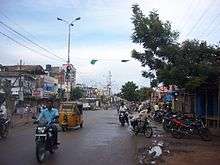
 Miryalaguda  Miryalaguda | |
| Coordinates: 16°52′00″N 79°35′00″E / 16.8667°N 79.5833°ECoordinates: 16°52′00″N 79°35′00″E / 16.8667°N 79.5833°E | |
| Country | India |
| State | Telangana |
| District | Nalgonda |
| Government | |
| • Type | Municipality |
| • Body | Miryalaguda Municipality |
| • MLA | N Bhaskar Rao |
| Area | |
| • Total | 28.36 km2 (10.95 sq mi) |
| Population (2011)[1][2] | |
| • Total | 109,891[3] |
| Languages | |
| • Official | Telugu |
| Time zone | UTC+5:30 (IST) |
| PIN | 508207 |
| Telephone code | +91-8689 |
| Vehicle registration | TS–05 |
| Sex ratio | 1000:995 ♂/♀ |
| Literacy | 82.09% |
| Website |
miryalagudamunicipality |
Miryalaguda is a town in Nalgonda district of the Indian state of Telangana.[4] Government of India announced Miryalaguda to be developed under the Atal Mission for Rejuvenation and Urban Transformation (AMRUT) scheme.[5]
Geography
Miryalguda or Miryalaguda is located at 16°52′00″N 79°35′00″E / 16.8667°N 79.5833°E.[6] It has an average elevation of 105 metres (344 ft).
Demographics
As of 2011 census, Miryalaguda had a population of 109,891. The total population constitute, 55,136 males and 54,755 females. a sex ratio of 995 females per 1000 males. 10,435 children are in the age group of 0–6 years. The average literacy rate stands at 82.09% with 76,693 literates, significantly higher than the district average of 64.20%.[2][7]
Culture

Telugu is the language spoken by the majority in Miryalaguda. Major Hindu festivals celebrated in the region are Sankranti, Ugadi, Vinayaka Chavithi, Holi, Sri Krishna Janmashtami, Dasara, Deepavali and Maha Sivaratri. Christians celebrate Christmas and Good Friday. Apart from these, regional festivals like Bathkamma and Bonalu are also celebrated.Muslims celebrate Eid-ul-Fitr, Ramadan (ninth month of the Islamic calendar) Milad-un-Nabi (Mawlid) and Muharram (Day of Ashura).
Transport
The railway station is situated on the Nadikudi-Pagidipalli section in Guntur Division. The rail is an unelectrified, single line. State highway 2 passes through Miryalaguda. It has good bus facility for Hyderabad, Guntur, Suryapet, Nalgonda and Warangal.
Nearest Cities
Industries
Water from Left canal of Nagarjuna Sagar makes Miryalguda and its surroundings green and commercially rich.It has become the most congested town in the district as a result of new settlers and rapid expansion.[8] The city has large number of rice mills which results in employment opportunities for thousands of people.[9]
Marketyard
Miryalguda is famous for the paddy growth and it is listed among the top 5 paddy markets in Telangana. The new agriculture market is the largest in Telangana, with a size of 45 acres. It also has famous F.C.I (Food Corporation Of India)near to the chinthapally village.[8][10]
See also
- Miryalaguda (Assembly constituency)
- List of cities in Telangana by area
- List of cities in Telangana by population
- List of Smart and Amrut Cities in Telangana
References
- ↑ "Cities, Towns and Outgrowth Wards". Citypopulation.de. Retrieved 19 September 2015.
- 1 2 "Census 2011". The Registrar General & Census Commissioner, India. Retrieved 3 May 2015.
- ↑ "Official Site of Miryalaguda Municipality". miryalagudamunicipality.in. Retrieved 18 October 2016.
- ↑ "District Census Handbook - Nalgonda" (PDF). Census of India. p. 13. Retrieved 15 February 2016.
- ↑ "AP identifies 31, Telangana 15 cities under AMRUT scheme". Eenadu English Portal.
- ↑ "redirect to /world/IN/02/Mirialguda.html".
- ↑ "Literacy of AP (Census 2011)". Official Portal of Telangana Government. Retrieved 3 May 2015.
- 1 2 "Miryalaguda - town, mandal headquarter".
- ↑ "Miryalaguda". Mygola.com.
- ↑ "About mlg". MIRYALAGUDA.