Xinzhuang District
| Xinzhuang 新莊區 | |
|---|---|
| District | |
| Xinzhuang District | |
 | |
 Xinzhuang District in New Taipei City | |
| Coordinates: 25°02′N 121°27′E / 25.033°N 121.450°ECoordinates: 25°02′N 121°27′E / 25.033°N 121.450°E | |
| Country | Republic of China (Taiwan) |
| Region | Northern Taiwan |
| Special municipality | New Taipei |
| Area | |
| • Total | 19.74 km2 (7.62 sq mi) |
| Population (January 2016) | |
| • Total | 413,443 |
| • Density | 9,678.14/km2 (25,066.3/sq mi) |
| Time zone | UTC+8 (CST) |
| Postal code | 242 |
| Website | https://web.archive.org/web/20120126062951/ http://www.xinzhuang.tpc.gov.tw:80/ |
| Xinzhuang District | |||||||||||||||
| Chinese | 新莊區 | ||||||||||||||
|---|---|---|---|---|---|---|---|---|---|---|---|---|---|---|---|
| |||||||||||||||

Xinzhuang District office
Xinzhuang District (Chinese: 新莊區; Hanyu Pinyin: Xīnzhuāng Qū; Tongyong Pinyin: Sinjhuang Cyu) is an inner city district in the western part of New Taipei in northern Taiwan. It has an area of 19.74 km2 (7.62 sq mi) and a population of 413,443 people (2016).
History
A former name of the area is Pulauan (Chinese: 武溜灣; Pe̍h-ōe-jī: Bú-liu-oan).[1] On 15 January 1980, Xinzhuang was upgraded from an urban township to be a county-controlled city of Taipei County. On 25 December 2010, Taipei County was upgraded to New Taipei City, and Xinzhuang City was upgraded to a district.
Overview
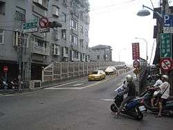
The district is bordered by Wugu and Taishan to the north, Sanchong to the east, Banqiao and Shulin to the south, and Taoyuan City to the west.
Government agencies
Educational institutions
Colleges
Senior High Schools
- National Xinzhuang High School (國立新莊高級中學)
- Heng Yee Catholic High School (天主教恆毅中學)
- New Taipei Municipal DanFeng High School (新北市立丹鳳高中)
- New Taipei Municipal Hsinchuang Senior High School
Infrastructures
Tourist attractions
- Cihyou Temple
- Losheng Sanatorium
- Siangrenhe Clock and Drum Workshop
- Temple to Erudition Deity
- Temple to the Martial Deity
- Xinzhuang Baseball Stadium
- Xinzhuang Culture and Arts Center
Transportation
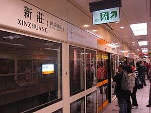
Taipei Metro
Taoyuan Airport MRT
Notable natives
- Guo Qiusen, former writer
- Jolin Tsai, singer-songwriter and actress
See also
References
- ↑ "Entry #40111 (武溜灣)". 臺灣閩南語常用詞辭典 [Dictionary of Frequently-Used Taiwan Minnan] (in Chinese and Hokkien). Ministry of Education, R.O.C. 2011.
External links
| Wikimedia Commons has media related to Xinzhuang District, New Taipei. |
City seat: Banqiao | ||
| Northern |  | |
| Eastern | ||
| Western | ||
| Southern | ||
| Mountain indigenous district | ||
Note: Although Hanyu Pinyin is the national standard, the municipal government endorses and uses "New Taipei" instead of "Xinbei" and "Tamsui" instead of "Danshui." | ||
This article is issued from
Wikipedia.
The text is licensed under Creative Commons - Attribution - Sharealike.
Additional terms may apply for the media files.