Al-Bayyadiyah
| al-Bayyadiyah البياضية Beyadiyeh | |
|---|---|
| Village | |
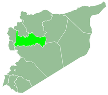
 al-Bayyadiyah Location in Syria | |
| Coordinates: 34°59′34″N 36°23′23″E / 34.992914°N 36.389766°ECoordinates: 34°59′34″N 36°23′23″E / 34.992914°N 36.389766°E | |
| Country |
|
| Governorate | Hama |
| District | Masyaf |
| Subdistrict | Masyaf |
| Population (2004) | |
| • Total | 2,701 |
| Time zone | UTC+2 (EET) |
| • Summer (DST) | UTC+3 (EEST) |
Al-Bayyadiyah (Arabic: البياضية, also spelled Beyadiyeh) is a village in northern Syria, administratively part of the Hama Governorate, located southwest of Hama. Nearby localities include al-Bayda and district center Masyaf to the northwest, Ayn Halaqim to the southwest, Baarin and Nisaf to the south, Aqrab to the southeast and al-Muah to the east. According to the Syria Central Bureau of Statistics (CBS), al-Bayyadiyah had a population of 2,701 in the 2004 census.[1] Its inhabitants are predominantly Alawites and Christians.[2]
References
- ↑ General Census of Population and Housing 2004. Syria Central Bureau of Statistics (CBS). Hama Governorate. (in Arabic)
- ↑ Boulanger, 1966, p. 452.
Bibliography
- Boulanger, Robert (1966). The Middle East, Lebanon, Syria, Jordan, Iraq, Iran. Hachette.
This article is issued from
Wikipedia.
The text is licensed under Creative Commons - Attribution - Sharealike.
Additional terms may apply for the media files.