Bisin, Syria
| Bisin بيصين Biseen | |
|---|---|
| Village | |
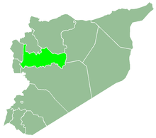
 Bisin Location in Syria | |
| Coordinates: 35°0′9″N 36°30′13″E / 35.00250°N 36.50361°E | |
| Country |
|
| Governorate | Hama |
| District | Hama |
| Subdistrict | Hirbnafsah |
| Population (2004) | |
| • Total | 3,224 |
Bisin (Arabic: بيصين, also spelled Biseen) is a village in northwestern Syria, administratively part of the Hama Governorate, located southwest of Hama. Nearby localities include Billin to the north, al-Muaa to the northeast, Deir al-Fardis to the east, Mousa al-Houla to the southeast, Tell Dahab and Houla to the south, Aqrab and Baarin to the southwest, al-Bayyadiyah to the west and al-Suwaydah to the northwest. According to the Syria Central Bureau of Statistics, Bisin had a population of 3,224 in the 2004 census.[1] Its inhabitants are predominantly Alawites.[2]
References
- ↑ General Census of Population and Housing 2004 Archived 2013-01-12 at Archive.is. Syria Central Bureau of Statistics (CBS). Hama Governorate. (in Arabic)
- ↑ Smith, 1841, p. 180.
Bibliography
- Douwes, Dick (2000). The Ottomans in Syria: a history of justice and oppression. I.B. Tauris. ISBN 1860640311.
- Smith, Eli; Robinson, Edward (1841). Biblical Researches in Palestine, Mount Sinai and Arabia Petraea: A Journal of Travels in the Year 1838. 3. Crocker and Brewster.
This article is issued from
Wikipedia.
The text is licensed under Creative Commons - Attribution - Sharealike.
Additional terms may apply for the media files.