Khirbet Hazur
| Kheurbet Hazzour[1] خربة حزور Khirbat Hazzur | |
|---|---|
| Village | |
| Nickname(s): Khirbat-Hazzour[2] | |
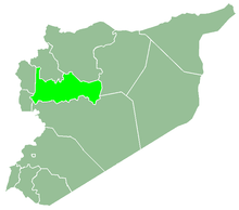
 Kheurbet Hazzour[5] Location in Syria | |
| Coordinates: 34°55′16″N 36°19′7″E / 34.92111°N 36.31861°ECoordinates: 34°55′16″N 36°19′7″E / 34.92111°N 36.31861°E | |
| Country |
|
| Governorate | Hama |
| District | Masyaf |
| Subdistrict | Ayn Halaqim |
| Population (2004) | |
| • Total | 479 |
| Time zone | UTC+2 (EET) |
| • Summer (DST) | UTC+3 (EEST) |
| City Qrya Pcode | C3409 |
Khirbet Hazur (Arabic: خربة حزور, also known as Hazzur or Khirbat-Hazzour) is a Syrian village located in the Ayn Halaqim Subdistrict in Masyaf District, located southwest of Hama. According to the Syria Central Bureau of Statistics (CBS), Khirbet Hazur had a population of 479 in the 2004 census.
References
- ↑ "Kheurbet Hazzour, Syria - Geotagged Places of Interest". www.latlongwiki.com.
- ↑ "Khirbat Hazzour - خربة حزور -Homs - Syria Remembered". www.syriaremembered.org.
- ↑ "Kheurbet Hazzour, Syria - Geotagged Places of Interest". www.latlongwiki.com.
- ↑ "Kheurbet Hazzour, Syria - Geotagged Places of Interest". www.latlongwiki.com.
- ↑ "Kheurbet Hazzour, Syria - Geotagged Places of Interest". www.latlongwiki.com.
Bibliography
This article is issued from
Wikipedia.
The text is licensed under Creative Commons - Attribution - Sharealike.
Additional terms may apply for the media files.