Kafr Nabudah
| Kafr Nabudah كفر نبودة Kafar Nabuda | |
|---|---|
| Village | |
 Kafr Nabudah Location in Syria | |
| Coordinates: 35°25′54″N 36°29′34″E / 35.43167°N 36.49278°ECoordinates: 35°25′54″N 36°29′34″E / 35.43167°N 36.49278°E | |
| Country |
|
| Governorate | Hama |
| District | Al-Suqaylabiyah |
| Subdistrict | Qalaat al-Madiq |
| Population (2004) | |
| • Total | 13,513 |
| • Ethnicities | Syrians |
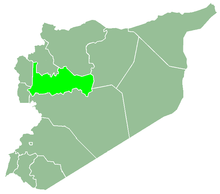
Kafr Nabudah (Arabic: كفر نبودة, also spelled Kafar Nabuda) is a village in northern Syria, administratively part of the Hama Governorate, located northwest of Hama. Nearby localities include Qalaat al-Madiq and Jamasat Adiyat to the west, al-Suqaylabiyah to the southwest, al-Mughayr and Karnaz to the south, Kafr Zita to the southeast and al-Habit to the east. According to the Syria Central Bureau of Statistics (CBS), Kafr Nabudah had a population of 13,513 in the 2004 census, making it the largest locality in the Qalaat al-Madiq nahiyah ("subdistrict.")[1]
Etymology
The first word of Kafr Nabudah, which is Kafr, is a Syriac word for "farm" or "village". The second part 'Nabudah' is probably derived from another Syriac word Nabeeda, which refers to wine. The village is known for cultivation of grapes which now lost its importance to the favor of other crops. Although the wine industry has extinct since longtime, some winepresses ruins still exist in the surrounding areas..
References
- ↑ General Census of Population and Housing 2004. Syria Central Bureau of Statistics (CBS). Hama Governorate. (in Arabic)