Bayt Natar
| Bayt Natar بيت ناطر Beit Nater[1] | |
|---|---|
| Village | |
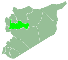
 Bayt Natar Location in Syria | |
| Coordinates: 34°55′1″N 36°21′2″E / 34.91694°N 36.35056°ECoordinates: 34°55′1″N 36°21′2″E / 34.91694°N 36.35056°E | |
| Country |
|
| Governorate | Hama |
| District | Masyaf |
| Subdistrict | Ayn Halaqim |
| Population (2004) | |
| • Total | 1,304 |
| Time zone | UTC+2 (EET) |
| • Summer (DST) | UTC+3 (EEST) |
| City Qrya Pcode | C3411 |
Bayt Natar (Arabic: بيت ناطر, translit. Bait Nātar, Turkish: Beit Nater[1]) is a Syrian village located in the Ayn Halaqim Subdistrict of the Masyaf District in Hama Governorate. According to the Syria Central Bureau of Statistics (CBS), Bayt Natar had a population of 1,304 in the 2004 census.[2] Its inhabitants are predominantly Turkmens.[3]
References
- 1 2 Günümüzde Suriye Türkmenleri. — Suriye’de Değişimin Ortaya Çıkardığı Toplum: Suriye Türkmenleri, p. 18 ORSAM Rapor № 83. ORSAM – Ortadoğu Türkmenleri Programı Rapor № 14. Ankara — November 2011, 33 pages.
- ↑ "General Census of Population 2004". Retrieved 2014-07-10.
- ↑ Hürmüzlü, Erşat (Spring 2015). "Turkish Policy in the Middle East". Turkish Policy Quarterly. 14 (1): 90.
This article is issued from
Wikipedia.
The text is licensed under Creative Commons - Attribution - Sharealike.
Additional terms may apply for the media files.