Nisaf
| Nisaf نيصاف Nasaf | |
|---|---|
| Village | |
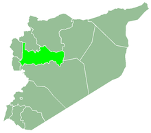
 Nisaf Location in Syria | |
| Coordinates: 34°55′58″N 36°22′40″E / 34.932667°N 36.377792°ECoordinates: 34°55′58″N 36°22′40″E / 34.932667°N 36.377792°E | |
| Country |
|
| Governorate | Hama |
| District | Masyaf |
| Subdistrict | Awj |
| Elevation | 470 m (1,540 ft) |
| Population (2004) | |
| • Total | 4,048 |
| Time zone | UTC+2 (EET) |
| • Summer (DST) | UTC+3 (EEST) |
Nisaf (Arabic: نيصاف, also spelled Nasaf) is a village in northern Syria, administratively part of the Hama Governorate, located west of Hama. Nearby localities include Kafr Kamrah to the southeast, Baarin and Taunah to the east, al-Bayyadiyah to the northeast, al-Suwaydah to the north and Ayn Halaqim to the west. According to the Syria Central Bureau of Statistics, Nisaf had a population of 4,048 in the 2004 census.[1] Its inhabitants are predominantly Alawites.[2] The local governing council for Nisaf was established in 1977 and it became a village council in 1999.[3]
References
- ↑ General Census of Population and Housing 2004 Archived 2013-01-13 at Archive.is. Syria Central Bureau of Statistics (CBS). Hama Governorate. (in Arabic)
- ↑ Smith, 1841, p. 180.
- ↑ لمحة موجزة عن الوحدة الإدارية في قرية نيصاف. موقع محافظة حماة (in Arabic). محافظة حماة. 29 September 2010. Retrieved 1 January 2013.
Bibliography
- Boulanger, Robert (1966). The Middle East, Lebanon, Syria, Jordan, Iraq, Iran. Hachette.
- Smith, Eli; Robinson, Edward (1841). Biblical Researches in Palestine, Mount Sinai and Arabia Petraea: A Journal of Travels in the Year 1838. 3. Crocker and Brewster.
This article is issued from
Wikipedia.
The text is licensed under Creative Commons - Attribution - Sharealike.
Additional terms may apply for the media files.