Farikah
| Farikah فريكة Furaykah | |
|---|---|
| Village | |
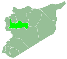
 Farikah Location in Syria | |
| Coordinates: 35°34′30″N 36°16′13″E / 35.57500°N 36.27028°ECoordinates: 35°34′30″N 36°16′13″E / 35.57500°N 36.27028°E | |
| Country |
|
| Governorate | Hama |
| District | Al-Suqaylabiyah |
| Subdistrict | Shathah |
| Occupation | Jaish al-Fatah |
| Population (2004) | |
| • Total | 2,497 |
Farikah (Arabic: فريكة, also spelled Frikka, Freikeh or Furaykah) is a village in northern Syria, administratively part of the Hama Governorate, located north of Hama. It is situated in the Ghab plain. Nearby localities include Shathah and Nabl al-Khatib to the south, al-Amqiyah Tahta and al-Ankawi to the east, al-Ziyarah to the northeast and Sirmaniyah to the north. According to the Syria Central Bureau of Statistics (CBS), Farikah had a population of 2,497 in the 2004 census.[1] Its inhabitants are predominantly Alawites.[2]
Government forces and rebels contested Farikah throughout July 2015.[3]
References
- ↑ General Census of Population and Housing 2004. Syria Central Bureau of Statistics (CBS). Hama Governorate. (in Arabic)
- ↑ Rockwood, Bill. "Interactive Map: A Valley at War". PBS Frontline.
- ↑ http://www.albawaba.com/loop/syrian-rebels-took-last-idlib-province-government-forces-today-heres-how-it-happened-724288
This article is issued from
Wikipedia.
The text is licensed under Creative Commons - Attribution - Sharealike.
Additional terms may apply for the media files.