Abu Mansaf
| Abu Mansaf أبو منسف | |
|---|---|
| Village | |
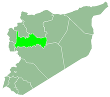
 Abu Mansaf Location in Syria | |
| Coordinates: 35°15′57″N 36°52′20″E / 35.26583°N 36.87222°ECoordinates: 35°15′57″N 36°52′20″E / 35.26583°N 36.87222°E | |
| Country |
|
| Governorate | Hama |
| District | Hama |
| Subdistrict | Hama |
| Population (2004) | |
| • Total | 364 |
| Time zone | UTC+2 (EET) |
| • Summer (DST) | UTC+3 (EEST) |
| City Qrya Pcode | C2978 |
Abu Mansaf (Arabic: أبو منسف) is a Syrian village located in the Hama Subdistrict of the Hama District in the Hama Governorate. According to the Syria Central Bureau of Statistics (CBS), Abu Mansaf had a population of 364 in the 2004 census.[1]
References
This article is issued from
Wikipedia.
The text is licensed under Creative Commons - Attribution - Sharealike.
Additional terms may apply for the media files.