Maarin
| Maarin معرين Ma'arrin | |
|---|---|
| Village | |
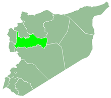
 Maarin Location in Syria | |
| Coordinates: 35°9′25″N 36°26′41″E / 35.15694°N 36.44472°E | |
| Country |
|
| Governorate | Hama |
| District | Masyaf |
| Subdistrict | Jubb Ramlah |
| Population (2004) | |
| • Total | 1,830 |
| Time zone | UTC+2 (EET) |
| • Summer (DST) | UTC+3 (EEST) |
Maarin (Arabic: معرين, also spelled Ma'arrin) is a village in northwestern Syria, administratively part of the Hama Governorate, located west of Hama. Nearby localities include Mahrusah to the west, Jubb Ramlah to the north, Hanjur and Asilah to the northeast, Umm al-Tiyur to the east, Deir al-Salib to the south and Masyaf to the southwest. According to the Central Bureau of Statistics (CBS), Maarin had a population of 1,830 in the 2004 census.[1] Its inhabitants are predominantly Greek Orthodox Christians or Alawites.[2]
References
- ↑ General Census of Population and Housing 2004. Syria Central Bureau of Statistics (CBS). Hama Governorate. (in Arabic)
- ↑ Smith, 1841, p. 180.
Bibliography
- Smith, Eli; Robinson, Edward (1841). Biblical Researches in Palestine, Mount Sinai and Arabia Petraea: A Journal of Travels in the Year 1838. 3. Crocker and Brewster.
This article is issued from
Wikipedia.
The text is licensed under Creative Commons - Attribution - Sharealike.
Additional terms may apply for the media files.