Sewaren, New Jersey
| Sewaren, New Jersey | |
|---|---|
| Census-designated place | |
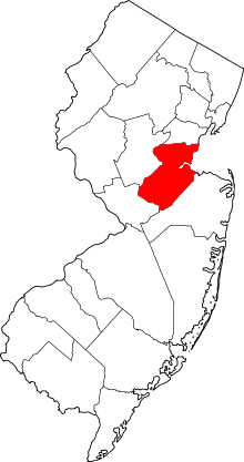
 Map of Sewaren highlighted within Middlesex County. Right: Location of Middlesex County in New Jersey. | |
| Coordinates: 40°33′03″N 74°15′36″W / 40.550726°N 74.259885°WCoordinates: 40°33′03″N 74°15′36″W / 40.550726°N 74.259885°W | |
| Country |
|
| State |
|
| County | Middlesex |
| Township | Woodbridge |
| Area[1] | |
| • Total | 1.004 sq mi (2.601 km2) |
| • Land | 0.954 sq mi (2.471 km2) |
| • Water | 0.050 sq mi (0.131 km2) 5.02% |
| Elevation[2] | 16 ft (5 m) |
| Population (2010 Census)[3] | |
| • Total | 2,756 |
| • Density | 2,889.2/sq mi (1,115.5/km2) |
| Time zone | UTC-5 (Eastern (EST)) |
| • Summer (DST) | UTC-4 (Eastern (EDT)) |
| ZIP code | 07077[4] |
| Area code(s) | 732/848 |
| FIPS code | 3466720[1][5] |
| GNIS feature ID | 02390280[1][6] |
Sewaren (pronounced SEE-waren) is an unincorporated community and census-designated place (CDP) within Woodbridge Township, in Middlesex County, New Jersey, United States.[7][8][9] As of the 2010 United States Census, the CDP's population was 2,756.[3]
PSE&G's Sewaren Generating Station is a 582 megawatt facility on 152 acres (62 ha) along the Arthur Kill. The facility had five steam generators and one combustion turbine. Four of the steam units were installed during and just after World War II, from 1942 to 1951.[10] Generator 5, which included a gas/oil-fired boiler and two turbine generators, was dismantled in 2002.[11]
Geography
According to the United States Census Bureau, the CDP had a total area of 1.004 square miles (2.601 km2), including 0.954 square miles (2.471 km2) of land and 0.050 square miles (0.131 km2) of water (5.02%).[1][12] Sewaren is located between Perth Amboy and Carteret, on the waterfront across the Arthur Kill waterway from Staten Island, New York, which is accessible via the Outerbridge Crossing just minutes away.
Demographics
| Historical population | |||
|---|---|---|---|
| Census | Pop. | %± | |
| 1990 | 2,569 | — | |
| 2000 | 2,780 | 8.2% | |
| 2010 | 2,756 | −0.9% | |
| Population sources: 1990-2010[7] 2000[13] 2010[3] | |||
Census 2010
As of the 2010 United States Census, there were 2,756 people, 1,005 households, and 721.6 families residing in the CDP. The population density was 2,889.2 per square mile (1,115.5/km2). There were 1,043 housing units at an average density of 1,093.4 per square mile (422.2/km2). The racial makeup of the CDP was 79.54% (2,192) White, 7.98% (220) Black or African American, 0.15% (4) Native American, 6.20% (171) Asian, 0.18% (5) Pacific Islander, 3.74% (103) from other races, and 2.21% (61) from two or more races. Hispanic or Latino of any race were 18.69% (515) of the population.[3]
There were 1,005 households out of which 30.0% had children under the age of 18 living with them, 53.1% were married couples living together, 14.7% had a female householder with no husband present, and 28.2% were non-families. 22.2% of all households were made up of individuals, and 7.4% had someone living alone who was 65 years of age or older. The average household size was 2.74 and the average family size was 3.26.[3]
In the CDP, the population was spread out with 21.8% under the age of 18, 8.6% from 18 to 24, 26.3% from 25 to 44, 30.8% from 45 to 64, and 12.5% who were 65 years of age or older. The median age was 40.5 years. For every 100 females there were 92.6 males. For every 100 females ages 18 and older there were 92.4 males.[3]
Census 2000
As of the 2000 United States Census[5] there were 2,780 people, 1,019 households, and 768 families residing in the CDP. The population density was 1,129.9/km² (2,920.9/mi²). There were 1,046 housing units at an average density of 425.1/km² (1,099.0/mi²). The racial makeup of the CDP was 85.36% White, 5.72% African American, 0.18% Native American, 4.71% Asian, 0.04% Pacific Islander, 2.73% from other races, and 1.26% from two or more races. Hispanic or Latino of any race were 9.57% of the population.[13]
There were 1,019 households out of which 34.5% had children under the age of 18 living with them, 57.0% were married couples living together, 13.5% had a female householder with no husband present, and 24.6% were non-families. 20.6% of all households were made up of individuals and 7.0% had someone living alone who was 65 years of age or older. The average household size was 2.73 and the average family size was 3.16.[13]
In the CDP the population was spread out with 23.8% under the age of 18, 7.5% from 18 to 24, 31.5% from 25 to 44, 24.6% from 45 to 64, and 12.6% who were 65 years of age or older. The median age was 38 years. For every 100 females, there were 92.8 males. For every 100 females age 18 and over, there were 88.1 males.[13]
The median income for a household in the CDP was $62,381, and the median income for a family was $72,685. Males had a median income of $46,683 versus $35,655 for females. The per capita income for the CDP was $24,681. About 2.5% of families and 3.5% of the population were below the poverty line, including 0.6% of those under age 18 and 4.6% of those age 65 or over.[13]
Education
Sewaren has one elementary school, Matthew Jago School #28.
References
- 1 2 3 4 Gazetteer of New Jersey Places, United States Census Bureau. Accessed July 21, 2016.
- ↑ U.S. Geological Survey Geographic Names Information System: Sewaren Census Designated Place, Geographic Names Information System. Accessed November 30, 2012.
- 1 2 3 4 5 6 DP-1 - Profile of General Population and Housing Characteristics: 2010 Demographic Profile Data for Sewaren CDP, New Jersey, United States Census Bureau. Accessed November 30, 2012.
- ↑ Look Up a ZIP Code for Avenel, NJ, United States Postal Service. Accessed November 30, 2012.
- 1 2 American FactFinder, United States Census Bureau. Accessed September 4, 2014.
- ↑ US Board on Geographic Names, United States Geological Survey. Accessed September 4, 2014.
- 1 2 New Jersey: 2010 - Population and Housing Unit Counts - 2010 Census of Population and Housing (CPH-2-32), United States Census Bureau, August 2012. Accessed November 30, 2012.
- ↑ GCT-PH1 - Population, Housing Units, Area, and Density: 2010 - County -- County Subdivision and Place from the 2010 Census Summary File 1 for Middlesex County, New Jersey, United States Census Bureau. Accessed November 30, 2012.
- ↑ Locality Search, State of New Jersey. Accessed April 19, 2015.
- ↑ Sewaren Generating Station Archived 2006-09-11 at the Wayback Machine., accessed August 9, 2006
- ↑ PSE&G Sewaren Unit #5, Brandenburg. Accessed July 22, 2016. "In 2002, Brandenburg was retained by Public Service Enterprise Group (PSE&G) todecontaminate and demolish their Sewaren Unit #5 boiler, located on the Arthur Kill."
- ↑ US Gazetteer files: 2010, 2000, and 1990, United States Census Bureau. Accessed September 4, 2014.
- 1 2 3 4 5 DP-1 - Profile of General Demographic Characteristics: 2000 from the Census 2000 Summary File 1 (SF 1) 100-Percent Data for Sewaren CDP, New Jersey, United States Census Bureau. Accessed November 30, 2012.