Dunhams Corner, New Jersey
| Dunhams Corner, New Jersey | |
|---|---|
| Unincorporated community | |
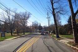 Along Dunhams Corner Road approaching Ryders Lane (CR 617) | |
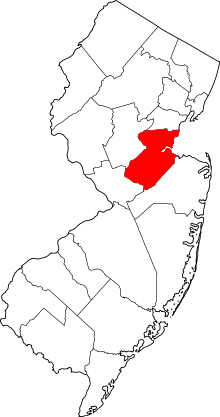
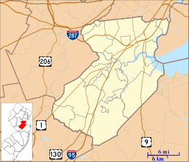 Dunhams Corner, New Jersey Location of Dunhams Corner in Middlesex County Inset: Location of county within the state of New Jersey  Dunhams Corner, New Jersey Dunhams Corner, New Jersey (New Jersey)  Dunhams Corner, New Jersey Dunhams Corner, New Jersey (the US) | |
| Coordinates: 40°25′26″N 74°25′19″W / 40.42389°N 74.42194°WCoordinates: 40°25′26″N 74°25′19″W / 40.42389°N 74.42194°W | |
| Country |
|
| State |
|
| County | Middlesex |
| Township | East Brunswick |
| Elevation[1] | 115 ft (35 m) |
| GNIS feature ID | 876010[1] |
Dunhams Corner is an unincorporated community in East Brunswick Township in Middlesex County, New Jersey, United States.[2] The area is suburban and is mostly made up of single family houses with some churches, temples, and schools located throughout. The settlement is centered on the intersection of Dunhams Corner Road and Ryders Lane (County Route 617).[3]
References
- 1 2 "Dunhams Corner". Geographic Names Information System. United States Geological Survey.
- ↑ Locality Search, State of New Jersey. Accessed February 8, 2015.
- ↑ Google (November 22, 2015). "Aerial view of Dunhams Corner" (Map). Google Maps. Google. Retrieved November 22, 2015.
This article is issued from
Wikipedia.
The text is licensed under Creative Commons - Attribution - Sharealike.
Additional terms may apply for the media files.