Society Hill, Middlesex County, New Jersey
| Society Hill, New Jersey | |
|---|---|
| Census-designated place | |
 Society Hill from Morris Avenue | |
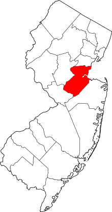
 Map of Society Hill highlighted within Middlesex County. Inset: Location of Middlesex County in New Jersey. | |
| Coordinates: 40°32′04″N 74°27′22″W / 40.534508°N 74.45608°WCoordinates: 40°32′04″N 74°27′22″W / 40.534508°N 74.45608°W | |
| Country |
|
| State |
|
| County | Middlesex |
| Township | Piscataway |
| Area[1] | |
| • Total | 1.387 sq mi (3.594 km2) |
| • Land | 1.387 sq mi (3.593 km2) |
| • Water | <0.001 sq mi (0.001 km2) 0.03% |
| Elevation[2] | 95 ft (29 m) |
| Population (2010 Census)[3] | |
| • Total | 3,829 |
| • Density | 2,760.4/sq mi (1,065.8/km2) |
| Time zone | UTC-5 (Eastern (EST)) |
| • Summer (DST) | UTC-4 (Eastern (EDT)) |
| Area code(s) | 609 |
| FIPS code | 3468304[1][4] |
| GNIS feature ID | 02390310[1][5] |
Society Hill is an unincorporated community and census-designated place (CDP) located within Piscataway Township, in Middlesex County, New Jersey, United States.[6][7] As of the 2010 United States Census, the CDP's population was 3,829.[3]
Geography
According to the United States Census Bureau, the CDP had a total area of 1.387 square miles (3.594 km2), including 1.387 square miles (3.593 km2) of land and <0.001 square miles (0.001 km2) of water (0.03%).[1][8] The CDP is located near the center of the township north of New Jersey Route 18 and Rutgers University's Busch Campus. The area mainly consists of single-family homes, an apartment complex, and a cemetery.[9]
Demographics
| Historical population | |||
|---|---|---|---|
| Census | Pop. | %± | |
| 1990 | 3,577 | — | |
| 2000 | 3,804 | 6.3% | |
| 2010 | 3,829 | 0.7% | |
| Population sources: 2000[10] 2010[3] | |||
Census 2010
As of the 2010 United States Census, there were 3,829 people, 1,226 households, and 904.8 families residing in the CDP. The population density was 2,760.4 per square mile (1,065.8/km2). There were 1,264 housing units at an average density of 911.2 per square mile (351.8/km2). The racial makeup of the CDP was 34.79% (1,332) White, 15.57% (596) Black or African American, 0.13% (5) Native American, 44.63% (1,709) Asian, 0.00% (0) Pacific Islander, 2.17% (83) from other races, and 2.72% (104) from two or more races. Hispanic or Latino of any race were 7.13% (273) of the population.[3]
There were 1,226 households out of which 32.8% had children under the age of 18 living with them, 58.1% were married couples living together, 12.2% had a female householder with no husband present, and 26.2% were non-families. 16.6% of all households were made up of individuals, and 2.9% had someone living alone who was 65 years of age or older. The average household size was 2.85 and the average family size was 3.26.[3]
In the CDP, the population was spread out with 19.6% under the age of 18, 18.9% from 18 to 24, 26.8% from 25 to 44, 26.2% from 45 to 64, and 8.5% who were 65 years of age or older. The median age was 33.5 years. For every 100 females there were 90.2 males. For every 100 females ages 18 and older there were 87.3 males.[3]
Census 2000
As of the 2000 United States Census[4] there were 3,804 people, 1,248 households, and 913 families residing in the CDP. The population density was 1,072.1/km2 (2,774.0/mi2). There were 1,269 housing units at an average density of 357.6/km2 (925.4/mi2). The racial makeup of the CDP was 45.45% White, 15.96% African American, 0.24% Native American, 34.07% Asian, 1.42% from other races, and 2.87% from two or more races. Hispanic or Latino of any race were 5.05% of the population.[10]
There were 1,248 households out of which 38.5% had children under the age of 18 living with them, 59.7% were married couples living together, 10.4% had a female householder with no husband present, and 26.8% were non-families. 16.7% of all households were made up of individuals and 2.6% had someone living alone who was 65 years of age or older. The average household size was 2.90 and the average family size was 3.34.[10]
In the CDP the population was spread out with 22.9% under the age of 18, 14.0% from 18 to 24, 33.8% from 25 to 44, 22.3% from 45 to 64, and 7.0% who were 65 years of age or older. The median age was 33 years. For every 100 females, there were 97.7 males. For every 100 females age 18 and over, there were 92.1 males.[10]

2010-2014 American Community Survey 5-Year Estimates
The median income for a household in the CDP was $81,956, and the median income for a family was $89,411. Males had a median income of $60,000 versus $39,224 for females. The per capita income for the CDP was $31,143. About 1.8% of families and 4.3% of the population were below the poverty line, including 1.7% of those under age 18 and 2.3% of those age 65 or over.[10]
References
- 1 2 3 4 Gazetteer of New Jersey Places, United States Census Bureau. Accessed July 21, 2016.
- ↑ U.S. Geological Survey Geographic Names Information System: Society Hill Census Designated Place, Geographic Names Information System. Accessed November 29, 2012.
- 1 2 3 4 5 6 DP-1 - Profile of General Population and Housing Characteristics: 2010 Demographic Profile Data for Society Hill CDP, New Jersey, United States Census Bureau. Accessed November 29, 2012.
- 1 2 American FactFinder, United States Census Bureau. Accessed September 4, 2014.
- ↑ US Board on Geographic Names, United States Geological Survey. Accessed September 4, 2014.
- ↑ New Jersey: 2010 - Population and Housing Unit Counts - 2010 Census of Population and Housing (CPH-2-32), United States Census Bureau, August 2012. Accessed November 29, 2012.
- ↑ GCT-PH1 - Population, Housing Units, Area, and Density: 2010 - County -- County Subdivision and Place from the 2010 Census Summary File 1 for Middlesex County, New Jersey, United States Census Bureau. Accessed November 29, 2012.
- ↑ US Gazetteer files: 2010, 2000, and 1990, United States Census Bureau. Accessed September 4, 2014.
- ↑ Google (November 29, 2016). "Aerial view of Society Hill" (Map). Google Maps. Google. Retrieved November 29, 2016.
- 1 2 3 4 5 DP-1 - Profile of General Demographic Characteristics: 2000 from the Census 2000 Summary File 1 (SF 1) 100-Percent Data for Society Hill CDP, New Jersey, United States Census Bureau. Accessed November 29, 2012.