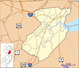
Maurer, Perth Amboy
| Maurer | |
|---|---|
| Unincorporated community | |
 Maurer Maurer, Perth Amboy, Middlesex County, New Jersey | |
| Coordinates: 40°32′13″N 74°16′09″W / 40.53694°N 74.26917°WCoordinates: 40°32′13″N 74°16′09″W / 40.53694°N 74.26917°W | |
| Country | United States |
| State | New Jersey |
| County | Middlesex |
| City | Perth Amboy |
| Elevation[1] | 13 ft (4 m) |
| Time zone | EST |
| GNIS feature ID | 878195[1] |
Maurer is residential neighbourhood and industrial district of Perth Amboy in Middlesex County, New Jersey, United States. Its name is derived from the "company town" built there in 1876.[2][3][4][5][6] It is north of the Route 440 approach to the Outerbridge Crossing and south of the Perth Amboy Refinery, which began in 1920 as the Barber Asphalt Company.[7] For a time it was known as Barber, a name which has fallen out of use [4]
The eastern area along the waterfront was active during World War II in building and decommissioning ships for the U.S. Navy. One of the primary ship builders during World War II was the New Jersey Shipbuilding Company.[8] The community also housed the American Smelting and Refining Company.[9][10]
See also
References
- 1 2 "Maurer". Geographic Names Information System. United States Geological Survey.
- ↑ http://brickcollecting.com/collection2.htm
- ↑ http://www.bricktwphistoricalsociety.com/JUNE/JUNE-1938-14.html
- 1 2 http://www.njpostalhistory.org/mayfeaturedcover.html
- ↑ http://www.city-data.com/neighborhood/Maurer-Perth-Amboy-NJ.html
- ↑ Locality Search, State of New Jersey. Accessed February 7, 2015.
- ↑ http://www.epa.gov/region2/waste/chev_p725.pdf
- ↑ "Archived copy". Archived from the original on 2016-01-04. Retrieved 2015-05-05.
- ↑ http://www.nj.gov/oag/newsreleases09/pr20091210d.html
- ↑ http://www.fios1news.com/newjersey/perth-amboy-demolition#.VUkJwt6G-8U
This article is issued from
Wikipedia.
The text is licensed under Creative Commons - Attribution - Sharealike.
Additional terms may apply for the media files.