Morristown, Middlesex County, New Jersey
- For other places with similar names, see Morristown, New Jersey (disambiguation).
| Morristown, New Jersey | |
|---|---|
| Unincorporated community | |
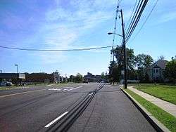 Along eastbound Cliffwood Road (CR 689) | |
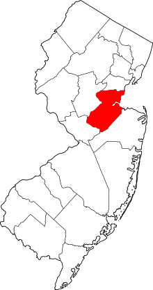
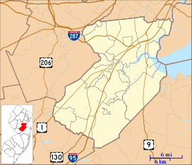 Morristown, New Jersey Location of Morristown in Middlesex County Inset: Location of county within the state of New Jersey  Morristown, New Jersey Morristown, New Jersey (New Jersey)  Morristown, New Jersey Morristown, New Jersey (the US) | |
| Coordinates: 40°25′30″N 74°15′14″W / 40.42500°N 74.25389°WCoordinates: 40°25′30″N 74°15′14″W / 40.42500°N 74.25389°W | |
| Country |
|
| State |
|
| County | Middlesex |
| Township | Old Bridge |
| Elevation[1] | 95 ft (29 m) |
| GNIS feature ID | 883001[1] |
Morristown is an unincorporated community located within Old Bridge Township in Middlesex County, New Jersey, United States.[2] Located on the eastern side of the township near its border with Aberdeen and Matawan (both in Monmouth County), it is centered on the intersection of Cliffwood Road (County Route 689) and Matawan Road (CR 626). Many commercial offices and businesses (including one strip mall) line the two major county roads in the area while single-family houses make up the rest of the area. The settlement is located to the south of Cheesequake State Park and the Garden State Parkway.[3]
References
- 1 2 "Morristown". Geographic Names Information System. United States Geological Survey.
- ↑ Locality Search, State of New Jersey. Accessed February 11, 2015.
- ↑ Google (August 31, 2016). "Aerial view of Morristown, New Jersey" (Map). Google Maps. Google. Retrieved August 31, 2016.
This article is issued from
Wikipedia.
The text is licensed under Creative Commons - Attribution - Sharealike.
Additional terms may apply for the media files.