Applegarth, New Jersey
| Applegarth, New Jersey | |
|---|---|
| Unincorporated community | |
.jpg) Looking north along Applegarth Road (CR 619) | |
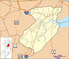 Applegarth, New Jersey Location of Applegarth in Middlesex County Inset: Location of county within the state of New Jersey  Applegarth, New Jersey Applegarth, New Jersey (New Jersey)  Applegarth, New Jersey Applegarth, New Jersey (the US) | |
| Coordinates: 40°16′42″N 74°28′22″W / 40.27833°N 74.47278°WCoordinates: 40°16′42″N 74°28′22″W / 40.27833°N 74.47278°W | |
| Country |
|
| State |
|
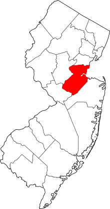
| County | Middlesex |
| Township | Monroe |
| Elevation[1] | 105 ft (32 m) |
| GNIS feature ID | 874361[1] |
Applegarth is an unincorporated community located within Monroe Township in Middlesex County, New Jersey, United States.[2] The settlement is located in the southern portion of the township and is traversed by the road of the same name, Applegarth Road (County Route 619). At the location of the original settlement, at the intersection of Applegarth, Wycoffs Mills, and Old Church Roads, there is a restaurant, farmland, and the Applegarth Fire Department. Further north along Applegarth Road are housing developments, age-restricted communities, and two elementary schools: Applegarth and Oak Tree.[3]
References
- 1 2 "Applegarth". Geographic Names Information System. United States Geological Survey.
- ↑ Locality Search Archived 2016-07-09 at the Wayback Machine., State of New Jersey. Accessed February 7, 2015.
- ↑ Google (November 22, 2015). "Aerial view of Applegarth" (Map). Google Maps. Google. Retrieved November 22, 2015.
This article is issued from
Wikipedia.
The text is licensed under Creative Commons - Attribution - Sharealike.
Additional terms may apply for the media files.