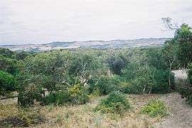
Sellicks Hill, South Australia
| Sellicks Hill South Australia | |||||||||||||||
|---|---|---|---|---|---|---|---|---|---|---|---|---|---|---|---|
 The Willunga Scarp | |||||||||||||||
 Sellicks Hill | |||||||||||||||
| Coordinates | 35°20′S 138°28′E / 35.333°S 138.467°ECoordinates: 35°20′S 138°28′E / 35.333°S 138.467°E | ||||||||||||||
| Population | 225 (2011 census)[1] | ||||||||||||||
| Established | 1999[2] | ||||||||||||||
| Postcode(s) | 5174[3] | ||||||||||||||
| Location | 48 km (30 mi) South of Adelaide city centre | ||||||||||||||
| LGA(s) |
City of Onkaparinga[2] District Council of Yankalilla[2] | ||||||||||||||
| Region |
Fleurieu and Kangaroo Island[4] Southern Adelaide[5] | ||||||||||||||
| County | Adelaide[6] | ||||||||||||||
| State electorate(s) | Mawson [7] | ||||||||||||||
| |||||||||||||||
| |||||||||||||||
| Footnotes |
Location[3] Climate[8] Adjoining suburbs[2] | ||||||||||||||
Sellicks Hill (previously Sellick's Hill) is a semi-rural suburb of Adelaide, South Australia. It lies within both the City of Onkaparinga and the District Council of Yankalilla.[2]
History
Sellick's Hill Post Office opened on 2 July 1860.[9]
References
- ↑ Australian Bureau of Statistics (31 October 2012). "Sellicks Hill". 2011 Census QuickStats. Retrieved 27 April 2016.

- 1 2 3 4 5 "Search result for "Sellicks Hill (Locality Bounded)" (Record no SA0062060) with the following layers selected - "Suburbs and Localities" and "Local Government Areas"". Department of Planning, Transport and Infrastructure. Retrieved 27 April 2016.
- 1 2 "Postcode for Sellicks Hill, South Australia)". postcodes-australia.com. Retrieved 27 April 2016.
- ↑ "Fleurieu Kangaroo Island SA Government region" (PDF). The Government of South Australia. Retrieved 17 April 2017.
- ↑ "Southern Adelaide SA Government region" (PDF). The Government of South Australia. Retrieved 17 April 2017.
- ↑ "Search result for "County of Adelaide, CNTY" with the following data sets selected - "Counties" and "Local Government Areas"". Property Location SA Map Viewer. Government of South Australia. Retrieved 24 April 2017.
- ↑ Mawson (Map). Electoral District Boundaries Commission. 2016. Retrieved 2 March 2018.
- ↑ "Monthly climate statistics: Summary statistics MYPONGA (nearest station)". Commonwealth of Australia , Bureau of Meteorology. Retrieved 26 April 2016.
- ↑ Premier Postal History. "Post Office List". Premier Postal Auctions. Retrieved 26 May 2011.
This article is issued from
Wikipedia.
The text is licensed under Creative Commons - Attribution - Sharealike.
Additional terms may apply for the media files.