Aldinga Beach, South Australia
| Aldinga Beach South Australia | |||||||||||||||
|---|---|---|---|---|---|---|---|---|---|---|---|---|---|---|---|
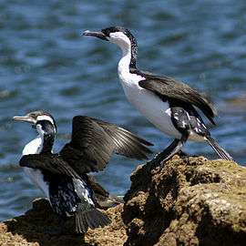 Black cormorants at Aldinga Beach | |||||||||||||||
 Aldinga Beach | |||||||||||||||
| Coordinates | 35°16′52″S 138°27′14″E / 35.281°S 138.454°ECoordinates: 35°16′52″S 138°27′14″E / 35.281°S 138.454°E | ||||||||||||||
| Population |
| ||||||||||||||
| Postcode(s) | 5173 | ||||||||||||||
| LGA(s) | City of Onkaparinga | ||||||||||||||
| Region | Southern Adelaide[3] | ||||||||||||||
| County | Adelaide[4] | ||||||||||||||
| State electorate(s) | Mawson [5] | ||||||||||||||
| Federal Division(s) | Kingston | ||||||||||||||
| |||||||||||||||
| Footnotes | Adjoining suburbs[6] | ||||||||||||||
Aldinga Beach is an outer southern suburb of Adelaide, South Australia. It lies within the City of Onkaparinga and has the postcode 5173. At the 2011 census, Aldinga Beach had a population of 9,697.[2][6]
History
Aldinga Beach Post Office opened on 1 March 1960.[7]
Aldinga Beach is known as Dingy to the local residents. pronounced ding-ee
Protected areas
Aldinga Beach is associated with two protected areas - the Aldinga Scrub Conservation Park and the Aldinga Reef Aquatic Reserve. The Aldinga Scrub Conservation Park is located within the southern extent of the suburb and on land in the adjoining suburb of Sellicks Beach.[8] The Aldinga Reef aquatic reserve is located immediately offshore of both Aldinga Beach and Port Willunga and includes land within the intertidal zone of both suburbs.[9]
See also
References
- ↑ Australian Bureau of Statistics (27 June 2017). "Aldinga Beach (State Suburb)". 2016 Census QuickStats. Retrieved 23 November 2017.

- 1 2 Australian Bureau of Statistics (31 October 2012). "Aldinga Beach (State Suburb)". 2011 Census QuickStats. Retrieved 16 October 2014.
- ↑ "Southern Adelaide SA Government region" (PDF). The Government of South Australia. Retrieved 17 April 2017.
- ↑ "Search result for "County of Adelaide, CNTY" with the following data sets selected - "Counties" and "Local Government Areas"". Property Location SA Map Viewer. Government of South Australia. Retrieved 24 April 2017.
- ↑ Mawson (Map). Electoral District Boundaries Commission. 2016. Retrieved 2 March 2018.
- 1 2 "City of Onkaparinga suburb boundaries map". City of Onkaparinga. 9 January 2014. Retrieved 8 October 2014.
- ↑ Premier Postal History. "Post Office List". Premier Postal Auctions. Retrieved 26 May 2011.
- ↑ "Protected Areas of South Australia September (Map) 2014 Edition" (PDF). Department of Environment, Water and Natural Resources. Retrieved 15 April 2015.
- ↑ "Search result for "Aldinga Reef Aquatic Reserve" with the following databases selected - "Suburbs and Localities" and "Aquatic Reserves"". Location SA Viewer. Government of South Australia. Retrieved 10 October 2016.
External links