Aldinga, South Australia
| Aldinga South Australia | |||||||||||||||
|---|---|---|---|---|---|---|---|---|---|---|---|---|---|---|---|
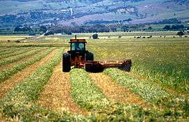 Cutting hay near Aldinga, south of Adelaide in South Australia, 1992 | |||||||||||||||
 Aldinga | |||||||||||||||
| Coordinates | 35°16′01″S 138°28′59″E / 35.267°S 138.483°ECoordinates: 35°16′01″S 138°28′59″E / 35.267°S 138.483°E | ||||||||||||||
| Population |
| ||||||||||||||
| Established | 1857 | ||||||||||||||
| Postcode(s) | 5173 | ||||||||||||||
| LGA(s) | City of Onkaparinga | ||||||||||||||
| Region | Southern Adelaide[3] | ||||||||||||||
| County | Adelaide[4] | ||||||||||||||
| State electorate(s) |
Kaurna[5] Mawson[6] | ||||||||||||||
| Federal Division(s) | Kingston | ||||||||||||||
| |||||||||||||||
| |||||||||||||||
| Footnotes |
Climate[7] Adjoining suburbs[8] | ||||||||||||||
Aldinga /ɔːlˈdɪŋɡə/ is a suburb of Adelaide in South Australia located about 45 kilometres (28 miles) south of the Adelaide city centre in the City of Onkaparinga.
History
European history
Aldinga started as a town in the 1850s in response to the development of farming on the Aldinga Plains. The layout of the town in circa 1857 is attributed to Lewis Fidge, a local farmer. The town is reported as growing quickly with the construction of a ‘hotel, church, blacksmith’s shop and a number of other shops and trades.’ In the 1870s, the combination of declining productivity of the land and opportunities such as the availability of land in South Australia’s mid-North resulted in a population decline. However, the town survived due to its location on the Old Coach Road which continues south to towns along the east coast of Gulf St Vincent as part of what is now called the Main South Road.[9] Aldinga Post Office opened around 1851 and closed in 1992.[10]
Popular culture
The bands Another's Life, The Fall Of Troy, I Killed The Prom Queen and Spirit of Alondray come from Aldinga.
References
- ↑ Australian Bureau of Statistics (27 June 2017). "Aldinga (State Suburb)". 2016 Census QuickStats. Retrieved 23 November 2017.

- ↑ Australian Bureau of Statistics (31 October 2012). "Aldinga (State Suburb)". 2011 Census QuickStats. Retrieved 8 October 2014.
- ↑ "Southern Adelaide SA Government region" (PDF). The Government of South Australia. Retrieved 17 April 2017.
- ↑ "Search result for "County of Adelaide, CNTY" with the following data sets selected - "Counties" and "Local Government Areas"". Property Location SA Map Viewer. Government of South Australia. Retrieved 24 April 2017.
- ↑ "2014 State election boundaries". ELECTORAL COMMISSION SA. Retrieved 17 October 2014.
- ↑ "2014 State election boundaries". ELECTORAL COMMISSION SA. Retrieved 17 October 2014.
- ↑ "Monthly climate statistics: Summary statistics Noarlunga (nearest weather station)". Commonwealth of Australia , Bureau of Meteorology. Retrieved 4 February 2017.
- ↑ "City of Onkaparinga suburb boundaries map". City of Onkaparinga. 9 January 2014. Retrieved 8 October 2014.
- ↑ "European History and Heritage - suburb profile, Aldinga". City of Onkaparinga. Retrieved 4 November 2014.
- ↑ Premier Postal History. "Post Office List". Premier Postal Auctions. Retrieved 26 May 2011.